Jacobabad facts for kids
Quick facts for kids
Jacobabad
|
|
|---|---|

Jacobabad Junction railway station
|
|
| Country | |
| Province | |
| Division | Larkana Division |
| District | Jacobabad District |
| Founded | 1847 |
| Population
(2023)
|
|
| • City | 219,315 |
| • Rank | 47th in Pakistan |
| Time zone | UTC+5 (PST) |
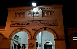
Jacobabad is a city in the Sindh province of Pakistan. It was once known as Khanger or Khangarh. Jacobabad is the main city of Jacobabad District and also its administrative center.
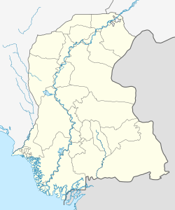
The city is located in the northwest part of Sindh, close to the border of the Balochistan province. It is an important hub for Pakistan Railways and many major roads. Jacobabad is one of the largest cities in Pakistan by population.
Jacobabad is famous for being one of the hottest places on Earth. During summer, temperatures often reach around 37 degrees Celsius (99 degrees Fahrenheit) on average. Sometimes, the heat combined with humidity can create a dangerous condition called a wet-bulb temperature above 35 degrees Celsius (95 degrees Fahrenheit). When this happens, the human body cannot cool itself down enough, which can be very risky. Because of this, Jacobabad is considered one of the places most affected by climate change.
Contents
How Jacobabad Got Its Name
Jacobabad is named after Brigadier-General John Jacob (1812–1858). He was an officer in the British East India Company. John Jacob was in charge of this area during the last ten years of his life. He was also known for a cavalry group called 36th Jacob's Horse.
John Jacob studied at the Addiscombe Military Seminary. He joined the Bombay Artillery (part of the Bombay Army) when he was 16. He sailed to India in January 1828 and never returned to England. Local people started calling the new settlement "Jekumbad," which the British later changed to Jacobabad. John Jacob brought a lot of progress and wealth to the region through his work.
History of Jacobabad
In 1847, John Jacob was given control of the frontier area. He set up his main office in a village called Khangurh (or Khanger). He began building new structures and improving the town around the village.
Since he was also an architect and engineer, he designed and built a large network of wide roads. These roads stretched for about 965 kilometers (600 miles) around the town. He also solved the problem of drinking water by digging a tank. This tank was filled with water brought from the Indus River through a canal.
His most important achievement was digging the Begaree Canal. This canal starts from the Guddu barrage on the Indus River. It goes around the district, bringing water to thousands of acres of land that were not farmed before. This helped thousands of people find ways to make a living.
After the time of the British Raj (British rule in India), the city was led by a local leader named Sardar Taj Dero Khan Odho. In November 2010, the then Prime Minister Yousaf Raza Gillani announced that a new University of Information Technology would be built in Jacobabad.
Population Information
Here's how the population of Jacobabad has changed over the years:
| Census | Population |
|---|---|
| 1972 | 57,596 |
| 1981 | 79,365 |
| 1998 | 138,780 |
| 2017 | 191,098 |
| 2023 | 219,315 |
Climate and Weather
Jacobabad has a hot desert climate. This means it has extremely hot summers and mild winters. The city is known for having some of the highest temperatures in South Asia. The average summer temperature is about 37 degrees Celsius (99 degrees Fahrenheit).
The highest temperature ever recorded in Jacobabad was 52.8 degrees Celsius (127 degrees Fahrenheit). The lowest temperature ever recorded was -3.9 degrees Celsius (25 degrees Fahrenheit). The city does not get much rain. Most of the rain falls during the monsoon season, which is from July to September. The average yearly rainfall is about 202.5 millimeters (8 inches). In 2022, Jacobabad had its highest annual rainfall ever, with 838.7 millimeters (33 inches). The lowest was 3.3 millimeters (0.13 inches) in 1922.
During the 2022 heat wave in South Asia, the average temperature for May in Jacobabad was 43 degrees Celsius (109 degrees Fahrenheit). On four days, the temperature reached or went above 50 degrees Celsius (122 degrees Fahrenheit). It is hard for the city to provide ways to deal with this extreme heat. Many people who can afford to, move to the cooler city of Quetta in the mountains during the summer school break.
| Climate data for Jacobabad (1991–2020, extremes 1961–present) | |||||||||||||
|---|---|---|---|---|---|---|---|---|---|---|---|---|---|
| Month | Jan | Feb | Mar | Apr | May | Jun | Jul | Aug | Sep | Oct | Nov | Dec | Year |
| Record high °C (°F) | 30.6 (87.1) |
34.0 (93.2) |
42.1 (107.8) |
47.0 (116.6) |
52.8 (127.0) |
51.1 (124.0) |
47.8 (118.0) |
45.0 (113.0) |
42.8 (109.0) |
41.7 (107.1) |
38.0 (100.4) |
30.6 (87.1) |
52.8 (127.0) |
| Mean daily maximum °C (°F) | 22.0 (71.6) |
25.5 (77.9) |
31.4 (88.5) |
38.5 (101.3) |
43.8 (110.8) |
44.3 (111.7) |
40.2 (104.4) |
37.5 (99.5) |
36.5 (97.7) |
35.0 (95.0) |
29.9 (85.8) |
24.2 (75.6) |
34.1 (93.4) |
| Daily mean °C (°F) | 15.1 (59.2) |
18.5 (65.3) |
24.2 (75.6) |
30.7 (87.3) |
35.7 (96.3) |
37.1 (98.8) |
34.9 (94.8) |
33.1 (91.6) |
31.5 (88.7) |
28.1 (82.6) |
22.4 (72.3) |
16.9 (62.4) |
27.4 (81.3) |
| Mean daily minimum °C (°F) | 8.1 (46.6) |
11.5 (52.7) |
17.0 (62.6) |
22.8 (73.0) |
27.6 (81.7) |
30.0 (86.0) |
29.6 (85.3) |
28.5 (83.3) |
26.7 (80.1) |
21.1 (70.0) |
14.9 (58.8) |
9.5 (49.1) |
20.6 (69.1) |
| Record low °C (°F) | −1.1 (30.0) |
1.0 (33.8) |
6.0 (42.8) |
13.5 (56.3) |
18.9 (66.0) |
21.0 (69.8) |
20.3 (68.5) |
22.8 (73.0) |
17.8 (64.0) |
12.0 (53.6) |
3.9 (39.0) |
0.3 (32.5) |
−1.1 (30.0) |
| Average precipitation mm (inches) | 4.6 (0.18) |
8.4 (0.33) |
11.0 (0.43) |
4.9 (0.19) |
4.0 (0.16) |
26.8 (1.06) |
47.8 (1.88) |
54.5 (2.15) |
38.2 (1.50) |
1.6 (0.06) |
11.5 (0.45) |
8.7 (0.34) |
212.0 (8.35) |
| Average precipitation days (≥ 1.0 mm) | 1.2 | 1.6 | 1.9 | 1.0 | 0.7 | 0.7 | 1.9 | 1.7 | 0.6 | 0.3 | 0.3 | 0.9 | 12.8 |
| Mean monthly sunshine hours | 241.9 | 214.7 | 247.5 | 249.4 | 266.4 | 272.7 | 236.0 | 259.8 | 278.1 | 288.8 | 267.6 | 243.7 | 3,066.6 |
| Source: NOAA (sun 1961–1990) | |||||||||||||
Airport and Airbase
Jacobabad has a commercial airport. It is about 480 kilometers (300 miles) north of Karachi. It is also about 480 kilometers (300 miles) southeast of Kandahar. The airport is located where the Sindh and Balochistan provinces meet.
The Shahbaz Air Base is located at the same place as the commercial airport. This air base was used by the U.S. and its allies to support operations in Afghanistan.
See also
 In Spanish: Yacobabad para niños
 | Madam C. J. Walker |
 | Janet Emerson Bashen |
 | Annie Turnbo Malone |
 | Maggie L. Walker |


