
Jeffersonville, Kentucky facts for kids
Quick facts for kids
Jeffersonville, Kentucky
|
|
|---|---|

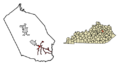
Location in Montgomery County, Kentucky
|
|

Jeffersonville, Kentucky
Location in Kentucky

Jeffersonville, Kentucky
Location in the United States
|
|
| Country | United States |
| State | Kentucky |
| County | Montgomery |
| Incorporated | March 20, 1876 |
| Named for | Pres. Thomas Jefferson |
| Government | |
| • Type | City Commission |
| Area | |
| • Total | 2.75 sq mi (7.13 km2) |
| • Land | 2.74 sq mi (7.10 km2) |
| • Water | 0.01 sq mi (0.03 km2) |
| Elevation | 817 ft (249 m) |
| Population
(2020)
|
|
| • Total | 1,708 |
| • Estimate
(2022)
|
1,729 |
| • Density | 622.68/sq mi (240.41/km2) |
| Time zone | UTC-5 (Eastern (EST)) |
| • Summer (DST) | UTC-4 (EDT) |
| ZIP code |
40337
|
| Area code(s) | 859 |
| FIPS code | 21-40240 |
| GNIS feature ID | 0512986 |
Jeffersonville is a small city in Montgomery County, Kentucky, in the United States. It is known as a "home rule-class city," which means it has the power to manage its own local affairs.
In 2020, about 1,708 people lived in Jeffersonville. This number was a bit higher than the 1,506 people who lived there in 2010. Jeffersonville is also part of the Mount Sterling micropolitan area, which is a group of towns and cities connected by their economy.
Contents
History of Jeffersonville
Jeffersonville started as an important place for trading cattle in Eastern Kentucky. This was in the middle of the 1800s. Back then, it had a different name: "Ticktown."
Why "Ticktown"?
The name "Ticktown" might have come from two things. It could be because of a type of grass called tickgrass that grew in the area. Or, it might have been named after the ticks that were often found in the cattle pens.
Becoming Jeffersonville
No one knows exactly when the town's name changed to Jeffersonville. However, the first post office opened with the name Jeffersonville on March 9, 1866. The city was likely named to honor President Thomas Jefferson.
Jeffersonville officially became an incorporated city on March 20, 1876. This meant it could set up its own local government.
Geography of Jeffersonville
Jeffersonville is located in the southeastern part of Montgomery County. You can find it at these coordinates: 37°58′9″N 83°49′28″W / 37.96917°N 83.82444°W.
Roads and Travel
U.S. Route 460 runs through the city as Main Street. If you go northwest on this road, you'll reach Mount Sterling, which is about 8 miles (13 km) away. Mount Sterling is the main town of the county. If you go east on Route 460, you'll get to Frenchburg, about 13 miles (21 km) away.
Another road, Kentucky Route 213, goes south from Jeffersonville to Stanton, which is about 9 miles (14 km) away. If you go north on Route 213 for about 4 miles (6 km), the road ends at Kentucky Route 713.
Water and Land
The United States Census Bureau says that Jeffersonville covers a total area of about 2.75 square miles (7.12 square kilometers). Most of this area is land, with only a tiny bit, about 0.01 square miles (0.03 square kilometers), being water.
Water from the city flows north into small streams that lead to Slate Creek. Slate Creek then flows into the Licking River. The Licking River eventually joins the Ohio River.
People of Jeffersonville
Let's look at some information about the people who live in Jeffersonville.
Population Numbers
Here's how the population of Jeffersonville has changed over the years:
| Historical population | |||
|---|---|---|---|
| Census | Pop. | %± | |
| 1880 | 60 | — | |
| 1900 | 84 | — | |
| 1910 | 86 | 2.4% | |
| 1920 | 53 | −38.4% | |
| 1930 | 84 | 58.5% | |
| 1970 | 775 | — | |
| 1980 | 1,528 | 97.2% | |
| 1990 | 1,854 | 21.3% | |
| 2000 | 1,804 | −2.7% | |
| 2010 | 1,506 | −16.5% | |
| 2020 | 1,708 | 13.4% | |
| 2022 (est.) | 1,729 | 14.8% | |
| U.S. Decennial Census | |||
In the year 2000, there were 1,804 people living in Jeffersonville. Most of the people were White (99.06%). A small number were African American, Native American, Asian, or from two or more races. About 0.94% of the population identified as Hispanic or Latino.
Households and Families
In 2000, there were 682 households in the city. A household is a group of people living together.
- About 38.4% of these households had children under 18 living with them.
- Most households (61.6%) were married couples living together.
- About 12.3% had a female head of household with no husband present.
- About 22.9% were non-family households, meaning people living alone or with roommates.
The average household had about 2.65 people, and the average family had about 3.02 people.
Age Groups
The people in Jeffersonville were spread out across different age groups:
- About 26.6% were under 18 years old.
- About 8.6% were between 18 and 24 years old.
- About 31.4% were between 25 and 44 years old.
- About 22.4% were between 45 and 64 years old.
- About 11.0% were 65 years old or older.
The median age in the city was 34 years. This means half the people were younger than 34, and half were older.
Education in Jeffersonville
Students living in Jeffersonville usually attend schools in nearby Mount Sterling.
Public Schools
Here are some of the public schools that students from Jeffersonville attend:
- Early Learning Center
- Camargo Elementary School
- Mapleton Elementary School
- Mount Sterling Elementary School
- J.B. McNabb Middle School
- Montgomery County High School
Private Schools
There are also a couple of private schools in Jeffersonville:
- Jeffersonville Christian Academy
- Grace Christian Academy
Images for kids
-
Location of Jeffersonville in Montgomery County, Kentucky
See also
 In Spanish: Jeffersonville (Kentucky) para niños
