Jemez Lineament facts for kids
The Jemez Lineament is a long chain of volcanic fields. It stretches about 600 kilometers (370 miles) across parts of Arizona and New Mexico. This line of volcanoes formed in the Cenozoic Era, which is the most recent major time period in Earth's history.
For a long time, people thought the Jemez Lineament was like a "hotspot" trail, similar to the Yellowstone hotspot. A hotspot is a place where hot rock from deep inside the Earth melts its way to the surface. However, scientists found that the volcanoes along the Jemez Lineament don't get systematically older in one direction. This is what you would expect from a hotspot.
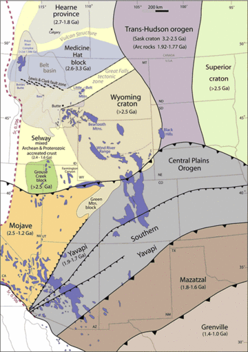
Now, scientists believe the Jemez Lineament is actually a very old "scar" from a subduction zone. This scar formed about 1.7 billion years ago. Back then, a piece of oceanic crust (the Earth's outer layer under the oceans) was sliding under what is now the southern part of North America. This process is called subduction. When a large group of volcanic islands (an island arc) arrived at this subduction zone, the subduction moved further south. This left behind pieces of oceanic crust deep inside the Earth's mantle (the layer below the crust). These leftover pieces contain special minerals that make the rock melt more easily. This ancient subduction scar is now a weak spot in the Earth's crust.
Volcanoes Along the Lineament
The Jemez Lineament includes several important volcanic areas. These are the San Carlos volcanic field, Springerville volcanic field, Red Hill volcanic field, Zuni-Bandera volcanic field, Mount Taylor volcanic field, and Jemez volcanic field. It might also include the Ocate volcanic field, Raton-Clayton volcanic field, and Mesa de Maya. All these volcanoes are geologically young, meaning they formed in the Cenozoic Era.
While some volcanoes show a slight age difference from southeast to northwest across the line, there isn't a clear pattern of age along the entire lineament.
The total area covered by volcanic rocks from the Jemez Lineament is about 23,870 square kilometers (9,216 square miles). This is a huge area! The total amount of volcanic rock that erupted is around 3,300 cubic kilometers (790 cubic miles). The Jemez volcanic field is especially large. It's located where the Rio Grande Rift crosses the lineament. This field alone has produced three times more volcanic material than all the other fields on the lineament combined.
The path of the lineament changes a bit where it meets the Rio Grande Rift. West of the rift, the lineament follows the edge of the Colorado Plateau. East of the rift, it cuts across the High Plains.
How the Lineament Formed
The volcanic fields along the Jemez Lineament don't all look the same when you look at them from the side. This shows that the lineament isn't just one single crack or fault in the Earth. Instead, it's believed to be that old, watery subduction zone scar. This scar marks the southern edge of a very old part of the Earth's crust, formed over 1.7 billion years ago.
Scientists use special tools to "see" inside the Earth. These studies show reflections that go deep down to the crust-mantle boundary. This is the place where the Earth's outer crust meets the hotter, softer mantle below. There's also a special chemical boundary that matches the lineament. Other studies show that the upper mantle beneath the lineament is a "low-velocity zone." This means seismic waves (like those from earthquakes) travel slower there, suggesting the rock is softer or hotter. All these things tell us that the Jemez Lineament is a long-lasting weak spot in the Earth's crust.
 | Aurelia Browder |
 | Nannie Helen Burroughs |
 | Michelle Alexander |


