Kagaru, Queensland facts for kids
Quick facts for kids KagaruQueensland |
|||||||||||||||
|---|---|---|---|---|---|---|---|---|---|---|---|---|---|---|---|

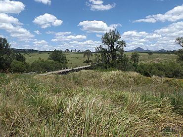
Teviot Brook crossing, 2016
|
|||||||||||||||
| Population | 19 (2021 census) | ||||||||||||||
| • Density | 0.655/km2 (1.70/sq mi) | ||||||||||||||
| Established | 1997 | ||||||||||||||
| Postcode(s) | 4285 | ||||||||||||||
| Area | 29.0 km2 (11.2 sq mi) | ||||||||||||||
| Time zone | AEST (UTC+10:00) | ||||||||||||||
| Location |
|
||||||||||||||
| LGA(s) |
|
||||||||||||||
| State electorate(s) |
|
||||||||||||||
| Federal Division(s) | Wright | ||||||||||||||
|
|||||||||||||||
Kagaru is a quiet rural area in Queensland, Australia. It's split between two local government areas: the Scenic Rim Region and the City of Logan. In 2021, only 19 people lived here, making it a very small community.
Contents
What Kagaru Looks Like
Kagaru is a mostly undeveloped area. Its eastern side follows the path of a railway line that connects Sydney and Brisbane. The Logan River and Teviot Brook also form part of its eastern boundary.
A Look Back at Kagaru
Where the Name Comes From
The name 'Kagaru' comes from the Ugarapul language. It means 'blue-winged kookaburra'. In the 1930s, a railway station in the area was given this name.
Becoming a Locality
On April 24, 1997, the area was officially named 'Kagaru' after the old railway station. Before 2008, Kagaru was part of the Shire of Beaudesert. However, after some changes to local government areas in March 2008, Kagaru was split. Now, it belongs to both Logan City and the Scenic Rim Region. The original railway station no longer exists.
Who Lives in Kagaru
In 2016, Kagaru had a population of 13 people. There were 6 households in the area. The median age of residents was 57 years old. By 2021, the population had grown slightly to 19 people.
 | Jewel Prestage |
 | Ella Baker |
 | Fannie Lou Hamer |


