Undullah, Queensland facts for kids
Quick facts for kids UndullahQueensland |
|||||||||||||||
|---|---|---|---|---|---|---|---|---|---|---|---|---|---|---|---|

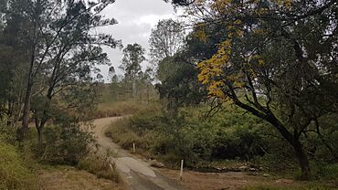
Undullah Road, 2023
|
|||||||||||||||
| Population | 24 (2021 census) | ||||||||||||||
| • Density | 0.257/km2 (0.67/sq mi) | ||||||||||||||
| Postcode(s) | 4285 | ||||||||||||||
| Area | 93.3 km2 (36.0 sq mi) | ||||||||||||||
| Time zone | AEST (UTC+10:00) | ||||||||||||||
| Location |
|
||||||||||||||
| LGA(s) |
|
||||||||||||||
| State electorate(s) |
|
||||||||||||||
| Federal Division(s) | Wright | ||||||||||||||
|
|||||||||||||||
Undullah is a small countryside area in Queensland, Australia. It's special because it's split between two different local government areas: the City of Logan and the Scenic Rim Region. In 2021, only 24 people lived there.
Contents
Exploring Undullah's Landscape
Undullah is mostly covered by the Flinders Peak Group of mountains. These mountains rise up towards the western side of the area.
Mountains in Undullah
Here are some of the mountains you can find in Undullah:
- Mount Elliott is about 437 meters (1,434 feet) tall.
- Mount Wilbraham is about 222 meters (728 feet) tall.
- Rocky Knob is also about 222 meters (728 feet) tall.
- Mount Flintoff reaches about 354 meters (1,161 feet) high.
- Mount Joyce is the tallest at about 469 meters (1,539 feet).
Waterways and Nature
The main stream in Undullah is Woollaman Creek. This creek flows into Teviot Brook. Most of Undullah is undeveloped and covered by natural bushland.
Undullah's Past
The name Undullah likely comes from an Aboriginal word. It is thought to be from the Bundjalung or Yuggera languages. The word nandulla means "silver leafed iron bark," which is a type of eucalyptus tree.
Early Settlers
Henry Herbert Elliott was one of the first settlers in the area. He was a cattle farmer.
Changes in Local Government
Undullah used to be part of the Shire of Beaudesert. In March 2008, local government areas were changed. Undullah was then split between Logan City and the Scenic Rim Region.
Later, in May 2016, some parts of Undullah were used to create new areas. These new places included Flinders Lakes, Monarch Glen, and part of Flagstone.
How Many People Live Here?
The number of people living in Undullah has changed over time.
- In 2016, the population was 45 people.
- By 2021, the population had decreased to 24 people.
Learning in Undullah
There are no schools directly in Undullah. Students usually travel to nearby areas for their education.
Primary Schools Nearby
The closest primary schools are:
- Ripley Valley State School in South Ripley (to the north).
- Flagstone State School in Flagstone (to the east).
- Peak Crossing State School in Peak Crossing (to the west).
Secondary Schools Nearby
For high school, students can go to:
- Ripley Valley State Secondary College in South Ripley.
- Flagstone State Community College in Flagstone.
- Bremer State High School in Ipswich (to the north-west).
 | Anna J. Cooper |
 | Mary McLeod Bethune |
 | Lillie Mae Bradford |


