Peak Crossing, Queensland facts for kids
Quick facts for kids Peak CrossingQueensland |
|||||||||||||||
|---|---|---|---|---|---|---|---|---|---|---|---|---|---|---|---|
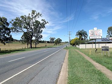
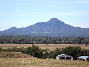
Ipswich Boonah Road, 2015
|
|||||||||||||||
| Population | 1,016 (2021 census) | ||||||||||||||
| • Density | 11.104/km2 (28.76/sq mi) | ||||||||||||||
| Postcode(s) | 4306 | ||||||||||||||
| Area | 91.5 km2 (35.3 sq mi) | ||||||||||||||
| Time zone | AEST (UTC+10:00) | ||||||||||||||
| Location |
|
||||||||||||||
| LGA(s) |
|
||||||||||||||
| State electorate(s) | Scenic Rim | ||||||||||||||
| Federal Division(s) | |||||||||||||||
|
|||||||||||||||
Peak Crossing is a small rural area in Queensland, Australia. It's located about 20 kilometers (12 miles) south of the city of Ipswich. This area is shared between two local government regions: the City of Ipswich and the Scenic Rim Region. In 2021, about 1,016 people lived in Peak Crossing.
Contents
Exploring Peak Crossing's Landscape
Peak Crossing is surrounded by farmland, where people grow various crops. A creek called Warrill Creek forms the western edge of the area. This creek flows into the Bremer River. You can find the Churchbank Weir on Warrill Creek.
Mountains and Nature Parks
The eastern part of Peak Crossing has several natural mountains. These include Mount Goolman, Ivorys Rock (also known as Muntambin), Mount Blaine, and Flinders Peak. These mountains are part of the Flinders Peak Group.
You'll also find the Flinders Peak Conservation Park and parts of the Flinders-Goolman Conservation Estate here. These parks are great for outdoor activities. You can go bushwalking, horse riding, mountain biking, and camping.
The main road through Peak Crossing is the Ipswich – Boonah Road (State Route 93). It runs from north to south.
A Look Back: Peak Crossing's History
The name Peak Crossing comes from two things. One is a mountain, and the other is an important old road crossing over Purga Creek.
How Peak Crossing Got Its Name
The mountain, Flinders Peak, is to the east of the town. It was named after a famous explorer, Matthew Flinders.
The "crossing" part of the name refers to where the Ipswich-Boonah Road met the Old Warwick Road. This meeting point was next to Purga Creek. These roads were once very important for travel. Today, most traffic uses the Cunningham Highway, which is about 8 kilometers (5 miles) west.
Schools and Railways
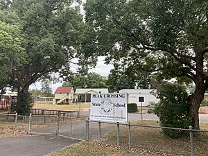
The first school in the area, Purga Creek No 2 School, opened in 1871. It was later renamed Peak Mountain State School. In the late 1920s, it became known as Peak Crossing State School.
A railway line, called the Fassifern railway line, opened in 1882. It connected Ipswich to nearby towns like Harrisville. There were several railway stations in the Peak Crossing area, including Hillside, Rocktown, Peak Crossing, and Flinders stations. This railway line helped people and goods travel. However, it closed in 1964.
The Peak Crossing Post Office started in 1886.
Churches in the Community
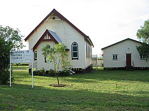
In 1872, a Congregational Church was built near Peak Mountain. A new church building was constructed in 1929. The old church building was moved to another town. In 1977, the Congregational Church joined with others to form the Uniting Church in Australia. Today, it's called Flinders Uniting Church.
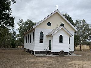
The first Catholic church in the area, St Patrick's, was built in 1882. A local person, George McDonald, donated the land. The church was officially opened in December 1882. Many people came for the opening, including about 400 who traveled from Ipswich by a special train.
In 1911, St Patrick's Catholic Church was damaged by a cyclone. It was also found to have white ants. So, a new church was built. This new church, St James's Catholic Church, opened in 1914. Today, it is known as St John's Catholic Church.
Peak Crossing Public Hall
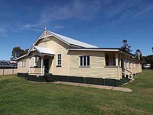
In 1924, local residents decided to build a public hall. Land was bought, and the hall was built. It officially opened in 1926. This hall has been an important place for community events.
In 2018, a new memorial called the Peak Crossing ANZAC Memorial was dedicated. It honors those who served in wars.
Who Lives in Peak Crossing?
The number of people living in Peak Crossing has grown over the years.
- In 2011, there were 768 people.
- In 2016, the population grew to 965 people.
- In 2021, the population reached 1,016 people.
Places of Interest
Peak Crossing has some special places that are listed for their historical importance. These are called heritage-listed sites:
- The Peak Crossing Public Hall on Fassifern Street.
- The Flinders Uniting Church on Flinders Street.
Learning in Peak Crossing
Peak Crossing State School is a government primary school for students from Prep to Year 6. It's located on Ipswich-Boonah Road. In 2018, the school had 215 students.
Community Amenities
Peak Mountain View Park
The Peak Mountain View Park is a great place for families. It has open spaces, play equipment, and electric BBQs for picnics. There are also picnic shelters, public toilets, and parking. The Peak Crossing ANZAC memorial is located inside this park.
The local council also provides a mobile library service that visits the Peak Mountain View Park.
Queensland Country Women's Association
The Peak Crossing branch of the Queensland Country Women's Association (QCWA) meets in the Peak Crossing Public Hall. The QCWA is a group that supports women and communities in rural areas.
 | Percy Lavon Julian |
 | Katherine Johnson |
 | George Washington Carver |
 | Annie Easley |


