Boonah, Queensland facts for kids
Quick facts for kids BoonahQueensland |
|||||||||||||||
|---|---|---|---|---|---|---|---|---|---|---|---|---|---|---|---|
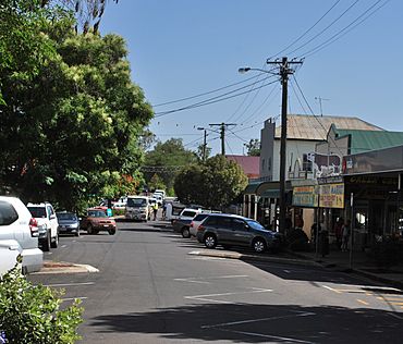
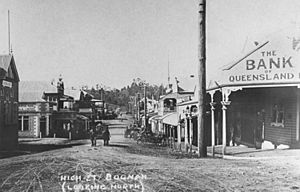
Main street of Boonah, 2008
|
|||||||||||||||
| Population | 2,557 (2021 census) | ||||||||||||||
| • Density | 230.4/km2 (597/sq mi) | ||||||||||||||
| Established | 1882 | ||||||||||||||
| Postcode(s) | 4310 | ||||||||||||||
| Area | 11.1 km2 (4.3 sq mi) | ||||||||||||||
| Time zone | AEST (UTC+10:00) | ||||||||||||||
| Location |
|
||||||||||||||
| LGA(s) | Scenic Rim Region | ||||||||||||||
| State electorate(s) | Scenic Rim | ||||||||||||||
| Federal Division(s) | Wright | ||||||||||||||
|
|||||||||||||||
Boonah is a country town in the Scenic Rim Region of Queensland, Australia. It is also a specific area, or "locality," within this region. In 2021, about 2,557 people lived in Boonah.
Contents
Exploring Boonah's Location
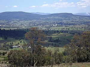
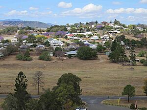
Boonah is located near the Fassifern Valley. It is also close to the McPherson Range and Main Range National Park. The town is surrounded by hills. These include Mount French and other Moogerah Peaks. Frog Buttress on Mount French is a popular spot for rock climbing.
Water Sources and Roads
The Wyaralong Dam was built east of Boonah. It is on Teviot Brook, which flows into the Logan River. A new road was built because the old one would have been underwater when the dam was full. Boonah gets its water from Lake Moogerah. This lake is on Reynold's Creek, a branch of the Bremer River. Another dam, Maroon Dam, is about 25 kilometres (16 miles) south of Boonah.
Major roads connect Boonah to other towns. State Route 93 runs through Boonah. It is called Ipswich – Boonah Road from the north and Boonah – Rathdowney Road to the south. Boonah–Fassifern Road (State Route 90) also starts here and heads west.
Boonah's Past: A Brief History
The Ugarapul people are the Aboriginal traditional owners of this land. Their language is spoken in parts of South-East Queensland.
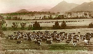
Boonah's history is linked to a nearby place called Dugandan. This area was first used for farming in 1844. It was one of the earliest farms in Queensland. At first, sheep were raised here. But people soon found the area was perfect for cattle. It became known for its high-quality beef and dairy cows.
Early Names and Growth
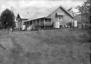
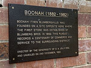
Boonah was once known by different names, like Dugandan Scrub and Blumbergville. In 1878, John Hooper bought land that would become Boonah. The first building in the area was the Dugandan Provisional School. It opened in 1878. This school later became Boonah State School in 1895.
By 1880, about 40 families lived in the area. Blumbergville started to grow. It was named after a store owned by the Blumberg brothers.
The Railway Arrives
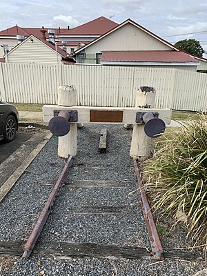
The first branch railway line in Queensland reached Harrisville in 1882. It was extended to Dugandan in 1887. Boonah got its own railway station. The town was named after this station. The name "Boonah" is an Aboriginal word. It might mean "Bloodwood tree" or "Brigalow tree."
After big floods in 1887, many businesses moved from lower-lying Dugandan to higher ground in Boonah. This helped Boonah grow into the main town. The Post Office was renamed Boonah around 1888.
Churches and Businesses
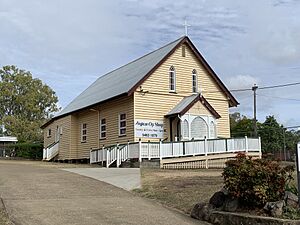
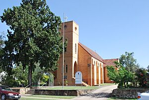
The Primitive Methodist Church opened in Boonah in 1883. It was later moved and rebuilt as the Boonah Methodist Church in 1907. Christ Church, an Anglican church, opened in 1890. The original building is now used as a church hall.
The Fassifern Butter Factory started operating in 1900. A bigger, modern factory, the Boonah Butter Factory, opened in 1916. It closed in 1974 because dairy farming changed.
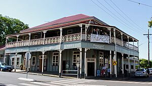
The Commercial Hotel opened in 1905. It was a two-storey building with fancy railings.
Schools and Local Government
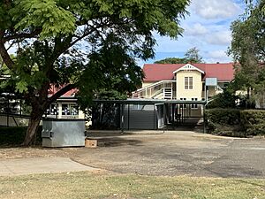
Boonah State School started as a primary school. A secondary class was added in 1955. Then, Boonah State High School opened in 1965. All Saints' Catholic Primary School was built in 1956. Volunteers helped to build it.
Boonah was the main town for the Shire of Boonah local government area. This changed in 2008 when councils were combined.
People of Boonah
In 2016, Boonah had 2,484 people living there. The average age was 46, which is a bit older than the national average. Most people spoke English at home. The most common backgrounds were English, Australian, and German.
By 2021, the population of Boonah had grown slightly to 2,557 people.
Historic Places in Boonah
Boonah has several places that are listed for their historical importance. These include:
- Christ Church Anglican, at 8-10 Church Street.
- Boonah Showgrounds, on Cossart Street and Macquarie Street.
- Australian Hotel, at 32 High Street.
- Commercial Hotel, at 39 High Street and Yeates Avenue.
- Coochin Coochin Homestead, on J Bell Road.
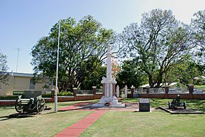
- Boonah War Memorial and Memorial Park, on Park Street.
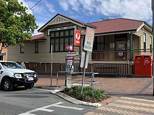
- Boonah Post Office, at 1 Park Street.
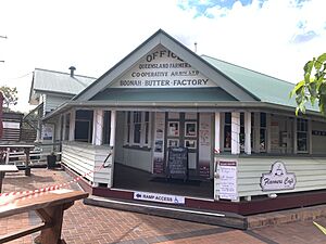
- The old offices of the Boonah Butter Factory, now Flavours Cafe, at 8 Railway Street.
Boonah's Economy
The Boonah area is known for its farms. Farmers grow vegetables like carrots, potatoes, and other crops. They also raise beef and pork, and produce timber. In 2000–01, the Boonah area produced about $67 million worth of farm products. Vegetables made up more than 20% of this. The area also produced a lot of hay and soybeans for the state. Many farms in Boonah raise beef cattle.
Learning in Boonah
Boonah has several schools for students:
- Boonah State School is a government primary school for students from Prep to Year 6. It is located on Park Street. In 2018, it had 231 students.
- All Saints' School is a Catholic primary school for students from Prep to Year 6. It is on Oliver Street. In 2018, it had 181 students.
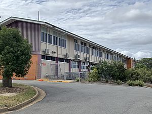
- Boonah State High School is a government secondary school for students from Year 7 to Year 12. It is located on Macquarie Street. In 2018, it had 658 students.
The Bremer Institute of TAFE used to have a campus in Boonah. However, it has since closed.
Local News
Boonah gets its news from the daily newspaper The Queensland Times. There is also a weekly newspaper called The Fassifern Guardian.
Places to Visit and Things to Do
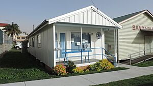
Boonah has a public library run by the Scenic Rim Regional Council. It is located at 3 High Street. The Boonah branch of the Queensland Country Women's Association (CWA) also has a meeting hall on Walter Street. Christ Church Anglican holds services on Wednesdays and Sundays.
There are several parks in Boonah where you can relax and play:
- Bicentennial Park
- Coronation Park
- Cossart Street Park
- Devin Drive Park
- Dugandan Park
- Springleigh Park
Boonah's Attractions
The Boonah Visitor Information Centre is in Bicentennial Park. You can get information about the area there. There is also the Rotary Lookout nearby. From the lookout, you can see great views of the town and the mountains of the Scenic Rim.
The Blumbergville Clock
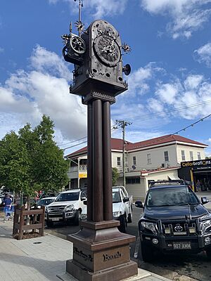
The Blumbergville Clock is a unique sculpture in High Street. It was made by local artists to celebrate the community's strength after floods in 2011 and 2013. "Blumbergville" was an old name for Boonah. The clock is 6 metres (20 feet) tall and weighs 5 tonnes (11,000 pounds). It even has a steam whistle that sounds every hour!
The Old Butter Factory
The old Boonah Butter Factory building now has an art space and a fruit and vegetable store. Its former office building is now the Flavours Café.
Boonah's Climate
Boonah has a sub-tropical climate. This means it has warm, wet summers and mild, dry winters. The town is about 80 metres (260 feet) above sea level. On average, Boonah gets about 866 millimetres (34 inches) of rain each year. This rain falls on about 89 days. Summer temperatures are usually in the mid-thirties degrees Celsius (around 90s Fahrenheit). Winter daytime temperatures are usually in the low twenties degrees Celsius (around 70s Fahrenheit).
 | Janet Taylor Pickett |
 | Synthia Saint James |
 | Howardena Pindell |
 | Faith Ringgold |


