Wyaralong Dam facts for kids
Quick facts for kids Wyaralong Dam |
|
|---|---|

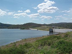
The dam wall, from the viewing platform.
|
|
|
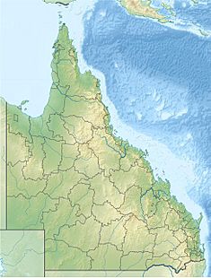
Location of the Wyaralong Dam
in Queensland |
|
| Country | Australia |
| Location | South East Queensland |
| Coordinates | 27°54′33″S 152°52′52″E / 27.90917°S 152.88111°E |
| Purpose | Potable water supply |
| Status | Operational |
| Construction began | 2010 |
| Opening date | 2011 |
| Construction cost | A$380 million |
| Operator(s) | SEQ Water |
| Dam and spillways | |
| Type of dam | Gravity dam |
| Impounds | Teviot Brook |
| Height | 48 m (157 ft) |
| Length | 490 m (1,610 ft) |
| Dam volume | 218,300×103 m3 (7,710×106 cu ft) |
| Spillway type | Uncontrolled |
| Reservoir | |
| Total capacity | 102,883 ML (22,631×106 imp gal; 27,179×106 US gal) |
| Catchment area | 546 km2 (211 sq mi) |
| Surface area | 1,230 ha (3,000 acres) |
The Wyaralong Dam is a large concrete dam in South East Queensland, Australia. It has a special spillway that lets water flow over it. Its main job is to provide clean drinking water for the Scenic Rim area. The big lake it creates is also called Wyaralong Dam. The Queensland Government started building it in 2006 because of a long drought. There wasn't enough rain to fill other dams in the region.
Contents
Where is Wyaralong Dam?
The dam is about 14 kilometers (9 miles) north-west of Beaudesert. The dam wall itself is partly in Wyaralong and partly in Allenview. However, most of the water it holds is within Wyaralong.
The Wyaralong Dam was finished just before the big 2010–2011 Queensland floods. During those floods, in January 2011, the mayors of Logan City and the Scenic Rim Region said the dam helped protect Logan from a lot of flood damage.
How Big is the Dam?
The concrete dam wall is 48 meters (157 feet) high and 490 meters (1,608 feet) long. It's built from a special type of concrete that is pressed down in layers. The dam has a wide spillway, 130 meters (427 feet) across, which lets water flow over when the dam is very full. There's also a second spillway on the left side.
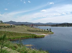
The dam wall holds back a huge amount of water, about 103,000 megalitres (27.2 billion US gallons). This water comes from a large area of 546 square kilometers (211 square miles), which includes parts of the McPherson Range. The dam creates a lake that covers about 1,230 hectares (3,000 acres). The Teviot Brook, which the dam crosses, and the land around it are important to Aboriginal culture.
SEQ Water manages the dam. It's part of a bigger plan to make sure South East Queensland has enough water. The dam has a special system that helps fish move up and down the river, even with the dam in place.
Why Was the Dam Built?
Experts first thought about this area for a dam in 1990. At that time, it was ranked 13th out of 15 possible dam locations. Another site, the Glendower Dam on the Albert River, was the top choice. The government even bought all the land for the Glendower Dam. A new dam wasn't expected to be needed until 2060 or later.
However, in 2005, the Queensland government changed its mind. They announced Wyaralong Dam as the new best option. This happened even though other studies suggested a different location on the Logan River might be better. After many studies and discussions, the Federal Environment Minister, Peter Garrett, approved the dam in November 2008.
The dam stores water and helps control its flow. It doesn't send water directly into pipes for homes. Instead, it releases water back into the Teviot Brook. This water then flows downstream to Cedar Grove Weir, where it is cleaned and sent into the water pipe system.
How Was the Dam Built?
The dam was built by a group called the Queensland Dam Consortium. This group included several companies working together. The contract for building the dam wall was for just over 100 million Australian dollars. However, the total cost for the dam project was about 333 million Australian dollars. This larger amount included other projects, like the Bromelton Offpeak Storage Project and new roads.
Work on the access roads started in early 2009. Building the dam wall began in early 2010. On December 17, 2010, the river was blocked, allowing the dam to start filling with water. The dam site was opened to the public on June 3, 2011. A new 12-kilometer (7.5-mile) road between Boonah and Beaudesert was also built.
The total cost to build the dam, including buying farmland that would be covered by the reservoir, was 380 million Australian dollars.
Water Treatment
By late 2012, the dam's water was not yet connected to the main water supply system. This was because the water contained many minerals, making it expensive to clean. A water treatment plant for Wyaralong Dam is expected to cost 235 million Australian dollars. Funding for this plant was planned for the 2014/15 financial year.
Wyaralong Dam and the 2011 Floods
During the heavy rains of the 2010–2011 Queensland floods, the dam filled up completely. This happened just 25 days after the wall was closed to hold water, even before the dam was fully finished. By January 10, 2011, the dam held 83,133 megalitres (22 billion US gallons). This was 80.7 percent of its total capacity.
On January 11, at 9:27 AM, the dam filled up and water began to flow over the spillway. In the first 24 hours after this, over 17,300 megalitres (4.6 billion US gallons) of water flowed over the main spillway and into the Logan River at Cedar Grove.
 | Jewel Prestage |
 | Ella Baker |
 | Fannie Lou Hamer |


