Harrisville, Queensland facts for kids
Quick facts for kids HarrisvilleQueensland |
|||||||||||||||
|---|---|---|---|---|---|---|---|---|---|---|---|---|---|---|---|
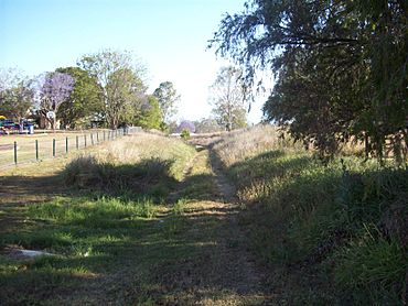
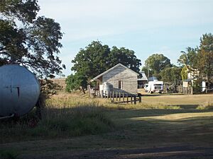
Former Dugandan railway line, 2009
|
|||||||||||||||
| Population | 667 (2021 census) | ||||||||||||||
| • Density | 20.97/km2 (54.3/sq mi) | ||||||||||||||
| Postcode(s) | 4307 | ||||||||||||||
| Area | 31.8 km2 (12.3 sq mi) | ||||||||||||||
| Time zone | AEST (UTC+10:00) | ||||||||||||||
| Location |
|
||||||||||||||
| LGA(s) | Scenic Rim Region | ||||||||||||||
| State electorate(s) | Scenic Rim | ||||||||||||||
| Federal Division(s) | Wright | ||||||||||||||
|
|||||||||||||||
Harrisville is a small, friendly town in the countryside of Queensland, Australia. It's part of the beautiful Scenic Rim Region. In 2021, about 667 people called Harrisville home.
Contents
Exploring Harrisville's Landscape
Warrill Creek flows through the western side of Harrisville. This creek is a smaller stream that eventually joins the Bremer River.
Harrisville's Past: A Journey Through Time
Early Surveys and Settlements
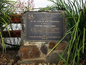
Back in 1839, an important survey took place here. A 3-mile (about 5 km) line was measured on the flat lands, then called Normanby Plains. This area is now part of Harrisville. This survey was led by Robert Dixon. It helped create the first accurate maps of Queensland's inland areas. You can still see a monument to this work west of town. It's called "In the Steps of Our Forefathers."
Around 1844, William Wilson and his brother Robert started a large sheep farm called Mount Flinders station. This was after the Moreton Bay penal colony closed. Later, some of this land became available for new settlers. In 1863, Robert Dunn chose a piece of land, and the Harris brothers bought it from him in 1870.
How Harrisville Got Its Name
The town is named after the Harris brothers, John and George. They were important figures in the area. They opened a store and a cotton gin. A cotton gin is a machine that separates cotton fibers from their seeds. Cotton was very valuable then because the American Civil War had caused a big shortage of it around the world.
Schools and Churches in Harrisville
The first school, Ipswich Reserve State School, opened in 1867. It was later renamed Harrisville State School in 1887. In 1891, a new Harrisville State School opened, and the old one became Hillgrove State School. The "new" Harrisville State School is still open today!
Churches also played a big part in the town's history:
- A Wesleyan Methodist church opened in 1871.
- St John's Anglican Church was built in 1878. Sadly, a storm destroyed it in 1985, but a new one was built in 1986.
- Harrisville Presbyterian Church was built in 1891.
- In the 1970s, the Methodist and Presbyterian churches joined together to form the Harrisville Uniting Church.
The Railway Arrives
The Harrisville Post Office opened in 1873. A few years later, in 1882, the Fassifern railway line reached Harrisville. This was Queensland's first branch railway line! It connected Harrisville to Ipswich. The railway line was later extended to Dugundan in 1887. However, the line eventually closed in 1964.
Celebrating Harrisville's Milestones
Harrisville celebrated its 100th birthday in 1963 with a street parade and a special dance. In 2013, the town marked 150 years with another parade and the unveiling of a special plaque.
Who Lives in Harrisville?
In 2021, Harrisville had a population of 667 people. In 2016, there were 613 people living here in 241 homes. The average age was 39. Most people spoke English at home. The most common jobs were in trades, like technicians.
Historic Places in Harrisville
Harrisville has several buildings and places that are important to its history. These are called heritage sites:
- Courthouse and Police Lock-up, 13 Church Street
- School of Arts, 5 Hall Street
- Masonic Hall, 16 Hall Street
- Commercial Hotel, 34 Queen Street
- Former Royal Bank, 35 Queen Street
- Memorial Park, 43–47 Queen Street
- Sacred Heart Catholic Church, 54–58 Queen Street
- Royal Hotel, 1–5 Wholly Drive
Learning in Harrisville
Harrisville State School is a primary school for students from Prep to Year 6. It's located at 17 Hall Street. In 2017, about 91 students attended the school.
There are no high schools in Harrisville itself. Students usually go to high schools in nearby towns like Boonah, Rosewood, or Ipswich CBD.
Community Life and Services
Local Facilities
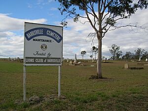
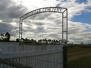
Harrisville Cemetery is a peaceful place at the intersection of Harrisville-Peak Crossing Road and Webers Road.
Community Amenities
The Scenic Rim Regional Council offers a mobile library service that visits Memorial Park. This means you can borrow books and other materials right in town!
The Harrisville branch of the Queensland Country Women's Association (QCWA) meets at the QCWA Rest Rooms on Queen Street. This group helps women in rural areas and supports the community.
You can find St John's Anglican Church at 1 Church Street. The Harrisville Uniting Church is at 4 Hall Street.
Fun Things to See
The Harrisville Historical Society has a museum on Queen Street. It's a great place to learn about the town's past. One interesting item they have is a "rain-gun" that was used during a big drought in 1902!
 | Bessie Coleman |
 | Spann Watson |
 | Jill E. Brown |
 | Sherman W. White |


