
Karoonda, South Australia facts for kids
Quick facts for kids KaroondaSouth Australia |
|||||||||||||||
|---|---|---|---|---|---|---|---|---|---|---|---|---|---|---|---|

Main Street of Karoonda
|
|||||||||||||||

Karoonda
Location in South Australia
|
|||||||||||||||
| Established | 11 December 1913 (town) 11 November 1999 (locality) |
||||||||||||||
| Postcode(s) | 5307 | ||||||||||||||
| Time zone | ACST (UTC+9:30) | ||||||||||||||
| • Summer (DST) | ACDT (UTC+10:30) | ||||||||||||||
| Location | 119 km (74 mi) E of Adelaide | ||||||||||||||
| LGA(s) | District Council of Karoonda East Murray | ||||||||||||||
| Region | Murray and Mallee | ||||||||||||||
| County | Buccleuch | ||||||||||||||
| State electorate(s) | Hammond | ||||||||||||||
| Federal Division(s) | Barker | ||||||||||||||
|
|||||||||||||||
|
|||||||||||||||
| Footnotes | Adjoining localities | ||||||||||||||

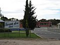
Karoonda is a cool town located in the Murray Mallee area of South Australia. It's about 60 kilometers northeast of Murray Bridge. The area of Karoonda today even includes a former town called Lowaldie, which was once the next stop on the railway line from Adelaide.
Contents
History of Karoonda
Karoonda gets its name from an Aboriginal word. It means "winter camp."
Early Days and Farming
Karoonda started as a town for growing wheat in the early 1900s. It was officially named a town on December 11, 1913. The land here is also great for raising merino sheep. To show how important sheep are, a huge statue of a Merino ram was built in the park on the main street. You can even find seats shaped like ram heads around town!
Many other types of agricultural (farming) and horticultural (gardening) businesses are now in the area. Every year, Karoonda hosts the Farm Fair. This two-day event brings over 10,000 visitors to the town.
In 1922, the District Council of Karoonda was created. This was the first time the town and nearby areas had their own local government.
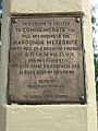
The Karoonda Meteorite
Karoonda became famous around the world for a short time in 1930. A special meteorite, called the "Karoonda meteorite", fell to Earth just east of the town. This happened on the night of November 25. It was a very rare type of meteorite and was found only a couple of weeks later. This made it very interesting to scientists who study space.
Railways in Karoonda
Railways were built between 1911 and 1914. They helped open up the Murray Mallee area for farming. Karoonda was on the railway line to Paringa. This line was later extended to Barmera in 1928. In 1914, Karoonda became a railway junction. This meant other lines branched off from here. There was the Waikerie railway line to the north and the Peebinga railway line to the east.
The Barmera railway line closed in 1990. The Waikerie branch line stayed open until 1994. The main line through Karoonda became the Loxton railway line. It was changed to a different track size (standard gauge). This line closed in July 2015.
Life in Karoonda
Karoonda is part of the District Council of Karoonda East Murray local government area. For state elections, it's in the Electoral district of Hammond. For federal elections, it's in the Division of Barker.
In 2016, a census counted the population of Karoonda. There were 512 people living in the wider Karoonda area. About 351 of them lived right in or near the town. Most people (90.6%) were born in Australia. Also, 93.3% of people spoke only English at home. The most common religions were Uniting Church (25.0%) and No Religion (22.4%).
Things to See and Do
Karoonda has some cool places to visit and things to do.
Schools and Art
The Karoonda Area School was the very first "area school" in South Australia. You can also see amazing silo art here! An artist named Heesco painted huge murals on the grain silos during the winter of 2019. There's also a great playground that's a perfect stop for kids of all ages.
Parks and Museums
Pioneer Park is being turned into a Malleelands Pioneer Railways and farm museum. You can see old harvesting machines, ploughs, and railway equipment there. Next to it, you'll find the Nature Trail & Bush Walk.
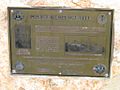
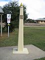
There's also a special monument (called an obelisk) in RSL Park. It remembers the Karoonda meteorite that fell nearby.
Climate in Karoonda
Karoonda has a climate that's a mix of Mediterranean and semi-arid. This means it has very warm, dry summers and mild, slightly wetter winters.
The average highest temperature in January is about 31.6°C. In July, it's around 15.7°C. The average lowest temperature in January is about 14.5°C. In July, it's around 4.8°C. The town doesn't get a lot of rain, averaging about 336.3 millimeters per year. The hottest day ever recorded was 47.6°C on December 20, 2019. The coldest was -4.0°C on June 15, 2006.
| Climate data for Karoonda (35º05'24"S, 139º54'00"E, 72 m AMSL) (2002-2024 normals and extremes, rainfall to 1914) | |||||||||||||
|---|---|---|---|---|---|---|---|---|---|---|---|---|---|
| Month | Jan | Feb | Mar | Apr | May | Jun | Jul | Aug | Sep | Oct | Nov | Dec | Year |
| Record high °C (°F) | 46.3 (115.3) |
46.3 (115.3) |
42.0 (107.6) |
38.0 (100.4) |
29.5 (85.1) |
24.9 (76.8) |
26.8 (80.2) |
32.0 (89.6) |
34.1 (93.4) |
39.2 (102.6) |
44.2 (111.6) |
47.6 (117.7) |
47.6 (117.7) |
| Mean daily maximum °C (°F) | 31.6 (88.9) |
30.5 (86.9) |
28.0 (82.4) |
23.5 (74.3) |
19.1 (66.4) |
16.1 (61.0) |
15.7 (60.3) |
17.2 (63.0) |
20.4 (68.7) |
24.0 (75.2) |
27.6 (81.7) |
29.7 (85.5) |
23.6 (74.5) |
| Mean daily minimum °C (°F) | 14.5 (58.1) |
14.1 (57.4) |
12.2 (54.0) |
9.6 (49.3) |
7.1 (44.8) |
5.5 (41.9) |
4.8 (40.6) |
4.9 (40.8) |
6.5 (43.7) |
8.4 (47.1) |
11.2 (52.2) |
13.0 (55.4) |
9.3 (48.8) |
| Record low °C (°F) | 6.4 (43.5) |
6.8 (44.2) |
4.0 (39.2) |
0.6 (33.1) |
−3.0 (26.6) |
−4.0 (24.8) |
−3.1 (26.4) |
−2.3 (27.9) |
−1.9 (28.6) |
0.6 (33.1) |
2.5 (36.5) |
4.3 (39.7) |
−4.0 (24.8) |
| Average precipitation mm (inches) | 17.8 (0.70) |
19.7 (0.78) |
16.9 (0.67) |
24.3 (0.96) |
35.0 (1.38) |
34.8 (1.37) |
34.5 (1.36) |
37.7 (1.48) |
35.1 (1.38) |
31.8 (1.25) |
24.5 (0.96) |
24.4 (0.96) |
336.3 (13.24) |
| Average precipitation days (≥ 0.2 mm) | 3.7 | 3.5 | 3.9 | 6.8 | 9.9 | 10.8 | 12.4 | 12.5 | 10.3 | 8.3 | 6.2 | 5.2 | 93.5 |
| Source: Bureau of Meteorology (2002-2024 normals and extremes, rainfall to 1914) | |||||||||||||
Lowaldie: A Former Town
Lowaldie was a small town located about 6.25 miles east of Karoonda. It once had its own railway station, school, and post office. However, these have all closed down over time. The old institute building is now used as a private home. The name Lowaldie comes from a Ngarrindjeri word meaning "summer."
Images for kids
-
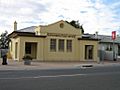
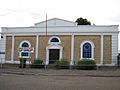
Post Office
-
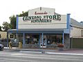
General Store
-
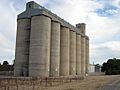
ABB Silos
-
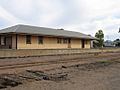
Old Railway Station
-
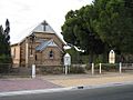
Police Memorial, Railway Tce
-
Lions Pioneer Park
-
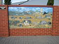
Painting at Parking Bay
-
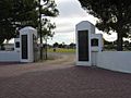
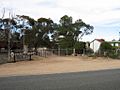
Memorial Gates at the Oval
-
Obelisk
-
Obelisk
-
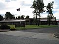
Area School
-
Area School
-
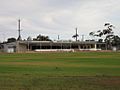
Oval
-
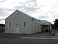
Institute
-
Hospital
-
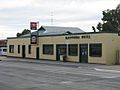
Karoonda Pub
-
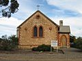
"All Hallows" Anglican Church
-
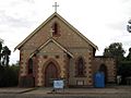
St Finian's Catholic Church
-
St Johns Lutheran Church
-
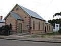
Uniting Church
-
Op-Shop
-
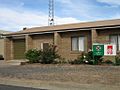
Ambulance Station
-
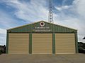
CFS Station
-
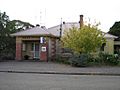
Police Station


