
Kendleton, Texas facts for kids
Quick facts for kids
Kendleton, Texas
|
|
|---|---|

|
|

Location of Kendleton, Texas
|
|
| Country | United States |
| State | Texas |
| County | Fort Bend |
| Area | |
| • Total | 1.10 sq mi (2.86 km2) |
| • Land | 1.10 sq mi (2.85 km2) |
| • Water | 0.01 sq mi (0.01 km2) |
| Elevation | 95 ft (29 m) |
| Population
(2020)
|
|
| • Total | 343 |
| • Density | 311.8/sq mi (119.9/km2) |
| Time zone | UTC-6 (Central (CST)) |
| • Summer (DST) | UTC-5 (CDT) |
| ZIP code |
77451
|
| Area code(s) | 979 |
| FIPS code | 48-38848 |
| GNIS feature ID | 1339029 |
| Website | http://www.kendletontx.net/ |
Kendleton is a small city in Fort Bend County, Texas, in the United States. It is located southwest of Sugar Land. This city was founded by formerly enslaved people after the American Civil War. In 2020, about 343 people lived there.
Contents
History of Kendleton
Founding the Community
The land where Kendleton now stands was once part of a large farm owned by William E. Kendall. In the 1860s, after the American Civil War, Mr. Kendall divided his property. He sold smaller plots of land to African Americans who had been freed from slavery. This new community of farms became known as Kendleton.
Growth and Changes Over Time
In 1882, a railroad track was built through Kendleton. This helped the community grow. A post office opened in 1884. By 1890, Kendleton had 25 residents and one general store. A few years later, in 1896, the community had two more general stores and two churches. One church was Baptist and the other was Methodist.
The number of people living in Kendleton changed over the years. In 1900, there were 116 residents. By 1933, the population dropped to 36. In the late 1940s, it grew to about 100 people. During the 1960s and 1970s, the population stayed between 150 and 200.
Becoming a City
In 1973, the people of Kendleton voted to make their community an official city. After this, the population grew to over 600. By 1990, there were 496 residents, and in 2000, there were 466.
Geography of Kendleton

Kendleton is located in the western part of Fort Bend County. Its western edge is along the San Bernard River, which is also the border between Fort Bend and Wharton County.
Roads and Travel
U.S. Route 59 is a major highway that goes through Kendleton. It bypasses the old town center, which is now served by Texas State Highway Loop 541. Another road, Farm to Market Road 2919, goes north from Kendleton to East Bernard. Using US 59, Kendleton is about 15 miles (24 km) southwest of Rosenberg and 6 miles (10 km) northeast of Hungerford.
Area and Water
According to the United States Census Bureau, the city of Kendleton covers about 1.1 square miles (2.9 square kilometers). Most of this area is land, with a very small part being water.
Population Information

The population of Kendleton has changed over the years. Here's how many people have lived in the city during different census counts:
| Historical population | |||
|---|---|---|---|
| Census | Pop. | %± | |
| 1980 | 606 | — | |
| 1990 | 496 | −18.2% | |
| 2000 | 466 | −6.0% | |
| 2010 | 380 | −18.5% | |
| 2020 | 343 | −9.7% | |
| U.S. Decennial Census 2020 Census |
|||
2020 Census Details
In 2020, the census showed that 343 people lived in Kendleton. Most residents were Black or African American. There was also a growing number of people who identified as Hispanic or Latino.
Education in Kendleton
Public Schools
Kendleton is part of the Lamar Consolidated Independent School District (LCISD). Students in Kendleton attend Beasley Elementary School in Beasley. For older students, they go to Wright Junior High School (grades 6-8) and Randle High School.
Historically, Kendleton had its own school district, the Kendleton Independent School District (KISD). In 1985, LCISD began serving high school students from the KISD area. Younger students went to Powell Point Elementary School, which was located nearby.
School District Merger
On March 25, 2010, the Texas Education Agency (TEA) decided to close the Kendleton Independent School District. This change happened on July 1, 2010. KISD was then merged with the Lamar Consolidated Independent School District. This decision was made because the district had struggled for many years. The TEA wanted to ensure students received a better education.
As a result of the merger, students from Powell Point Elementary were moved to Beasley and Wessendorf schools. For a couple of years, LCISD used the Powell Point building for its Head Start program. The community was still adjusting to the school closing in 2011.
Colleges and Universities
For community college, students from the LCISD area can attend Wharton County Junior College. There was also a college called Bay Ridge Christian College located just north of Kendleton.
Parks and Recreation
Fort Bend County has a park called Bates M. Allen Park near Kendleton. This park is about 235 acres (0.95 square kilometers) in size. It has many features for visitors to enjoy.
Park Features
At Bates M. Allen Park, you can find a canoe ramp, a fishing pier, and areas for grilling. There's also a historical site, a lake, and an observation deck. The park has two covered picnic areas (pavilions), a play area for kids, a sand volleyball court, and tables. Restrooms are available, and there are walking trails and wetlands to explore.
In 2023, the county announced plans to add a memorial to African-American settlements in the park. This project will involve updating much of the park and is expected to cost $4 million.
Gallery
-
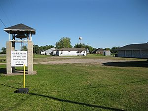
Church of God on FM 2919 in Kendleton
-
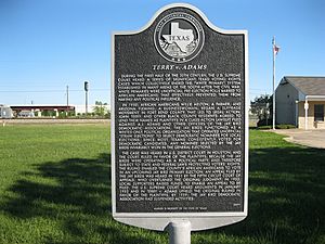
Marker explains the US Supreme Court case Terry v. Adams
-
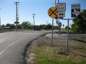
Union Pacific railroad crossing at Loop 541 and FM 2919
-
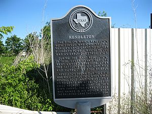
Marker on Loop 541 gives the history of Kendleton
-
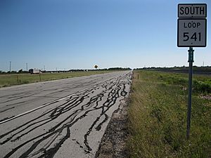
Loop 541 after the US 59 exit to the northeast of Kendleton


See also
 In Spanish: Kendleton para niños
