Kilbirnie Loch facts for kids
Quick facts for kids Kilbirnie Loch |
|
|---|---|
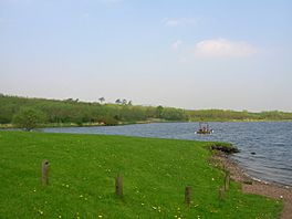
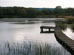
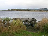
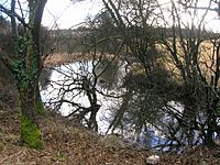
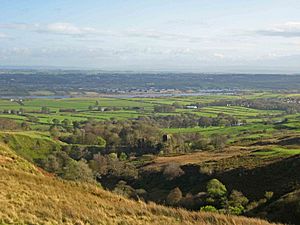
The loch from the southern end
|
|
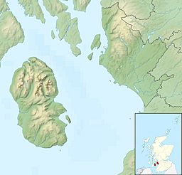
| Location | North Ayrshire, Scotland |
| Coordinates | 55°45′N 4°41′W / 55.750°N 4.683°W |
| Lake type | freshwater loch |
| Primary inflows | Maich Water |
| Primary outflows | Dibbs Water |
| Basin countries | Scotland |
| Max. length | 2 km (1.2 mi) |
| Max. width | 0.5 km (0.31 mi) |
| Surface area | 3.08 km2 (1.19 sq mi) |
| Average depth | 5.2 m (17 ft) |
| Max. depth | 105 ft (32 m) |
| Surface elevation | 50 m (160 ft) |
| Islands | The Cairn crannog (destroyed) |
| Settlements | Kilbirnie, Beith, Glengarnock |
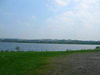
Kilbirnie Loch is a freshwater loch in North Ayrshire, Scotland. It lies in a flat area between the towns of Kilbirnie, Glengarnock, and Beith. The loch stretches for almost 2 kilometers (1.2 miles) from southwest to northeast. It is about 0.5 kilometers (0.3 miles) wide. The total area of the loch is around 3 square kilometers (761 acres).
The loch is generally about 5.2 meters (17 feet) deep. Its deepest point is around 11 meters (36 feet). The main water source for Kilbirnie Loch is the Maich Water. This river starts in the Kilbirnie Hills. Water flows out of the loch through the Dubbs Water. This water then goes into Barr Loch and Castle Semple Loch. Finally, it joins the Black Cart and River Clyde.
Contents
- History of Kilbirnie Loch
- Geology of the Loch Area
- Archaeological Discoveries
- Getting to Kilbirnie Loch
- Transport on the Loch
- Nature and Wildlife
- Activities on the Loch
- Water Quality Concerns
- Clyde Muirshiel Regional Park Authority
- The Willowyard Estate
- Mains Properties
- Interesting Facts (Micro-history)
History of Kilbirnie Loch
How the Loch Got Its Name

The first mention of the loch was by Hector Boece in 1527. He called it 'Garnoth' and said it was "full of fish." For a long time, people tried to drain parts of the area for farming. These efforts started around 1691 with Lord Sempill.
In the past, Kilbirnie Loch and Barr Loch were almost connected. Sometimes they even joined during floods. Early writers thought they were one big loch called 'Garnoth' or 'Garnott'. Over time, silt from the River Calder divided them.
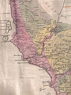
The earliest known name for the loch, from around 1210, was 'Loc Tancu'. Locals also called it 'Loch Tankard'. A farm nearby, 'Unthank', might have gotten its name from 'Tancu'. The name 'Garnoth' might come from 'Garnock'. Some early maps from around 1600 show the two lochs as separate but still very close.
The word 'Kerse' is used for farms and a bridge at the north end. In Scots, 'Kerse' means "low, fertile land next to a river or loch." This describes the area well.
Who Owned the Loch?
Long ago, monks from Paisley Abbey owned the land between the Maich and Calder rivers. The loch is in the Parish of Kilbirnie. The ancient Barony of Glengarnock once belonged to the Cuninghams. Later, it became part of the Crawfurds of Kilbirnie's land.
The Cunninghames and Crawfurds often argued about who had the right to use the loch for rowing and fishing. They even broke each other's boats! Eventually, marriages between the families helped solve these problems. Both families had the loch included in their official land papers.
Today, Scottish Enterprise owns the bottom of the loch. However, people who own land along the shoreline have certain rights and duties. North Ayrshire Council owns land at the south end. Network Rail owns land on the eastern side, next to the main railway line. Private owners hold land to the west and north. The right to fish for salmon belongs to the Crown.
The Cairn Island
'The Cairn' was the only island on Kilbirnie Loch. People in the 1860s thought it was built by a landowner. They believed it was a safe place for swans and other water birds to nest. A path that could be walked across led to it. The island was about 2.5 feet above the water.
From 1841, waste from nearby ironworks was dumped into the south end of the loch. This heavy waste caused the island to shift. It revealed that 'The Cairn' was actually a crannog, an ancient lake dwelling. Sadly, the dumping eventually destroyed the island completely.
In the 1980s, a new artificial island was made at the southeast end. This was to help birds find a place to nest.
Flax and Steel Industries
In the 1800s, there was a farm called Lochside Farm on the northwest side. A 'Flax Pond' was also nearby. This pond was used for "rhetting" flax, which is a step in making linen. The company William & James Knox, linen thread makers, started in 1788 and is still in Kilbirnie today.
The Glengarnock Ironworks and later steelworks dumped a lot of waste into the loch. This made the loch smaller and shallower. The southwest part of the loch is still dangerous because of this waste near the surface. The Dubbs Water was originally a canal. It was dug in the late 1700s to move coal and iron ore to the steelworks. It also helped transport finished products to markets. Roads back then were not good for heavy goods.
Loch Riggs Colliery
Loch Riggs was a small village for coal miners near the Maich Water. The Loch Riggs Colliery (coal mine) closed in 1808 because it flooded. The rich coal under the loch was never mined again. In 1900, workers building a railway found old mine waste from this colliery.
Geology of the Loch Area
The ground around the loch is made of carboniferous limestone. Higher areas to the north and south are mostly basalt. The top layers of soil include peat to the north. There is also boulder clay and lake alluvium in the lower areas. The soils are mostly alluvium to the north and southeast. To the east and west, the soils are poorly drained.
Archaeological Discoveries
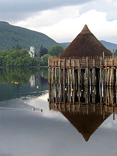
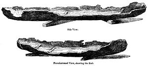
In 1868, amazing discoveries were made at the southwest corner of the loch. Dumping waste from the ironworks pushed up the lake-bed. This revealed a crannog (an ancient lake dwelling), its causeway (a raised path), and up to four logboats. A place called 'The Cairn' was already known. It would appear when the water level was very low.
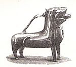
Two of the logboats were studied closely. The most complete one was 5.5 meters (18 feet) long and 0.9 meters (3 feet) wide. It was about 0.6 meters (2 feet) deep. A bronze ewer (a type of jug) was found in one of the boats. These items are now in the Royal Museum of Scotland. The boat itself fell apart quickly once it was exposed to air.
In 1952, another part of a logboat was found on the west side. This was also due to slag-dumping. Scientists studied mud from the boat. They think this logboat is from between 3000 and 700 BC. The remaining part of this boat was given to Paisley Museum.
The south end of the loch was filled with slag and other waste starting in 1841. The biggest changes happened between 1859 and 1909. By 1930, most of the dumping at the south end stopped. However, filling from the west bank continued for some time.
Getting to Kilbirnie Loch
If you are coming from Kilbirnie, you can take the B777 road. It leads to the Lochshore Industrial Estate. There is plenty of parking there. The road also goes to the boat launching area in the southwest corner of the loch.
From Beith, you can use the 'Kerse' road. This road runs between Beith and the A760. It gives access to the northern shore. Parking along the road can be tricky. Near the railway bridge, there is a rough track that goes down to the lochside. This area is used by the local Kayak Club.
Part of the Sustrans National Route 7 cycling path is near the loch. It goes from Paisley to Kilbirnie, passing by Castle Semple and Barr Lochs. The path continues through Glengarnock and Kilwinning.
Transport on the Loch
In the 1700s, people enjoyed pleasure cruises on the loch. Coal was also carried across the loch from Kilbirnie to Beith. Hugh Stevenson used to transport coal down to the loch. He would then ferry it across to a small dock. From there, it was taken to Beith by cart.
A passenger ferry also used to cross the loch. It likely ran from near the old Lochside Farm to a small dock where the Mains Burn met the loch. An old road then led up into Beith town.
Nature and Wildlife
There are some tree plantations near Beith from the 1800s. The south end of the loch had "Lady Mary's planting" of trees. The north end, however, had no trees. The old industrial sites on the western shore now have many willow trees. There are also some older deciduous trees (trees that lose their leaves).
Kilbirnie Loch is a special place for nature. It is a Local Site for Nature Conservation (LSNC). This means it is important for protecting local plants and animals. However, there are invasive waterweed species like Canadian waterweed that can harm native plants.
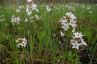
The southern end of the loch has large areas of mown grass. There are also mature bushes and small woods. The western shore has planted willows and some older trees. The northern shore is flat and has marshy areas. The eastern side has a narrow strip of reedbed. Bogbean grows in sheltered spots.
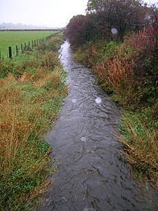
The Mains and Willowyard burns flow into the loch from the east. The Black Burn enters from the northwest. These burns have brought in silt, creating areas of reedbeds.
Common plants along the water's edge include reed canary grass, creeping bent, and iris. Other important species are common water-crowfoot, chara, slender spike-rush, and spiked water milfoil.
Many small creatures live in and around the loch. These include diatoms, blue-green algae, copepods, and rotifers. You can also find worms, snails, leeches, mayflies, beetles, and different types of butterfly larvae.
Rare Species Found Here
Surveys have found several rare plant species at Kilbirnie Loch. These include reed grass, viper's bugloss, mare's tail, and field scabious. Also found are spiked water-milfoil, shoreweed, butterfly orchid, and ivy-leaved crowfoot. Other rare plants are weld, marsh yellow-cress, bay willow, creeping yellow-cress, and the special bogbean.
Activities on the Loch
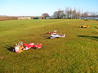
Many groups use Kilbirnie Loch and the land around it. These include the Kilbirnie Angling Club, Garnock Canoe and Boating Club, Kyle Waterski and Wakeboard Club, and the Model Boat Club. The Garnock Rugby Club and the Garnock Valley Model Aircraft Club also use the area.
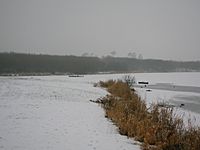
Curling on the Ice
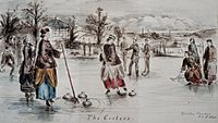
Before the ironworks, people used the frozen loch for curling. In the 1800s, curling clubs played matches there. In 1850, a big curling match took place on the loch. Many spectators came to watch. A large curling event called a Bonspiel also happened nearby. The company J & W Muir, which made curling stones, was once based in Beith.
An old book about curling says that "many keen and good curlers" from Beith would go to Kilbirnie Loch when it was safely frozen.
Fishing (Angling)
Kilbirnie Loch is well known for fishing. It has large pike, roach, and rainbow and brown trout. People can fish from boats or the shore. In 2009, a very large pike, weighing over 30 pounds, was caught in the loch.
The Kilbirnie Angling Club started in 1904. Today, the club manages fishing rights for Kilbirnie Loch and nearby waters. The loch is regularly stocked with rainbow trout.
In the 1600s, it was said that Kilbirnie Loch was "the goodliest fresh water in all Cuninghame." In 1876, records show it had "pike, trout, perch, braize (bream) and eels."
Birds at the Loch
The best time to see birds at Kilbirnie Loch is from late autumn through winter. You can see Mallard, tufted duck, Eurasian coot, and mute swan all year. In late September, more species arrive. These include common goldeneye, Eurasian wigeon, and Eurasian teal. Sometimes you might even spot goosander or smew.
Cormorants are often seen, and grey herons feed along the banks. Several types of gulls are also present. Waterfowl seem to prefer the northern parts of the loch. The willow trees and other plants on the western slopes provide cover for many birds. These include great spotted woodpecker, tits, thrushes, and warblers.
The north-eastern corner and north shore have shallower, marshy areas. Here, you might see waders like common snipe and curlew. These areas also attract finches and thrushes, which can be prey for sparrowhawks.
Water Skiing and Wakeboarding
The Kyle Waterski and Wakeboard Club has been active on the loch for over 30 years. Their clubhouse is at the south end of the loch. It has a car park, a slipway for boats, and changing rooms. The club is open for water skiing and wakeboarding from April 1 to September 30. They operate on Wednesday and Friday evenings, and Saturday and Sunday afternoons.
Garnock Rugby Football Club
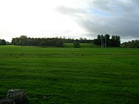
Garnock Rugby Club plays on the Lochshore Playing fields. This area was once part of the loch. It was filled in by the iron and steelworks in the 1800s. The club is an amateur rugby union club. It was formed in 1972 when two older clubs merged. This happened when local schools, including Spier's and Dalry High, combined to form Garnock Academy.
Water Quality Concerns
When the Glengarnock Iron and Steel Works were running, they discharged waste into the loch. The remaining slag in the loch has high levels of phosphates. This makes pollution problems worse. In the 1990s, the loch became "eutrophic." This means it had too many nutrients, leading to algal blooms in the summer. These blooms can be dangerous for people and dogs. Scientists are working to find the source of this pollution. They are also looking into creating a reedbed to filter the water.
Clyde Muirshiel Regional Park Authority
The Clyde Muirshiel Regional Park Authority helps manage the area around Kilbirnie Loch. They work with other groups like Scottish Natural Heritage and the Scottish Environment Protection Agency (SEPA). Their goal is to develop plans for managing this important wetland system in the future.
The Willowyard Estate
On the east side of the loch is the old Willowyard estate. This land was once given to Helen, daughter of Robert Lord Boyd. Later, it became the property of the Earl of Eglinton. In the 1700s and 1800s, the estate changed hands several times.
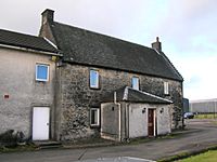
The Willowyard House, which still stands, dates from 1727. By the late 1700s, Willowyard was a well-established farm. It had about 175 acres of farmland, a good house, and a garden. There was also a quarry for stone and possibly coal and limestone.
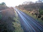
Today, the Willowyard Industrial Estate is between Kilbirnie Loch and Beith. A large whisky storage facility is in the area. Willowyard House is still there, used as offices for a chemicals company. The main railway line from Ayr to Glasgow runs along the eastern edge of the loch.
Mains Properties
The properties called 'Mains' were divided into 'Mains-Neil', 'Mains-Houston', and 'Mains-Marshal'. An old map from around 1600 shows Mains Mure as a castle-like tower house.
The Mains House was once owned by the Muir family. They also owned a tannery and built the Bark Mill. The Mains House was demolished around 1975 to build whisky storage facilities. Some engraved stones from the old house were saved.
An old road, Mid Road, used to cross a burn near Mains House. It then went up into Beith town. This road is now abandoned.
The Bark Mill
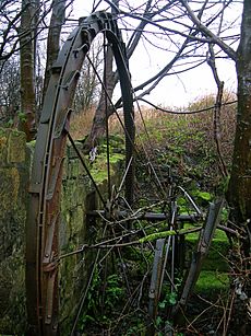
A Bark Mill was located near the loch. It was powered by the Mains and Bath Burns. The mill ground bark, likely from oak trees around the loch. This ground bark was used in tanneries in Beith. Later, the mill became a furniture factory. It used machinery to help make furniture. A railway siding was built to transport products. However, the site was isolated, so a new factory was built closer to Beith Town Station.
Interesting Facts (Micro-history)
In 2004, an early Bronze Age axehead was found near East Kerse. It is now in the Kelvingrove Museum in Glasgow.
One building at the Kerse Bridge was the old 'Kirk's Railway Inn'. It served the railway station that used to be across the road.
Many successful drainage projects, especially for Barr Loch, were done by Dutch immigrants. They brought their technology from Holland. Their surnames are still found in the area today.
In 1904–05, a model yacht race took place on Kilbirnie Loch.
There is a story of a secret Ley tunnel that runs from the Grace Church in Beith to Kilbirnie Loch.
A geocache (a hidden container for a treasure hunt) is located by the loch. Kilbirnie Loch is said to be the only Scottish loch where the main exit is at the same end as the source river.
Scottish Enterprise owns much of the land where the old steelworks used to be. Now, trees cover these former industrial areas.
The Earl of Eglinton once planned to build a canal from Ardrossan to Glasgow. It would have run close to Kilbirnie Loch.
The North Ayrshire Council Ranger Service regularly patrols the loch. They work with the Kilbirnie Loch Management Group. They help manage boats, fishing, canoeing, sailing, and power boat use.
 | Kyle Baker |
 | Joseph Yoakum |
 | Laura Wheeler Waring |
 | Henry Ossawa Tanner |


