Kingsweston (ward) facts for kids
Quick facts for kids Kingsweston |
|
|---|---|
| Population | 10,337 (2011.ward) |
| Unitary authority | |
| Ceremonial county | |
| Region | |
| Country | England |
| Sovereign state | United Kingdom |
| Post town | BRISTOL |
| Postcode district | BS9 |
| Dialling code | 0117 |
| Police | Avon and Somerset |
| Fire | Avon |
| Ambulance | Great Western |
| EU Parliament | South West England |
| UK Parliament |
|
Kingsweston was once a special area, called a ward, within the city of Bristol. It included three main parts: Coombe Dingle, Lawrence Weston, and Sea Mills. The name Kingsweston comes from an older area, Kings Weston, which is now mostly part of Lawrence Weston.
In 2015, the boundaries of these areas were changed. Now, the old Kingsweston ward is divided between two new wards: Stoke Bishop and Avonmouth and Lawrence Weston.
Contents
Exploring Coombe Dingle
Coombe Dingle is a lovely part of Bristol. It's located where the River Trym flows out of a valley near the Blaise Castle Estate. Many of the private homes here were built in the 1920s and 1930s. It's considered a very nice place to live. Further along the river from Coombe Dingle, you'll find Sea Mills.
Discovering Lawrence Weston
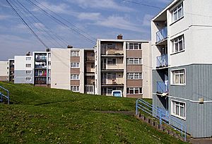
Lawrence Weston is a housing area in north-west Bristol. It was built after World War II, mostly in the late 1940s and early 1950s. It sits between Henbury and Shirehampton. To its east, you can find the beautiful woods and estate of Blaise Castle. The area is also right below the wooded Kingsweston Hill.
The industrial area and port of Avonmouth are only about a mile away, across a flat area of land. Many of the homes in Lawrence Weston were originally owned by the local council. However, many are now owned by private individuals. The local people sometimes call the area "El Dub." The shops in Ridingleaze have been updated, and each one now has a colourful mural.
Lawrence Weston is well known for its great places and activities for young people.
- There are two youth centres.
- You can find a fun BMX track.
- There's a shop just for young people called Juicy Blitz.
- A Youth Inclusion project helps young people get involved in the community.
- The area also has a community farm and many clubs and groups for young people to join.
The History of Kings Weston
The name Kings Weston, sometimes spelled Weston Regis, refers to an old small village or 'tything'. It was part of the Henbury parish and was located to the west of what is now Lawrence Weston. When the Lawrence Weston housing estate was built in the 1940s, Kings Weston became part of it.
Historically, Kings Weston is famous for Kings Weston House. This village also gave its name to Kingsweston Hill and Kings Weston Lane. This lane is the main road connecting Lawrence Weston and Shirehampton.
You can also find the remains of a Roman villa at Kings Weston.
Exploring Sea Mills
Sea Mills is a suburb of the port city of Bristol in England. It is about 3.5 miles (6 km) north-west of the city centre. It's located at the end of the Avon Gorge, where the river meets the sea. Nearby areas include Shirehampton, Sneyd Park, Combe Dingle, and Stoke Bishop.
Sea Mills was once the site of a Roman settlement. It was known as Portus Abonae. This name suggests it was a river port, but archaeologists are still looking for proof of this. The Roman settlement seems to have been left empty by the 4th century. There is no sign of Saxon people settling there later.
By the Middle Ages, Bristol had become a very important port. All ships going to and from the port had to travel through the Avon Gorge and past Sea Mills. In 1712, a Bristol merchant named Joshua Franklin built a wet dock at Sea Mills. This dock allowed large sailing ships to avoid navigating the dangerous River Avon further upstream. The dock was built where the River Trym flows into the River Avon.
However, it was hard to transport goods to and from the dock by land. Because of this, the harbour facilities fell into disrepair by the late 1700s. Some parts of the old dock still exist today. They are now used as a small harbour for pleasure boats.
In the 1920s and 1930s, Sea Mills was developed as a carefully planned green suburb. Much of the housing was built by the local council. Today, most of these homes are privately owned. Near the Portway road, there is a small area of prefabricated bungalows. These were built after World War II as part of a housing plan.
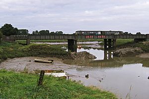
The wide A4 Portway trunk road runs along the south-west edge of Sea Mills. This road connects central Bristol with its outer port at Avonmouth. When it opened in 1926, the Portway was the most expensive road in Britain. Both the Portway and the railway line have bridges that cross over the harbour's outlet into the Avon.
In the past, large ocean-going ships would sail past Sea Mills. They were going to and from Bristol City Docks. Today, most of the ships you see are pleasure boats. Bristol's main docks are now located at Avonmouth and Portbury.
In October 2006, The Portway Rugby Development Centre opened. It has two outdoor 3G Crumb pitches, which are great for rugby and football. There are also outdoor grass rugby pitches. The centre has two meeting rooms and hosts many aerobics classes.
Population Information
According to the 2001 Census, about 10,844 people lived in the Kingsweston ward. More than 95% of these residents were white.
Getting Around (Transport)
The Kingsweston area is served by one railway station. It's located at Sea Mills, just outside the ward's boundary. Trains run hourly between Bristol Temple Meads and Avonmouth. During busy times, there are also connections to Severn Beach.
Several bus services also serve the area.
 | Mary Eliza Mahoney |
 | Susie King Taylor |
 | Ida Gray |
 | Eliza Ann Grier |


