Kitimat River facts for kids
Quick facts for kids Kitimat River |
|
|---|---|

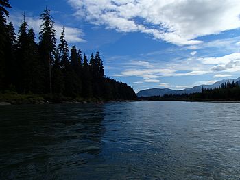
Kitimat River, August 2012
|
|
| Country | Canada |
| Province | British Columbia |
| Physical characteristics | |
| Main source | Kitimat Ranges, Coast Mountains 1,285 m (4,216 ft) 53°58′25″N 128°4′18″W / 53.97361°N 128.07167°W |
| River mouth | Pacific Ocean Kitimat, Douglas Channel 0 m (0 ft) 54°0′39″N 128°39′44″W / 54.01083°N 128.66222°W |
| Length | 100 km (62 mi) |
| Basin features | |
| Basin size | 1,990 km2 (770 sq mi) |
| Tributaries |
|
The Kitimat River is a river in the Canadian province of British Columbia. It starts in the Kitimat Ranges mountains. The river flows in a big curve, first north, then west, and finally south. It ends by flowing into Kitimat Arm, which is part of the Douglas Channel, right at the town of Kitimat.
The river gets its name from the Gitamaat people. They are the original First Nations people who lived in the river valley. In the Tsimshian language, "Gitamaat" means "People of the Falling Snow." The Gitamaat people are actually Haisla, not Tsimshian. Today, the Haisla Nation lives in Kitamaat Village, which is close to where the Kitimat River meets the ocean.
Contents
Journey of the Kitimat River
The Kitimat River begins high up in the mountains. Its water comes from melting glaciers on the northern side of Atna Peak. This same area is also the source for other rivers like the Dala River, Atna River, Clore River, and Kemano River.
The very start of the Kitimat River is located northwest of Atna River Provincial Park.
Flowing North and West
The Kitimat River first flows north through a deep valley. This valley is surrounded by tall, glaciated mountains like Mount Davies. Davies Creek joins the Kitimat River just north of Mount Davies. As the river continues north, Hunter Creek also flows into it. Hunter Creek brings water from glaciers on high mountains such as Andesite Peak and Mount Clore.
After this, the Kitimat River changes direction and flows west. Along this part of its journey, it collects water from several smaller streams. These include Tetlock Creek, McKay Creek, and Christ Creek. Christ Creek starts on the north side of Mount Clore.
Entering the Kitimat Valley
After Christ Creek joins, the Kitimat River turns south. It then enters the wide Kitimat Valley. This valley stretches between the town of Kitimat in the south and Terrace (which is on the Skeena River) in the north. The Stewart-Cassiar Highway, also known as Highway 37, runs alongside the Kitimat River in this valley.
As the Kitimat River flows south, it is joined by Cecil, Deception, Humphrys, and Nalbeelah Creeks. Then, it meets the Wedeene River, which flows in from the northwest. The Wedeene River and its main branch, Aveling Creek, get their water from glaciers around Wedeene Mountain, Mount Light, Mount Temple, and Mount Holt.
Nalbeelah Creek Wetlands Provincial Park is a special area located just southeast of where the Kitimat River and Nalbeelah Creek meet.
Reaching the Ocean
A little further downstream from the Wedeene River, the Little Wedeene River joins the Kitimat River from the west. The Little Wedeene River starts at Mount Madden and drains water from other high peaks like Mount Clague. Just after the Little Wedeene River joins, the Kitimat River flows past Kitimat River Provincial Park.
The areas where the Wedeene and Little Wedeene Rivers flow are just east of Gitnadoiks River Provincial Park.
As the Kitimat River gets closer to the town of Kitimat, Hirsch Creek flows into it from the east.
Finally, the river flows through the town of Kitimat and past Kitimaat Indian Reserve 1. This reserve is also known as Colichan Ground or Old Town. Sumgás Creek joins the river here. The Kitimat River then empties into Kitimat Arm, which is a part of the long fjord called Douglas Channel. The waters of Douglas Channel flow south towards Wright Sound and then out to Hecate Strait and the Pacific Ocean.
History of Kitimat Town
The town of Kitimat was once a small fishing village. In the 1950s, the Aluminum Company of Canada (Alcan, now Rio Tinto Alcan) built the modern town. They did this to support a large factory that makes aluminum.
To power this factory, Alcan built the Kenney Dam on the Nechako River. They also dug a 16 km (10 mi) long tunnel to the Kemano Generating Station. From there, 82 km (51 mi) of power lines carried electricity to Kitimat. In Kitimat, they built a deep-sea port and the aluminum factory.
Rivers and Creeks that Join the Kitimat
Here is a list of some of the streams and rivers that flow into the Kitimat River, starting from the mouth and going upstream:
- Sumgás Creek
- Hirsch Creek
- Little Wedeene River
- Bowbyes Creek
- Dahl Creek
- Lukes Creek
- Wedeene River
- Iron Mine Creek
- Raley Creek
- Lone Wolf Creek
- Aveling Creek
- Nalbeelah Creek
- Humphrys Creek
- Deception Creek
- Cecil Creek
- Christ Creek
- McKay Creek
- Bolton Creek
- Tetlock Creek
- Hunter Creek
- Davies Creek
- Hoult Creek
See also
 In Spanish: Río Kitimat para niños
 | Charles R. Drew |
 | Benjamin Banneker |
 | Jane C. Wright |
 | Roger Arliner Young |

