Kuna Peak facts for kids
Quick facts for kids Kuna Peak |
|
|---|---|

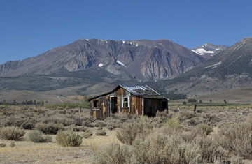
Kuna Peak, Parker Peak and Mt. Dana in the distance
|
|
| Highest point | |
| Elevation | 13,008 ft (3,965 m) NAVD 88 |
| Prominence | 1,922 ft (586 m) |
| Listing | Western States Climbers Emblem peak |
| Geography | |
| Location | Mono and Tuolumne counties, California, U.S. |
| Parent range | Kuna Crest, Sierra Nevada |
| Topo map | USGS Koip Peak |
| Climbing | |
| First ascent | 1919 by Walter L. Huber |
| Easiest route | Traverse from Koip Peak, class 2 |
Kuna Peak is a tall mountain in California, in the United States. It sits right on the border between Mono and Tuolumne counties. This peak is the highest point on a mountain range called Kuna Crest.
Kuna Peak is very high, reaching about 13,008 feet (3,965 meters) into the sky. This makes it one of the tallest mountains in California. It is also the third-highest mountain found within Yosemite National Park.
What's in a Name?
The name Kuna likely comes from an old Native American language called Shoshonean. In the local Mono dialect, the word means "firewood."
When you look at the top of Kuna Peak, you might see many sharp, jagged rocks. These rocks can look a bit like flames or pieces of firewood themselves. This might be why the mountain got its name.
Where is Kuna Peak?
Kuna Peak is surrounded by other mountains that are almost as tall. For example, Koip Peak is only about a mile to the east and is a little bit shorter.
The western side of Kuna Peak is part of the famous Yosemite National Park. The eastern side of the mountain is located in a protected area called the Ansel Adams Wilderness. This means both sides are beautiful natural places!
Nearby Places to Explore
Here are some other interesting places close to Kuna Peak:
- Bingaman Lake
- Donohue Peak
- Koip Peak
- Helen Lake
- Kuna Lake
- Mammoth Peak
- Mono Pass
- Mount Andrea Lawrence
- Mount Lewis
- Parker Peak
- Spillway Lake
Images for kids
-
North aspects of Parker Peak (left), Koip Peak (right of center), and Kuna Peak (right) as seen from Mount Gibbs.
 | May Edward Chinn |
 | Rebecca Cole |
 | Alexa Canady |
 | Dorothy Lavinia Brown |


