
Kwajalein Atoll facts for kids

Landsat satellite image of Kwajalein Atoll
|
|

Map from National Atlas of the United States
|
|

Kwajalein Atoll
Location in Marshall Islands
|
|
| Geography | |
|---|---|
| Location | North Pacific Ocean |
| Coordinates | 8°43′N 167°44′E / 8.717°N 167.733°E |
| Archipelago | Ralik |
| Administration | |
The Kwajalein Atoll is a special group of islands in the Marshall Islands. An atoll is a ring-shaped coral reef, island, or chain of islands that surrounds a lagoon. The biggest island in this group is called Kwajalein Island. Many people who live there are from the U.S. and often call it "Kwaj" for short.
The total land area of the atoll is just over 6 square miles (16 square kilometers). It is located in the Pacific Ocean, about 2,100 nautical miles (3,900 km) southwest of Honolulu, Hawaii.
Since World War II, the United States Navy and later the United States Army have used Kwajalein Island as a military base. It's famous for being a place where missiles are tested. Today, it's part of the Ronald Reagan Ballistic Missile Defense Test Site. This site has many radars, cameras, and missile launchers spread across different islands.

Contents
What is Kwajalein Atoll Like?

Kwajalein is one of the world's largest coral atolls. It has 97 islands and small islets. These islands surround a huge lagoon, which is one of the biggest in the world. The land area is about 6.33 square miles (16.4 square kilometers). The islands are very low, only about 6 feet (1.8 meters) above sea level.
The atoll was formed from volcanoes under the sea a very long time ago. Coral started growing on these volcanoes about 56 million years ago.
Kwajalein is about 2,100 miles (3,380 km) from Honolulu, 2,000 miles (3,200 km) from Australia, and 2,100 miles (3,380 km) from Japan. Kwajalein Island is about 500 miles (800 km) north of the equator.
.jpg)
Kwajalein Island is the largest island in the atoll. It was made bigger by adding land, especially for housing and industrial areas.
About 1,000 people live on Kwajalein Island. Most are Americans, with some Marshall Islanders and other nationalities. You need special permission from the United States Army to live there. However, about 13,500 Marshallese citizens live on the atoll, mostly on Ebeye Island.

Because of the Battle of Kwajalein during World War II, the lagoon has many sunken ships and airplanes. Most of these were merchant ships.
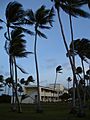
Kwajalein Atoll has two airbases and three airstrips. The water temperature is usually around 81°F (27°C). You can often see about 100 feet (30 meters) underwater on the ocean side. On Kwajalein Island, most people get around by bicycle.
Ebeye Island: A Busy City

Ebeye Island is about 4.5 miles (7.2 km) north of Kwajalein Island. It is not part of the Ronald Reagan Ballistic Missile Defense Test Site. Ebeye is a city for the Marshallese people, with shops, restaurants, and a busy port. It is the main government center for the Marshall Islands in the Kwajalein Atoll.
.jpg)
Ebeye has the largest population in the atoll, with about 13,000 people living on only 80 acres (320,000 square meters) of land. This makes it one of the most crowded places in the world. Most residents are Marshall Islanders.
A coral reef connects Ebeye to Kwajalein. At low tide, you can even walk across it. A causeway at the north end of Ebeye connects it to several other islands, forming a chain of inhabited islands about 6 miles (10 km) long.
Roi-Namur Island: Radar and History
.jpg)
Roi-Namur is the northernmost island in the atoll. It is home to several radar stations. A small group of U.S. personnel live there to help with missile testing and radar tracking.
You can still see Japanese bunkers and buildings from World War II on Roi-Namur. Roi and Namur used to be separate small islands. They were joined together by a causeway built by Korean workers under Japanese control.

Many Marshall Islanders travel to Roi-Namur from the nearby island of Enniburr for work. They have limited access to the island, similar to workers on Kwajalein.
Roi-Namur was originally four islands: Roi, Namur, Enedrikdrik, and Kottepina. The spaces between them were filled with sand by Korean and American workers between 1940 and 1945. After the war, the joined islands were renamed Roi-Namur.
A Look at Kwajalein's History
Kwajalein Atoll was very important to the Marshallese people. Kwajalein island had a special "zebra wood tree" that was believed to have spiritual powers. People from other islands would come to gather its "fruits."
Europeans first saw Kwajalein in January 1543 during a Spanish expedition. They called it Los Jardines (The Gardens) because it looked so fresh and green.

In 1828–1829, a Russian Navy captain named Ludwig von Hagemeister mapped Kwajalein. In 1875, a large typhoon caused an 8-foot (2.4-meter) storm surge that drowned everyone on Kwajalein Island.
In 1885, Germany took control of the Marshall Islands from Spain. Later, in 1922, the islands were placed under Japanese control by the League of Nations. Kwajalein Atoll was a quiet trading post managed by Japanese civilians until World War II began in 1941.

Some Japanese people lived in Kwajalein Atoll, mostly traders and their families. They worked in shops. School teachers from Japan also came to the island in 1935. Many Marshall Islanders remember this as a peaceful time of cooperation.
In the late 1930s, Japan started building up its military power in the Pacific. This was a big change from the peaceful way the islands had been managed.
_transporting_aircraft_1944.jpeg)
Korean people were forced to work in the Pacific starting in the early 1940s. Thousands were sent to the Marshall Islands. In Kwajalein, these Korean workers helped build defenses. They worked day and night to fix damage from American air raids.
In 1943, more Japanese soldiers came to Kwajalein. Many were young and not used to the tropical climate. They often got sick because their food supplies were sunk by Americans. As the war continued, these soldiers became harsher towards Marshall Islanders, sometimes suspecting them of spying.

After the war, some Japanese naval officers were tried for war crimes committed elsewhere.
American Occupation

On January 31, 1944, American soldiers attacked Kwajalein. On February 1, 1944, Kwajalein was hit by a huge amount of bombs and shells. Over 36,000 shells from naval ships and artillery struck the island. American bombers also dropped bombs, causing even more destruction.

Out of 8,782 Japanese personnel on the atoll, 7,870 were killed. About 200 Marshallese people were also killed during the fighting. Kwajalein was one of the few places in the Pacific War where local islanders were killed while fighting for the Japanese.
On February 6, 1944, the United States took control of Kwajalein. It became a United Nations Trust Territory under the U.S.
U.S. Military Base
.jpg)
After the war, the U.S. used Kwajalein as a base for Operation Crossroads in 1946. This was the first of many nuclear tests in the Marshall Islands. Many local people had to move because of these tests and military activities between 1945 and 1965.
The German warship Prinz Eugen was brought to Kwajalein after the nuclear tests. It started leaking and sank in the lagoon. The USS Pennsylvania battleship also sank near Kwajalein after being used in atomic bomb testing in 1948.
_drydocked_in_an_Advanced_Base_Sectional_Dock_at_the_Pacific_c1944.jpg)
In 1964, the U.S. started its Anti-ballistic missile testing program with the Nike Zeus program at Kwajalein. The remaining Marshall Islanders living on the atoll were moved to Ebeye, which was built with simple plywood houses.
After the Cold War ended in the early 1990s, many defense programs were stopped.

Kwajalein in the 21st Century

In 2008, the Marshall Islands government asked the U.S. to extend the land use agreement for Kwajalein. The U.S. agreed to extend it for another five years.
The U.S. Army base at Kwajalein Atoll has been getting smaller. This is partly due to budget cuts and new technology, like a fiber-optic cable. This cable allows the testing range to be controlled from the United States, reducing the need for as many workers on the island.

The number of American residents on Kwajalein has dropped a lot. However, the U.S. has invested a lot in new technologies. This shows that the United States plans to stay in the Marshall Islands at Kwajalein Atoll for a long time.
Kwajalein Atoll is leased by the United States for missile testing and other operations.

SpaceX used to launch its Falcon 1 rockets from Omelek Island in Kwajalein Atoll. The first successful launch was in 2008. SpaceX later moved its main facilities to the U.S. and no longer uses the atoll for launches.
Since 2000, Kwajalein has become one of five places where Pegasus rockets can be launched into orbit. Kwajalein and Roi-Namur are the main islands used by U.S. personnel.

Out of the 97 islands, 11 are leased by the United States. They are part of the Ronald Reagan Ballistic Missile Defense Test Site (RTS). The lease is active from 2006 to 2066, with an option to renew for another 20 years.
RTS has radar, optics, and communication equipment. These are used for testing ballistic missiles and missile interceptors, and for supporting space operations. Kwajalein island has a large radar system called the $914 million Space Fence, which tracks satellites and space debris.
Kwajalein is one of five ground stations that help control the RTS range. They also help operate the Global Positioning System (GPS) navigation system.
Fun Things to Do on Kwajalein

Kwajalein Island has many fun things to do! There are two saltwater swimming pools, tennis courts, racquetball courts, and basketball courts. You can also play baseball, soccer, and other sports.
The Corlett Recreational Center (CRC) has several rooms for residents to use. It also has a full-size indoor court for basketball, volleyball, and indoor soccer.

The island has a nine-hole golf course near the airport, a bowling alley, libraries, a fitness center, and two movie theaters. You can rent boats at the marina for water skiing and fishing. Residents also enjoy spear fishing, deep-sea fishing, and scuba diving. The island has a food court with places like Subway and Burger King, plus a bar for adults to relax.
Images for kids
-

Ballistic missile testing at Kwajalein
-
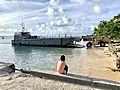
A Marshall Islander watches US Navy Seabees offload materials and tools in 2019
-
Short-term accommodations at the "Kwaj Lodge" showing typical Kwajalein housing construction
-
Site of the "Japanese Cemetery" on Kwajalein built as a memorial to war dead on the atoll

.jpg)


See also
 In Spanish: Kwajalein para niños
