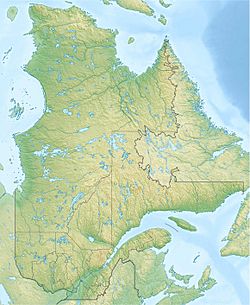
Lac des Pas Perdus facts for kids
Quick facts for kids Lac des Pas Perdus |
|
|---|---|
| Location | Lac-Pikauba, Charlevoix Regional County Municipality |
| Coordinates | 47°42′56″N 71°04′15″W / 47.71555°N 71.07083°W |
| Lake type | Natural |
| Primary inflows | Discharge of lac Éperon and a stream. |
| Primary outflows | Ruisseau Philippe |
| Basin countries | Canada |
| Max. length | 2.8 km (1.7 mi) |
| Max. width | 0.6 km (0.37 mi) |
| Surface elevation | 865 m (2,838 ft) |
Lac des Pas Perdus is a beautiful freshwater lake in Quebec, Canada. Its waters flow into the Pikauba River, then the Chicoutimi River (through Lake Kenogami), and finally the mighty Saguenay River.
This lake is found in the unorganized territory of Lac-Pikauba. It's part of the Charlevoix Regional County Municipality, in the Saguenay–Lac-Saint-Jean region. Lac des Pas Perdus is located right in the middle of the Laurentides Wildlife Reserve, a large protected area in Quebec.
You can reach the area around the lake using Quebec Route 175, a main road connecting Quebec City to Saguenay. Smaller forest roads, like R0360, also help people get around. These roads are used for both logging and for visitors enjoying nature.
The main activities here are forestry (cutting down trees) and recreational tourism (like fishing or hiking). The lake usually freezes over from early December until late April. It's generally safe to walk on the ice from mid-December to mid-April.
Contents
Exploring Lac des Pas Perdus
The mouth of Lac des Pas Perdus is about 2.7 kilometers northeast of the border between the Saguenay–Lac-Saint-Jean and Capitale-Nationale regions. Many other lakes and rivers are close to Lac des Pas Perdus.
Nearby Waters
- North: Lac des Bouleaux, Lac à Mars, Pikauba River, Grand Lac aux Montagnais, Lac Marchand, Lac de l'Enfer, rivière à Mars Nord-Ouest
- East: Great Lac des Enfers, Lac Hébert, rivière à Mars Nord-Ouest, rivière à Mars
- South: Philippe Lake, Philippe Creek, Jack Creek, Jacques-Cartier River, Jacques-Cartier Lake
- West: Philippe stream, Pikauba River, General Tremblay lake, Noir stream, Hell stream
Lake Size and Features
Lac des Pas Perdus is about 2.8 kilometers long and 0.6 kilometers wide at its widest point. It sits at an elevation of 865 meters above sea level. The lake has a bay that stretches for 1.0 kilometer to the east. Here, water from Lac Éperon flows in from the north. The lake narrows at the entrance to this bay, formed by two peninsulas reaching out from the north and south shores.
Where the Water Flows
The water from Lac des Pas Perdus flows out from its western shore. From there, the current travels through several waterways:
- The outlet of Lac des Pas Perdus flows about 4.2 kilometers southwest.
- Philippe stream continues for 10.2 kilometers, also generally southwest.
- The Pikauba River then flows north.
- Next, the water enters Lake Kenogami for 19.1 kilometers, moving east and then north.
- The rivière aux Sables carries the water 12.3 kilometers north.
- Finally, the Saguenay River takes the water 151.2 kilometers eastward to Tadoussac. Here, it joins the Saint Lawrence estuary, which leads to the Atlantic Ocean.
The Name of the Lake
The name "Lac des Pas Perdus" means "Lake of Lost Steps" in French. This name was first seen on maps in 1959 and 1961. The official name "Lac des Pas Perdus" was formally recognized on December 5, 1968, by the Commission de toponymie du Québec, which is the organization responsible for naming places in Quebec.
 | Ernest Everett Just |
 | Mary Jackson |
 | Emmett Chappelle |
 | Marie Maynard Daly |


