
Lafayette County, Mississippi facts for kids
Quick facts for kids
Lafayette County
|
||
|---|---|---|
| County of Lafayette | ||

The north façade of the Lafayette County Courthouse
|
||
|
||

Location within the U.S. state of Mississippi
|
||
 Mississippi's location within the U.S. |
||
| Country | ||
| State | ||
| Established | February 9, 1836 | |
| Named for | Marquis de Lafayette | |
| Seat | Oxford | |
| Largest city | Oxford | |
| Area | ||
| • Total | 679 sq mi (1,760 km2) | |
| • Land | 632 sq mi (1,640 km2) | |
| • Water | 47 sq mi (120 km2) 7.0% | |
| Population
(2020)
|
||
| • Total | 55,813 | |
| • Density | 82.20/sq mi (31.737/km2) | |
| Time zone | UTC−6 (Central) | |
| • Summer (DST) | UTC−5 (CDT) | |
| Congressional district | 1st | |

Lafayette County is a county located in the state of Mississippi in the United States. In 2020, about 55,813 people lived there. The main town and county seat is Oxford.
The county is named after Marquis de Lafayette. He was a French military hero who helped America during the American Revolutionary War. People in the area say the name "la-FAY-et."
Lafayette County is also famous because it inspired the fictional "Yoknapatawpha County." This made-up place appears in many books by the famous writer William Faulkner.
Contents
Exploring Lafayette County's Geography
Lafayette County covers a total area of about 679 square miles. Most of this area, 632 square miles, is land. The rest, about 47 square miles, is water.
Main Roads in Lafayette County
Several important roads help people travel through Lafayette County. These include:
 U.S. Route 278
 Mississippi Highway 6
 Mississippi Highway 7
 Mississippi Highway 9W
 Mississippi Highway 30
Neighboring Counties Around Lafayette
Lafayette County shares its borders with several other counties:
- Marshall County (to the north)
- Union County (to the northeast)
- Pontotoc County (to the southeast)
- Calhoun County (to the south)
- Yalobusha County (to the southwest)
- Panola County (to the west)
- Tate County (to the northwest)
Protected Natural Areas
Part of the Holly Springs National Forest is located within Lafayette County. This forest helps protect nature and offers outdoor activities.
Lafayette County's Population History
| Historical population | |||
|---|---|---|---|
| Census | Pop. | %± | |
| 1840 | 6,531 | — | |
| 1850 | 14,069 | 115.4% | |
| 1860 | 16,125 | 14.6% | |
| 1870 | 18,802 | 16.6% | |
| 1880 | 21,671 | 15.3% | |
| 1890 | 20,553 | −5.2% | |
| 1900 | 22,110 | 7.6% | |
| 1910 | 21,883 | −1.0% | |
| 1920 | 19,243 | −12.1% | |
| 1930 | 19,978 | 3.8% | |
| 1940 | 21,257 | 6.4% | |
| 1950 | 22,798 | 7.2% | |
| 1960 | 21,355 | −6.3% | |
| 1970 | 24,181 | 13.2% | |
| 1980 | 31,030 | 28.3% | |
| 1990 | 31,826 | 2.6% | |
| 2000 | 38,744 | 21.7% | |
| 2010 | 47,351 | 22.2% | |
| 2020 | 55,813 | 17.9% | |
| 2023 (est.) | 58,467 | 23.5% | |
| U.S. Decennial Census 1790–1960 1900–1990 1990–2000 2010–2020 |
|||
Who Lives in Lafayette County?
As of the 2020 census, 55,813 people lived in Lafayette County. Most residents, about 69.5%, were White. Around 20.3% were Black or African American. About 3% were Asian, and 3.8% were Hispanic or Latino.
Towns and Places in Lafayette County
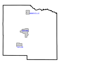
Cities and Towns
Other Communities
Some areas are called "census-designated places." This means they are like towns but not officially incorporated. These include:
There are also smaller, unincorporated communities:
- Denmark
- Harmontown
- Springdale
- Yocona
Historic Ghost Towns
Lafayette County also has some "ghost towns." These are places where people used to live, but now they are mostly empty.
Keeping Lafayette County Safe
| Lafayette County Sheriff's Department | |
|---|---|
| Common name | Lafayette County Sheriff |
| Abbreviation | LCSD |
| Motto | "Protect and Serve" |
| Agency overview | |
| Formed | 1836 |
| Employees | 26 |
| Jurisdictional structure | |
| Governing body | Lafayette County Board of Supervisors |
| General nature | |
| Operational structure | |
| Headquarters | 711 Jackson Avenue East, Oxford, MS 38655 |
| Deputys | 26 (2014) |
| Facilities | |
| Districts | Oxford, Mississippi |
The Lafayette County Sheriff's Department helps keep the county safe. They are in charge of law enforcement for most of Lafayette County. They also work with the Oxford Police Department and the University Police Department.
The Sheriff's Department also runs the Lafayette County Detention Center, which is the county jail. They also guard the county's courts.
A man named F.D. "Buddy" East was the sheriff for a very long time. He held the job for 46 years, from 1972 until he passed away in 2018. This made him the longest-serving sheriff in U.S. history! His son, Joey East, later became the sheriff in 2019.
Learning in Lafayette County
Lafayette County has several school districts for students. These include the Lafayette County School District and the Oxford School District.
The University of Mississippi is also located in the county. It's a big university where many students go to college. Northwest Mississippi Community College also has a technical center here.
Images for kids
-

The north façade of the Lafayette County Courthouse
-

Lafayette County logo
See also
 In Spanish: Condado de Lafayette (Misisipi) para niños
