Lake Aloha facts for kids
Quick facts for kids Lake Aloha |
|
|---|---|

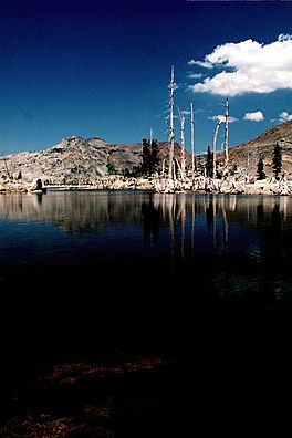
Lake Aloha, Desolation Wilderness; general view, taken August 2008.
|
|
| Location | Sierra Nevada, El Dorado County, California, U.S. |
| Coordinates | 38°52′1.74″N 120°8′56.56″W / 38.8671500°N 120.1490444°W |
| Basin countries | United States |
| Settlements | South Lake Tahoe |
Lake Aloha is a large, shallow lake located high in the Sierra Nevada mountains of eastern California. It sits at an elevation of 8,116 feet (about 2,474 meters) above sea level. This beautiful lake is actually a reservoir, which means it's a lake created by a dam. It's found west of Lake Tahoe in El Dorado County.
Exploring Lake Aloha
Lake Aloha is a special place because it's located inside the Desolation Wilderness area. This is a protected natural space where you can experience the outdoors. The lake is in a valley called Desolation Valley.
Getting There
Reaching Lake Aloha is an adventure! The easiest way to get there is by hiking from Echo Lake. You can follow the famous Pacific Crest Trail to reach the lake. Another way to get there is from the Glen Alpine Springs Trailhead, which is close to the city of South Lake Tahoe. No matter which way you go, you'll be hiking uphill as you head west towards the lake.
If you're coming from the south, you can use the Ralston Peak Trail. Or, for a more challenging trip, you can hike cross-country through Horsetail Falls and Desolation Valley. Lake Aloha is also a key area you'll pass through if you're trying to reach the base of Price Peak and Pyramid Peak in the Crystal Range of the Sierra Nevada.

Water Flow
The main stream that flows out of Lake Aloha is called Pyramid Creek. This creek flows south for about four miles (around 6.4 kilometers). Eventually, Pyramid Creek empties into the South Fork American River near a place called Twin Bridges.
History of the Dam
Pyramid Creek was first dammed to create Lake Aloha way back in 1875. The main reason for building the dam was to create a steady supply of water all year round for grazing cattle. Before the dam was built, this area had a group of natural lakes known as the Medley Lakes. When the dam was created, these natural lakes were covered by the new, larger reservoir. The dam was made even taller later on, and several smaller, helper dams were built up until 1955.
 | William L. Dawson |
 | W. E. B. Du Bois |
 | Harry Belafonte |


