Desolation Wilderness facts for kids
Quick facts for kids Desolation Wilderness |
|
|---|---|
|
IUCN Category Ib (Wilderness Area)
|
|
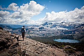
Desolation Wilderness from Mount Tallac
|
|
| Location | El Dorado County, California, USA |
| Nearest city | South Lake Tahoe, CA |
| Area | 63,960 acres (258.8 km2) |
| Established | January 1, 1969 |
| Governing body | U.S. Forest Service |
The Desolation Wilderness is a huge protected natural area in California. It covers about 64,000 acres (259 square kilometers). This special place is part of the Eldorado National Forest and the Lake Tahoe area. It's located in El Dorado County, near the beautiful Lake Tahoe. The tall Sierra Nevada mountains also run through this wilderness.
Contents
History of Desolation Wilderness
Before European settlers arrived in the mid-1800s, the Washoe tribe used this land. Later, people sometimes called it "Devil's Valley." It was often used for cows to graze.
To protect the area, it became a Forest Reserve in the late 1800s. The U.S. Forest Service now manages it. In 1931, it was named the Desolation Valley Primitive Area. It covered about 64,000 acres. Then, in 1969, it officially became the Desolation Wilderness. This happened after the Wilderness Act was passed in 1964.
Exploring Desolation Wilderness
Desolation Wilderness is a very popular spot for backpacking. It has many rocky areas and bare granite rocks. These areas are found near the edge of the tree line.
Two famous long trails go through the wilderness. These are the Tahoe Rim Trail and the Pacific Crest Trail. Many other trails also lead into the wilderness.
Trailheads for Entry
Here are some of the main starting points for trails:
- Loon Lake trailhead
- Buck Island trailhead
- Van Vleck trailhead
- Rockbound trailhead
- Twin Lakes trailhead
- Lyons trailhead
- Twin Bridges trailhead
- Ralston trailhead
- Echo trailhead
- Echo Lakes trailhead
- Glen Alpine trailhead
- Mount Tallac trailhead
- Bayview trailhead
- Eagle Falls trailhead
- Meeks Bay trailhead
- Horsetail Falls trailhead
Permits and Rules
You need a permit to visit Desolation Wilderness. This is true for both day trips and overnight camping. During summer, there's a limit on how many people can camp overnight. This helps protect the wilderness from too many visitors.
Desolation Wilderness is one of the most visited protected areas in the U.S. It is divided into 45 different zones. Each zone has its own limit for visitors. You can get permits online at recreation.gov.
Wildlife and Plants
The Desolation Wilderness is home to many different plants, fish, and animals.
Trees and Plants
The forests here mostly have red fir and lodgepole pine trees. You might also see Jeffrey pine, mountain hemlock, and ponderosa pine. These trees grow well between 7,400 and 9,000 feet (2,255 and 2,743 meters) high. They can grow in rocky, poor soil.
Much of the ground is solid granite rock. So, there isn't much soil. The best forests grow near lakes, streams, and meadows. These trees are important for keeping the water clean and providing homes for animals.
You can also find small shrubs like pinemat manzanita and huckleberry oak. Many wet meadows are spread throughout the wilderness. These meadows have a wide variety of wildflowers, grasses, and other plants. Aspen trees and willow bushes are also common in these wet areas.
Animals of the Wilderness
Mule deer are the biggest game animals here. Black bears are also becoming more common. They sometimes move into the higher mountains from other areas.
Smaller mammals include coyotes, porcupines, badgers, and bobcats. Some very rare animals in the area are the fisher, pine marten, red fox, and wolverine.
Many small mountain rodents live here too. These include the yellow-bellied marmot, golden-mantled ground squirrel, and Douglas squirrel. You might also spot a pika, which is a small animal related to rabbits.
Birds and Fish
Many types of mountain birds live in Desolation. These include the Steller's jay, Clark's nutcracker, and mountain chickadee. You might also see a sooty grouse, mountain bluebird, or American dipper. Sometimes, a golden eagle can be seen flying overhead.
The many lakes and streams are full of fish. You can find rainbow and brook trout. Less common, but also present, are brown and golden trout.
Geography of the Area
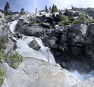
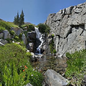
The Crystal Range of mountains is located within the wilderness. Pyramid Peak is the highest point. It stands at 9,985 feet (3,043 meters) high. There are also many waterfalls, like the beautiful Horsetail Falls.
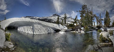
The largest body of water is Lake Aloha. It's a reservoir with clear, shallow water. It sits in a wide granite basin. This basin was carved out by glaciers during the last ice age. Many other lakes of different sizes are found throughout the area.
 | John T. Biggers |
 | Thomas Blackshear |
 | Mark Bradford |
 | Beverly Buchanan |


