South Fork American River facts for kids
Quick facts for kids South Fork American River |
|
|---|---|
 |
|
| Country | United States |
| State | California |
| Physical characteristics | |
| Main source | Sierra Nevada 38°48′38″N 120°01′52″W / 38.81056°N 120.03111°W |
| River mouth | Folsom Lake 466 ft (142 m) 38°44′03″N 121°06′15″W / 38.73417°N 121.10417°W |
| Length | 87 mi (140 km) |
| Basin features | |
| Progression | American–Sacramento |
| Basin size | 840 sq mi (2,200 km2) |
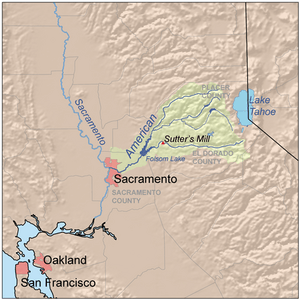
The South Fork American River is a big river in El Dorado County, California. It's a main branch of the American River. This river flows down the western side of the Sierra Nevada mountains, east of Sacramento.
The river starts in the beautiful Desolation Wilderness. It then flows through the lower hills of the Sierra Nevada. A very important event happened at this river in Coloma. On January 24, 1848, James Marshall found gold at Sutter's Mill. This discovery kicked off the famous California Gold Rush. Today, the South Fork American River is super popular for whitewater rafting in North America. About 80,000 people visited in 2011 just for rafting!
Contents
Where the River Flows: Geography
The South Fork American River begins high up at Nebelhorn. This spot is about 10 mi (16 km) south of Lake Tahoe. From there, the river flows west for about 87 mi (140 km).
It passes through towns like Kyburz, Pollock Pines, and Coloma. Finally, it empties into Folsom Lake. This lake is a big reservoir created by the Folsom Dam. The North Fork American River also flows into Folsom Lake. Both rivers then join to form the main American River. This larger river flows southwest from the dam to meet the Sacramento River.
The South Fork American River drains an area of about 840 sq mi (2,200 km2). This is about one-third of the entire American River area, which is 2,150 sq mi (5,600 km2). A "watershed" is all the land where water drains into a specific river.
Major smaller rivers that flow into the South Fork include Silver Creek, Rock Creek, Weber Creek, and Silver Fork American River. Most of the land around the river has tall, forested mountains and deep valleys. These areas get a lot of rain, up to 40 in (1,000 mm) each year. The western part of the river basin has drier, hilly country. The South Fork also provides about one-third of all the water that flows out of the American River system.
How Much Water Flows: Discharge
The amount of water flowing in a river is called its "discharge." The U.S. Geological Survey measures this. At Lotus, about 5 mi (8.0 km) before Folsom Lake, the average water flow was 1,458 cu ft/s (41.3 m3/s) from 1951 to 1995.
The most water ever recorded flowing was 90,000 cu ft/s (2,500 m3/s) on January 1, 1997. This happened during a big flood. The least amount of water flowing in a month was 86.8 cu ft/s (2.46 m3/s) in July 1977.
Fun on the River: Recreation
Rafting and Kayaking Adventures
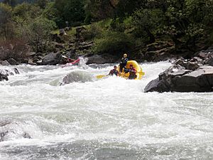
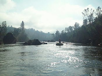
The South Fork American River is famous for its whitewater. It has about eight sections where you can go rafting or kayaking. These sections range from easy (Class II) to very difficult (Class V). The most popular part is a Class III section. This stretch is between Chili Bar Dam and Folsom Lake.
This 20 mi (32 km) section is usually split into two days of boating. The first part goes from Chili Bar to Coloma. The second part, called "The Gorge," goes from Coloma to Folsom Lake. You need good boating and river rescue skills to navigate these parts. If you're new to rafting, you can book a trip with one of the many companies in the Coloma valley. They will guide you safely down the river.
If you want to practice your skills on easier water, there's a shorter Class II section. It goes from Coloma to Greenwood Creek and is known as the "C-G" section.
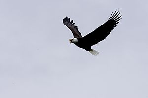
This 20 mi (32 km) section of the river winds through the Sierra foothills. It has so much to offer! Local groups have worked hard to protect the river's natural environment. This is amazing, especially after the changes from the Gold Rush. The river is home to many animals and plants. You might see bald eagles, golden eagles, beavers, and river otters.
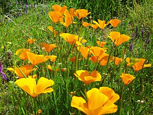
In spring, the hillsides near the Chili Bar section are covered with beautiful California poppies and other wildflowers.
There are also cool historical sites along the river. You can find grinding holes made by the Nisenan people who lived there long ago. There are also old channels blasted out during the Gold Rush.
Hiking, Mountain Biking, and Horse Riding Trails
You can find land managed by the Bureau of Land Management (BLM) off Highway 49. This is on the way to Auburn from Coloma. It has awesome trails for hiking, biking, and horse riding. Parking and using the trails are free. It's a great way to explore the South Fork American River.
These BLM areas are part of a long effort with the American River Conservancy. They work together to protect the beauty and wildlife of the South Fork American River. You can get to the trails from Cronin Ranch, Magnolia Ranch, and Salmon Falls. The trails are stunning all year round. Winter rains make the landscape green and bring out many wildflowers in spring. In summer, the golden hills contrast with oak trees. The trails lead you through fragrant sage-covered ridge tops. In the fall, the colors reflecting on the river are breathtaking. The trails show off different healthy ecosystems. These include grasslands, oak woodlands, chaparral, and river habitats. It's a wonderful place to relax and connect with nature.
Controlling the Flow: Dams
There are two main dams directly on the South Fork American River. One is Slab Creek Dam, which creates Slab Creek Reservoir near Camino. The other is Chili Bar Dam, located north of Placerville.
Both of these dams are "run-of-the-river" dams. This means they use the natural flow of the river to make hydroelectricity. Hydroelectricity is power made from moving water. Other important dams in the South Fork area are at Union Valley Reservoir and Ice House Reservoir. These are on the Silver Creek branch. Most of the dams and reservoirs in this area are run by the Sacramento Municipal Utility District (SMUD). They are part of the 688 megawatt Upper American River Project. Some are also run by Pacific Gas and Electric as part of the Chili Bar Project.
 | Sharif Bey |
 | Hale Woodruff |
 | Richmond Barthé |
 | Purvis Young |


