
Lake Scugog facts for kids
Quick facts for kids Lake Scugog |
|
|---|---|

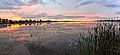
Lake Scugog on a cloudy day.
|
|

Lake Scugog
Location in Southern Ontario
|
|
| Location | Durham Region & Kawartha Lakes, Ontario |
| Group | Kawartha Lakes |
| Coordinates | 44°11′00″N 78°51′26″W / 44.18333°N 78.85722°W |
| Type | Artificial, eutrophic |
| Part of | Great Lakes Basin |
| Primary inflows | Nonquon River, Blackstock Creek, Cawkers Creek |
| Primary outflows | Scugog River |
| Catchment area | 529 square kilometres (204 sq mi) |
| Basin countries | Canada |
| Surface area | 68 square kilometres (26 sq mi) |
| Average depth | 1.4 metres (4 ft 7 in) |
| Max. depth | 7.6 metres (24 ft 11 in) |
| Water volume | 0.0957 cubic kilometres (0.0230 cu mi) |
| Shore length1 | 172 kilometres (107 mi) |
| Surface elevation | 249.9 metres (819 ft 11 in) |
| Islands | Scugog Island |
| Settlements | Port Perry, Lindsay |
| 1 Shore length is not a well-defined measure. | |
Lake Scugog is a special lake in Ontario, Canada. It's not a natural lake, but an artificial one, meaning it was created by people. You can find it between the towns of Port Perry and Lindsay.
Over time, the water level in Lake Scugog has changed a lot. Even though it's very shallow, it's often thought of as part of the Kawartha Lakes group. The lake's only outflow (where water flows out) is the Scugog River, which connects to Sturgeon Lake. Lake Scugog is also part of the larger Great Lakes Basin and the Trent–Severn Waterway, a system of canals and lakes for boats.
Contents
What Does "Scugog" Mean?
The name "Scugog" likely comes from the Ojibwe people, an Indigenous group. It might mean "marshy waters," which describes the area well.
Another idea, from a book called Place Names of Ontario, suggests it's a word from the Mississaugas, another Indigenous group. They might have meant "waves leap over a canoe." This could refer to how quickly waves can form on the lake because it's so shallow, or to the time when the river valley was flooded.
Where is Lake Scugog Located?

Lake Scugog is quite large, covering about 68 square kilometers (26 square miles). However, it's also very shallow, with an average depth of only 1.4 meters (about 4.5 feet). This makes it one of the shallowest lakes in the Kawartha Lakes area.
Several smaller streams and rivers feed into Lake Scugog. These include the Nonquon River, Blackstock Creek, and Cawkers Creek. The only river flowing out of the lake is the Scugog River. This river then flows into Sturgeon Lake, which is part of the larger Trent watershed system.
Besides Port Perry and Lindsay, other communities around the lake include Seagrave, View Lake, and Caesarea. In the middle of the lake is Scugog Island. Some people debate if it's truly an island because its southwestern side is a swamp that floods at certain times of the year.
A small part of Scugog Island is home to about 50 members of the Mississaugas Indigenous community. This area also has the Great Blue Heron Casino and many seasonal cottages.
How Does the Lake's Water Work?
Lake Scugog is a "hard-water" lake, which means it has a lot of minerals dissolved in it. It also produces something called marl, which is a type of soft, white mud. The bottom of the lake has thick layers of this marl. This is why the lake can look murky or cloudy, especially when the weather is warm in the summer. It's believed that the lake bottom is slowly filling up with this marl, at a rate of about 1 millimeter (a tiny bit!) each year.
During dry summer weather, the Scugog River, which usually flows out of the lake, can actually stop flowing. Sometimes, smaller streams that usually flow into the Scugog River will even flow backward into the lake! This helps to replace water that evaporates from the lake and surrounding marsh areas.
A Brief History of Lake Scugog
The area where Lake Scugog is now was originally a marshy area with two smaller lakes connected by a wide channel. Much of the land was forest and swamp.
The lake as we know it today was created in 1834. A man named William Purdy and his sons built a dam on the Scugog River in Lindsay. They did this to power their grist mill, which was a factory for grinding grain. This dam raised the water level by about ten feet, flooding the surrounding land. This is how the "islands" like Washburn, Nonquon, Ball, Platten, and the large Scugog Island were formed. Today, most of these are connected to the mainland, except for Scugog Island, which is kept as an island by man-made channels around its swampy southern end.
The new, stagnant (still) waters of the lake caused many people living on nearby farms to get sick with fevers. Because of this, the higher lake levels became very unpopular. In the summer of 1838, settlers from the countryside got together and used tools like axes and pitchforks to tear down the dam. This lowered the lake's water level again.
No one was charged for this act because so many people were angry about the high water. Eventually, a deal was made in 1843 between Mr. Purdy and the government. Purdy agreed to lower the dam's height to be closer to the lake's natural spring high-water level. The government then built a new dam and a lock (a water elevator for boats) for navigation into Lake Scugog, which was finished in 1844. In return, Purdy dropped all his claims against the settlers for damaging his dam.
Wildlife and Nature Around the Lake
Before the lake was flooded, the marshes were full of wild rice and cranberries. Indigenous people like the Mississaugas used to harvest these plants. The flooding of the lake unfortunately destroyed many of these natural areas.
Today, Lake Scugog is surrounded by swamps and marshes. These wet areas are perfect homes for many kinds of waterfowl (birds that live on water) and other wildlife.
Lake Scugog is also known for its many types of fish. You can find largemouth bass, walleye, crappie, musky, perch, carp, catfish, rock bass, smallmouth bass, and minnows. Because the walleye population has been decreasing, there is currently no season for catching or keeping walleye. The lake is a very popular spot for fishing in southern Ontario.
How Lake Scugog Helps the Economy

In the early 1800s, Lake Scugog was used to transport logs downstream to Trenton. However, this resource was quickly used up as pine trees were cut down in the area. Later, the Trent Canal (now called the Trent–Severn Waterway) was built through Lindsay in the late 1800s. This allowed steamboats to travel from Port Perry to Sturgeon Lake and Lake Ontario.
Today, Lake Scugog is a popular place for tourists. It's often called the southern edge of "Cottage Country," where many people go for vacations. The towns of Port Perry and Lindsay benefit from people who enjoy boating on the Trent-Severn Waterway during the summer. Fishing is also a big draw, as the lake's shallow, weed-filled bottom is home to many different fish species.
Rivers and Creeks of the Scugog Watershed
A watershed is an area of land where all the water drains into a common body of water, like a lake or river. Here are some of the rivers and creeks that flow into and out of Lake Scugog:
- Nonquon River: This river flows from the southwest (near Utica) towards Seagrave and empties into Lake Scugog southeast of Seagrave.
- Cawkers Creek: This creek flows from the southwest end of Port Perry southwards for about 16 kilometers (10 miles).
- Mariposa Brook: Also known by several other names, this brook starts in swamps near Manilla. It then flows northeast, then south past Little Britain, and finally east to empty into the Scugog River at Ops.
- Blackstock Creek: This creek is found southeast of Lake Scugog, between Lake Scugog and East Cross Creek.
- Scugog River: This is the only river that flows out of Lake Scugog.
Osler Marsh
The large marsh area along the Port Perry Causeway, south of Port Perry, Ontario, is named after Henry Smith Osler. He was one of the early owners of the land where these marshes are located. This marsh area covers about 417 hectares (1,030 acres) of wetlands.
Images for kids
-
Sundown on Lake Scugog

