Lanín facts for kids
Quick facts for kids Lanín |
|
|---|---|

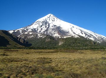
Lanín as seen from Mamuil Malal Pass
|
|
| Highest point | |
| Elevation | 3,776 m (12,388 ft) |
| Prominence | 2,624 m (8,609 ft) |
| Listing | Region high point Ultra |
| Geography | |
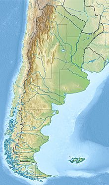
| Location | Argentina / Chile |
| Parent range | Andes |
| Geology | |
| Mountain type | Stratovolcano |
| Volcanic arc/belt | South Volcanic Zone |
| Last eruption | 560 CE ± 150 years |
| Climbing | |
| Easiest route | rock/snow/ice |
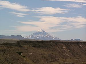
Lanín is a tall, cone-shaped stratovolcano covered in ice. It sits right on the border between Argentina and Chile. This amazing volcano is part of two national parks. These are Lanín in Argentina and Villarrica in Chile. Lanín is a very important symbol for the Argentine province of Neuquén. It even appears on their flag and in their anthem!
Scientists are not sure exactly when Lanín last erupted. They believe it was sometime in the last 10,000 years. After a big earthquake in 1906, a local newspaper said the volcano had erupted. However, a scientist named Karl Sapper later disagreed with this report in 1917.
Contents
Climbing Lanín: Reaching the Summit
Climbing Lanín is managed by the Argentine National Parks and the Argentine National Gendarmerie. The climb is not too difficult technically. However, it is more exposed to the weather than other nearby volcanoes.
Many climbers start their journey from nearby towns. These towns include Pucón in Chile and Junín de los Andes in Argentina.
There are two main paths to reach the top of Lanín.
- The north path starts at 1,200 meters (about 3,900 feet) high. It is near Tromen Lake and the Mamuil Malal Pass. You can get there using Neuquén's Provincial Route 60.
- The south path begins next to Huechulafquen Lake. This route is reached by Provincial Route 61.
Lanín's Location and Formation
Lanín is located in the Andes mountains. It sits on the line that divides water flowing to the Atlantic Ocean from water flowing to the Pacific Ocean. This is why it is on the border between Argentina and Chile. This border was set by a treaty in 1881. To the north of Lanín is Tromen Lake. To its south is Paimun Lake.
Lanín is the easternmost volcano in a line of three large stratovolcanoes. This line goes from northwest to southeast. Villarrica is the westernmost volcano. Quetrupillán is in the middle. Scientists think this line of volcanoes exists because there is a large crack, or fault, under them. Lanín has been the quietest of these volcanoes in recent history. There are also older, worn-down volcanoes along this same line.
How Lanín Volcano Was Formed
The Lanín volcano sits on top of older rocks. These rocks include gneiss (a type of rock formed by heat and pressure) and plutons (rocks formed deep underground). There are also layers of volcanic rock pieces. These older rocks form a raised block of land. This block is bordered on the west by a fault line called the Reigolil-Pirihueico Fault.
The oldest parts of Lanín volcano are thought to be from the Late Pliocene or Early Pleistocene periods. These parts are made of dacitic lava flows. These lava flows have special columnar joints, which look like tall columns.
The most common rock found in Lanín volcano is basalt. This is a dark, fine-grained volcanic rock.
See also
 In Spanish: Volcán Lanín para niños
- List of volcanoes in Chile
- List of volcanoes in Argentina
- List of Ultras of South America
- Quetrupillán
 | Stephanie Wilson |
 | Charles Bolden |
 | Ronald McNair |
 | Frederick D. Gregory |


