List of national parks of Argentina facts for kids
The National Parks of Argentina are a group of 35 special protected areas across Argentina. These parks protect many different types of land and natural environments, from the northern border with Bolivia at Baritú National Park all the way to Tierra del Fuego National Park in the far south. The Administración de Parques Nacionales (National Parks Administration) is the group in charge of looking after these national parks, as well as other important natural places and reserves in Argentina.
The main office for the National Parks Administration is in downtown Buenos Aires. They have a library and information center that anyone can visit. This administration also takes care of national monuments, like the Jaramillo Petrified Forest, and other natural and educational reserves.
Contents
History of Argentina's National Parks
How the Parks Began
The idea for national parks in Argentina started in 1903. A famous explorer and scientist named Francisco Moreno gave 75 square kilometers (about 29 square miles) of land in the Lake District to the country. This area, located in the Andes mountains, became the first part of a larger protected region in Patagonia, near San Carlos de Bariloche.
In the early 1920s, people became very interested in national parks again, especially around Lake Nahuel Huapí. This led to the official creation of the Parque Nacional del Sud on April 8, 1922, by President Yrigoyen.
Growing the Park System
In 1934, a law was passed that created the official National Parks system. This law made the protected area around Lake Nahuel Huapí into the Nahuel Huapi National Park. It also created the famous Iguazú National Park. Because of this, Argentina became the third country in the Americas to have a national park system, after the United States and Canada.
A special police force was created for the National Parks. Their job was to make sure people followed the new rules, like not cutting down trees or hunting animals. The first director of the National Parks, Exequiel Bustillo, believed the parks should help the region grow and develop. Besides tourism, the parks also helped Argentina show its control over distant areas and protect its borders.
By 1937, five more national parks were created in Patagonia. The park service even planned new towns and facilities to encourage tourism and education. By 1970, six more parks had been added.
Modern National Park Laws
In 1970, a new law introduced different ways to protect land. These included National Parks, National Monuments, Educational Reserves, and Natural Reserves. Three new national parks were named in the 1970s.
Another important law in 1980 confirmed the special status of national parks. This law is still used today! In the 1980s, the park service started working closely with local communities and governments. This teamwork helped create and manage the parks. Ten more national parks were created with local help, sometimes even suggested by the local people.
In the year 2000, Mburucuyá and Copo National Parks were officially declared. Also, the El Leoncito natural reserve was upgraded to a national park. Today, Argentina has 41 protected areas. These areas cover about 37,000 square kilometers (about 14,286 square miles), which is about 1.5% of Argentina's total land.
Map
List of National Parks
- ‡ World Heritage Site
| Name | Image | Province Coordinates |
Creation | Area | Visitors (2015) | Ref |
|---|---|---|---|---|---|---|
| Aconquija | 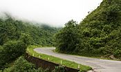 |
26°29′S 65°12′W / 26.48°S 65.20°W |
4 July 2018 | 90,000 ha (347 sq mi) | No data | |
| Baritú |  |
22°35′S 64°37′W / 22.58°S 64.62°W |
24 April 1974 | 72,439 ha (280 sq mi) | 938 | |
| Bosques Petrificados de Jaramillo | 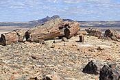 |
47°40′S 68°05′W / 47.67°S 68.09°W |
27 December 2012 | 78,543 ha (303 sq mi) | 6,535 | |
| Calilegua |  |
23°41′S 64°47′W / 23.69°S 64.79°W |
25 July 1979 | 76,306 ha (295 sq mi) | 13,667 | |
| Campos del Tuyú |  |
36°21′S 56°52′W / 36.35°S 56.87°W |
4 June 2009 | 3,040 ha (12 sq mi) | Not allowed | |
| Chaco | 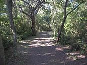 |
26°50′S 59°40′W / 26.83°S 59.66°W |
22 October 1954 | 14,981 ha (58 sq mi) | 4,913 | |
| Copo | 25°51′S 61°55′W / 25.85°S 61.91°W |
28 December 2000 | 118,119 ha (456 sq mi) | 444 | ||
| El Impenetrable | 24°59′S 61°05′W / 24.99°S 61.08°W |
30 October 2014 | 128,000 ha (494 sq mi) | Not allowed | ||
| El Leoncito | 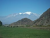 |
31°55′S 69°14′W / 31.92°S 69.24°W |
15 October 2002 | 89,706 ha (346 sq mi) | 16,343 | |
| El Palmar | 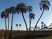 |
31°52′S 58°15′W / 31.87°S 58.25°W |
30 November 1965 | 8,213 ha (32 sq mi) | 175,414 | |
| El Rey | 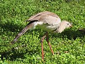 |
24°40′S 64°38′W / 24.67°S 64.63°W |
2 July 1948 | 44,162 ha (171 sq mi) | 1,204 | |
| Iberá | 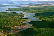 |
27°56′S 59°04′W / 27.93°S 59.07°W |
20 December 2018 | 183,500 ha (708 sq mi) | ||
| Iguazú‡ | 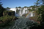 |
25°38′S 54°20′W / 25.64°S 54.34°W |
29 October 1934 | 67,620 ha (261 sq mi) | 1,349,801 | |
| Islas de Santa Fe | 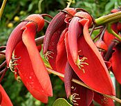 |
32°16′S 60°43′W / 32.27°S 60.71°W |
15 November 2010 | 4,096 ha (16 sq mi) | Not allowed | |
| Lago Puelo | 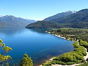 |
42°10′S 71°41′W / 42.17°S 71.69°W |
16 November 1971 | 27,675 ha (107 sq mi) | 120,554 | |
| Laguna Blanca | 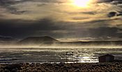 |
39°02′S 70°21′W / 39.03°S 70.35°W |
29 May 1945 | 11,251 ha (43 sq mi) | 938 | |
| Lanín | 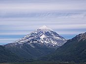 |
39°53′S 71°29′W / 39.89°S 71.48°W |
29 May 1945 | 412,003 ha (1,591 sq mi) | 51,321 | |
| Lihué Calel | 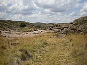 |
37°57′S 65°37′W / 37.95°S 65.61°W |
8 June 1976 | 32,500 ha (125 sq mi) | 7,582 | |
| Los Alerces‡ | 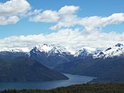 |
42°52′S 71°52′W / 42.87°S 71.87°W |
29 May 1945 | 263,000 ha (1,015 sq mi) | 143,943 | |
| Los Arrayanes | 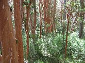 |
40°50′S 71°37′W / 40.83°S 71.61°W |
16 November 1971 | 1,840 ha (7 sq mi) | No data | |
| Los Cardones | 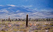 |
25°17′S 65°55′W / 25.28°S 65.92°W |
13 December 1996 | 65,000 ha (251 sq mi) | 72,947 | |
| Los Glaciares‡ | 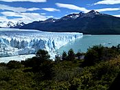 |
50°00′S 73°08′W / 50.00°S 73.13°W |
29 May 1945 | 726,927 ha (2,807 sq mi) | 542,794 | |
| Mburucuyá | 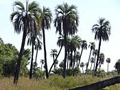 |
28°01′S 58°04′W / 28.02°S 58.07°W |
17 January 2002 | 17,086 ha (66 sq mi) | 3,136 | |
| Monte León | 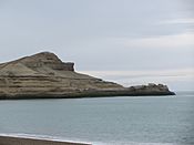 |
50°20′S 68°54′W / 50.34°S 68.90°W |
10 November 2004 | 62,169 ha (240 sq mi) | 6,762 | |
| Nahuel Huapi |  |
40°52′S 71°29′W / 40.87°S 71.49°W |
29 October 1934 | 712,160 ha (2,750 sq mi) | 279,360 | |
| Patagonia | 47°10′S 71°19′W / 47.16°S 71.32°W |
21 January 2015 | 53,000 ha (205 sq mi) | Not allowed | ||
| Perito Moreno | 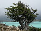 |
47°55′S 72°15′W / 47.92°S 72.25°W |
29 May 1945 | 127,120 ha (491 sq mi) | 177 | |
| Predelta | 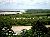 |
32°09′S 60°38′W / 32.15°S 60.63°W |
13 January 1992 | 2,608 ha (10 sq mi) | 74,217 | |
| Quebrada del Condorito | 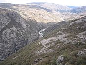 |
31°40′S 64°46′W / 31.67°S 64.77°W |
19 December 1996 | 35,393 ha (137 sq mi) | 22,079 | |
| Río Pilcomayo | 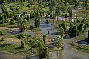 |
25°03′S 58°08′W / 25.05°S 58.13°W |
17 October 1951 | 50,417 ha (195 sq mi) | 10,186 | |
| San Guillermo | 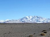 |
29°19′S 69°17′W / 29.31°S 69.29°W |
13 January 1999 | 166,000 ha (641 sq mi) | No data | |
| Sierra de las Quijadas | 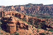 |
32°33′S 67°07′W / 32.55°S 67.12°W |
10 December 1991 | 73,785 ha (285 sq mi) | 29,599 | |
| Talampaya‡ | 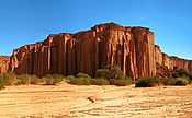 |
29°54′S 68°01′W / 29.90°S 68.01°W |
10 July 1997 | 215,000 ha (830 sq mi) | 63,797 | |
| Tierra del Fuego | 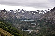 |
54°39′S 68°28′W / 54.65°S 68.47°W |
25 October 1960 | 68,909 ha (266 sq mi) | 265,633 | |
| Traslasierra | 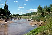 |
31°09′S 65°29′W / 31.15°S 65.49°W |
21 March 2018 | 105,385 ha (407 sq mi) | Not allowed |
See also
 In Spanish: Anexo:Parques nacionales de Argentina para niños
- List of World Heritage Sites in Argentina
- List of UNESCO Biosphere Reserves in Argentina
 | Kyle Baker |
 | Joseph Yoakum |
 | Laura Wheeler Waring |
 | Henry Ossawa Tanner |

