Lautaro (volcano) facts for kids
Quick facts for kids Lautaro |
|
|---|---|

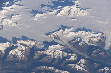
The volcano is visible in the upper portion of this NASA image, whereas Mount Fitz Roy is in the lower left corner.
|
|
| Highest point | |
| Elevation | 3,623 m (11,886 ft) |
| Prominence | 3,345 m (10,974 ft) Ranked 58th |
| Listing | Ultra |
| Geography | |
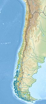
| Location | Aisén, Chile |
| Parent range | Andes |
| Geology | |
| Mountain type | Stratovolcano |
| Volcanic arc/belt | Austral Volcanic Zone |
| Last eruption | March 1979 |
| Climbing | |
| First ascent | January 29, 1964 by Peter Skvarca and Luciano Pera |
| Easiest route | snow/ice climb |
Lautaro Volcano is an exciting and active volcano found in Chile, specifically in a cold, icy region called Patagonia. It's a special type of volcano known as a stratovolcano, which means it's shaped like a cone and built up from many layers of hardened lava and ash. What makes Lautaro extra unique is that it's a subglacial volcano, meaning it's mostly covered by a huge sheet of ice!
This giant volcano stands tall in the northern part of the Southern Patagonian Ice Field, a massive area of ice. Its top, or summit, pokes up about 2,000 meters (or 6,560 feet) above the icy surface around it. Lautaro is the highest mountain in Bernardo O'Higgins National Park, a beautiful natural area. Close by, you can find the Pío XI Glacier, another huge ice formation. The volcano was named in 1952 to honor Lautaro, a brave Mapuche military leader from history.
Exploring Lautaro's First Climbs
Climbing Lautaro Volcano is a huge challenge because of its icy conditions and active nature. The very first time anyone successfully climbed to the top of Lautaro was on January 29, 1964. Two adventurous climbers, Peter Skvarca and Luciano Pera, made this historic first ascent.
They chose to climb along the volcano's southeast ridge. Their journey was full of difficulties. They had to navigate around many crevasses, which are deep cracks in the ice. They also faced steep walls of ice and tricky snow formations called cornices, which are overhangs of snow. Right at the summit, they even found a "snow mushroom," a unique shape formed by snow and ice.
When they reached the top, Skvarca and Pera discovered an active crater! They also noticed strong smells of sulfur, which are gases released from the volcano. This showed them that Lautaro was indeed an active volcano.
The second time Lautaro was climbed was on March 2, 1973. This ascent was made by Eric Jones, Mick Coffey, and Leo Dickinson. Their climb was part of a bigger adventure: they were crossing the entire Southern Patagonian Ice Field. This shows just how remote and challenging the area around Lautaro Volcano is for explorers.
See also
- List of volcanoes in Chile
- List of Ultras of South America
 In Spanish: Volcán Lautaro para niños
 | Selma Burke |
 | Pauline Powell Burns |
 | Frederick J. Brown |
 | Robert Blackburn |


