Leake County, Mississippi facts for kids
Quick facts for kids
Leake County
|
|
|---|---|

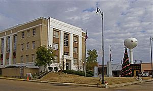
Leake County Courthouse in Carthage
|
|

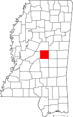
Location within the U.S. state of Mississippi
|
|
 Mississippi's location within the U.S. |
|
| Country | |
| State | |
| Founded | 1833 |
| Named for | Walter Leake |
| Seat | Carthage |
| Largest city | Carthage |
| Area | |
| • Total | 585 sq mi (1,520 km2) |
| • Land | 583 sq mi (1,510 km2) |
| • Water | 2.5 sq mi (6 km2) 0.4% |
| Population
(2020)
|
|
| • Total | 21,275 |
| • Density | 36.37/sq mi (14.042/km2) |
| Time zone | UTC−6 (Central) |
| • Summer (DST) | UTC−5 (CDT) |
| Congressional district | 2nd |
Leake County is a county located in the middle of Mississippi, a state in the United States. In 2020, about 21,275 people lived there. The main town and county seat is Carthage. The county got its name from Walter Leake, who was the Governor of Mississippi from 1822 to 1825.
In 2010, the exact middle point of Mississippi's population was found in Leake County, near a town called Lena. This means if you balanced the state's population on a map, this spot would be the center.
Contents
Geography of Leake County
According to the U.S. Census Bureau, Leake County covers a total area of about 585 square miles (1,515 square kilometers). Most of this area is land, about 583 square miles (1,510 square kilometers). A small part, about 2.5 square miles (6.5 square kilometers), is water.
Major Roads in Leake County
Several important highways pass through Leake County, connecting it to other parts of Mississippi. These roads help people travel and transport goods.
 Mississippi Highway 13
 Mississippi Highway 16
 Mississippi Highway 25
 Mississippi Highway 35
 Mississippi Highway 43
- Natchez Trace Parkway
Neighboring Counties
Leake County shares borders with several other counties in Mississippi:
- Attala County (to the north)
- Neshoba County (to the east)
- Scott County (to the south)
- Madison County (to the west)
National Protected Area
A part of the Natchez Trace Parkway is located within Leake County. This historic parkway is a scenic road that follows an ancient trail used by Native Americans, explorers, and traders.
Population of Leake County
The population of Leake County has changed over the years. In 1840, only 2,162 people lived there. By 1940, the population grew to 24,570. In the most recent 2020 United States Census, the population was 21,275.
People in Leake County (2020 Census)
As of the 2020 census, there were 21,275 people living in Leake County. These people formed 8,105 households, with 5,591 of them being families.
The population is made up of different groups:
- About 47.3% of the people were White.
- About 38.5% were Black or African American.
- About 6.1% were Native American.
- About 5.8% were Hispanic or Latino (of any race).
- Smaller percentages were Asian, Pacific Islander, or of two or more races.
People in Leake County (2010 Census)
In the 2010 United States Census, there were 23,805 people in the county.
- About 49.5% were White.
- About 40.6% were Black or African American.
- About 6.0% were Native American.
- About 4.3% were Hispanic or Latino (of any race).
Education in Leake County
The main school system for the county is the Leake County School District. This district includes Leake Central High School, where many students attend.
The Choctaw Tribal School System also has two schools in Leake County: Red Water Elementary School and Standing Pine Elementary School. These schools serve children from the Choctaw community.
For older students, East Central Community College has a campus in Leake County called the Carthage Career Advancement Center. This college offers programs for students who want to continue their education after high school.
School Attendance Patterns
In Leake County, students attend different types of schools. There are public schools, which are open to everyone, and private schools, which usually have tuition fees.
For example, in 2010, Leake Central High School (a public school) had 562 students. About 20% of these students were White, 66% were Black, and 10% were Hispanic. Leake Academy, a private school, had 578 students, and almost all of them (99%) were White. Children of all backgrounds have the chance to attend either public or private schools.
Communities in Leake County
Leake County has several towns and communities where people live and work.
City
- Carthage is the largest city and the county seat.
Towns
- Lena
- Sebastopol (most of this town is in Scott County)
- Walnut Grove
Census-Designated Places
These are areas that are identified for census purposes but are not officially incorporated as cities or towns.
Unincorporated Communities
These are smaller communities that are not officially part of a city or town.
See also
 In Spanish: Condado de Leake (Misisipi) para niños
 | Kyle Baker |
 | Joseph Yoakum |
 | Laura Wheeler Waring |
 | Henry Ossawa Tanner |

