
Neshoba County, Mississippi facts for kids
Quick facts for kids
Neshoba County
|
|
|---|---|

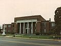
Neshoba County courthouse and Confederate Monument in Philadelphia
|
|

Location within the U.S. state of Mississippi
|
|
 Mississippi's location within the U.S. |
|
| Country | |
| State | |
| Founded | 1833 |
| Named for | Choctaw for “wolf” |
| Seat | Philadelphia |
| Largest city | Philadelphia |
| Area | |
| • Total | 572 sq mi (1,480 km2) |
| • Land | 570 sq mi (1,500 km2) |
| • Water | 1.5 sq mi (4 km2) 0.3% |
| Population
(2020)
|
|
| • Total | 29,087 |
| • Density | 50.85/sq mi (19.634/km2) |
| Time zone | UTC−6 (Central) |
| • Summer (DST) | UTC−5 (CDT) |
| Congressional district | 3rd |
Neshoba County is a county in the central part of Mississippi, a state in the United States. In 2020, about 29,087 people lived here. Its main city and county seat is Philadelphia.
Neshoba County is famous for the Neshoba County Fair, which includes exciting horse races. It is also home to the Williams Brothers Store, a business that has been open since the early 1900s.
The Mississippi Band of Choctaw Indians (MBCI), a recognized Native American tribe, is based in Neshoba County. They have built one of the biggest casino resorts in Mississippi, called the Pearl River Resort, on their land.
Contents
A Look at Neshoba County's Past
When Europeans first arrived, this area was part of the land belonging to the historic Choctaw people. They were a large Native American group living across much of what is now Mississippi.
Early History and the Choctaw People
In the 1830s, under President Andrew Jackson, the U.S. government forced many Native American tribes, including most of the Choctaw, to move west. This event is known as Indian removal. The Choctaw were moved to land that is now part of Oklahoma. This difficult journey is sometimes called the Choctaw Trail of Tears.
Neshoba County was officially created by European American settlers in 1833. Some Choctaw people chose to stay in Mississippi. Their descendants continued to live in their communities. In the 1930s, they officially formed the Mississippi Band of Choctaw Indians. Even in the 1970s, many of them still spoke the Choctaw language.
Changes and Challenges Over Time
In 1890, Mississippi passed a new state constitution. This law made it very hard for most African Americans and Native Americans to vote. This unfair rule lasted for many years. However, in the 1960s, people worked hard to bring back voting rights for everyone in the state.
In June 1964, three young civil rights workers, James Chaney, Andrew Goodman, and Michael Schwerner, disappeared in Neshoba County. Their disappearance caused a lot of anger and sadness across the country. This event helped lead to the passing of the important Civil Rights Act by President Johnson in July of that year. This law helped protect the rights of all Americans.
Over the years, many small post offices opened and closed in the county. By 1971, only two were left, in Philadelphia and Neshoba. Today, only the post office in Philadelphia is still open.
In 1980, Ronald Reagan started his campaign to become president at the Neshoba County Fair. He gave a speech there about the economy and states' rights.
Exploring Neshoba County's Geography
Neshoba County covers about 572 square miles. Most of this area is land, with a small amount of water.
Main Roads in the County
 Mississippi Highway 15
 Mississippi Highway 16
 Mississippi Highway 19
 Mississippi Highway 21
Neighboring Counties
Neshoba County shares borders with these other counties:
- Winston County (to the north)
- Kemper County (to the east)
- Newton County (to the south)
- Leake County (to the west)
People of Neshoba County
| Historical population | |||
|---|---|---|---|
| Census | Pop. | %± | |
| 1840 | 2,437 | — | |
| 1850 | 4,728 | 94.0% | |
| 1860 | 8,343 | 76.5% | |
| 1870 | 7,439 | −10.8% | |
| 1880 | 8,741 | 17.5% | |
| 1890 | 11,146 | 27.5% | |
| 1900 | 12,726 | 14.2% | |
| 1910 | 17,980 | 41.3% | |
| 1920 | 19,303 | 7.4% | |
| 1930 | 26,691 | 38.3% | |
| 1940 | 27,882 | 4.5% | |
| 1950 | 25,730 | −7.7% | |
| 1960 | 20,927 | −18.7% | |
| 1970 | 20,802 | −0.6% | |
| 1980 | 23,789 | 14.4% | |
| 1990 | 24,800 | 4.2% | |
| 2000 | 28,684 | 15.7% | |
| 2010 | 29,676 | 3.5% | |
| 2020 | 29,087 | −2.0% | |
| 2023 (est.) | 28,789 | −3.0% | |
| U.S. Decennial Census 1790-1960 1900-1990 1990-2000 2010-2013 |
|||
In 2020, there were 29,087 people living in Neshoba County. There were about 10,657 households and 7,184 families.
Towns and Communities
Neshoba County has one city, one town, and several smaller communities.
Cities
- Philadelphia (This is the main city and county seat.)
Towns
- Union (Most of this town is in Newton County.)
Census-Designated Places
These are areas that are like towns but are not officially incorporated:
- Bogue Chitto (Part of this area is in Kemper County.)
- Pearl River
- Tucker
Unincorporated Communities
These are smaller communities without their own local government:
Schools in Neshoba County
Students in Neshoba County attend schools in these districts:
- Neshoba County School District
- Philadelphia Public School District
- Union Public School District
The Choctaw Tribal School System also runs several schools in the county. These include Bogue Chitto Elementary School, Pearl River Elementary School, Tucker Elementary School, Choctaw Central Middle School, and Choctaw Central High School.
Images for kids
-
The Neshoba County courthouse in Philadelphia.
See also
 In Spanish: Condado de Neshoba para niños
