Lee Flood Relief Channel facts for kids
The Lee Flood Relief Channel (FRC) is a special waterway built to protect the Lea Valley from floods. It stretches from Ware, Hertfordshire, all the way to Stratford in east London. Building this channel started in 1947 after a huge flood. It was fully ready to help by 1976. The channel uses parts of old rivers, lakes, and new paths dug just for it. Water from this channel also helps fill the Lee Valley Reservoir Chain.
Contents
How the Flood Channel Was Designed
Flood defences are built to handle different levels of flooding. For example, a 100-year flood means a flood so big it's only expected to happen once every 100 years. This is also called "1 per cent protection." It means there's a 1% chance of that level of flood happening in any given year.
The big flood in 1947 was a very rare event. When the Lee Flood Relief Channel was first designed, it was built to handle floods of that size. Since it was finished in 1976, there haven't been any major floods in the Lea Valley. However, the river system has been almost full three times: in 1987, 1993, and 2000.
Over time, the channel's ability to protect against floods has changed. In some areas, it now offers "2 per cent protection," meaning a 2% chance of a flood happening each year. In other spots, it's only "5 per cent protection." The Environment Agency looked at ways to improve these flood defences in 2008.
The Channel's Journey
Through Hertfordshire and Essex
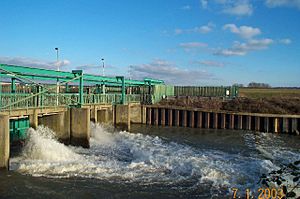
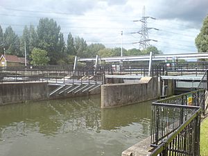
The Flood Relief Channel begins in Ware. Here, it joins the Lee Navigation, which is a system of canals and rivers. It flows through two locks called Hardmead Lock and Stanstead Lock. These locks have special automatic sluice gates. These gates help control the water flow during high water levels.
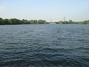
At Feildes Weir, a new channel was built next to the main one. The channel then goes around Glen Faba Lake, which is about 120-acre (49 ha) big. It passes under Dobbs Weir Road. After that, it enters the North Lagoon of the Nazeing Meads lake complex. It leaves this area from the South Lagoon at Nazeing Weir.
The channel continues under Nazeing Road (B194). It then flows through the River Lee Country Park at Holyfield Lake. The water exits through Holyfield Weir. After going under Stubbins Hall Lane, it meets up with the old River Lea at Fishers Green.
The channel then goes around Seventy Acres Lake and Hooks Marsh Lake. It becomes part of the Horsemill Stream, also known as Waltons Walk. The water forms a natural border for the Waltham Abbey Royal Gunpowder Mills. It passes through special gates called David Stoker sluice near Waltham Abbey. These gates are controlled by machines.
Now, the channel flows very close to the Lee Navigation. It first goes under the A121 road. Then it passes through Rammey Marsh Sluice. This sluice has three computer-controlled gates that lift up and down. Next, it goes under the M25 motorway. Here, it is joined by Cobbins Brook. Finally, it flows through Newman's Sluice, which has four computer-controlled gates.
Entering Greater London
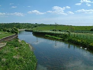
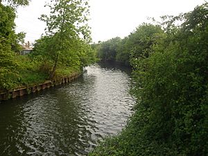
The channel crosses Rammey Marsh. It forms the eastern edge of what used to be the Royal Small Arms Factory. This area is now a housing development called Enfield Island Village. Further downstream, the channel joins the River Lea. Together, they become the River Lee Diversion. This part of the river is man-made and has concrete banks.
The River Lee Diversion flows around the eastern side of the King George V Reservoir. This is the first of the Lee Valley Reservoir Chain. It then goes past the William Girling Reservoir. The river forms the border between the London Borough of Enfield and Waltham Forest. It also marks the old border between Middlesex and Essex.
The channel flows under the North Circular Road. It passes close to Banbury Reservoir. Then, it splits off from the River Lee Diversion. It crosses Tottenham Marshes. It also goes near the Lockwood Reservoir, High Maynard Reservoir, and Low Maynard Reservoir.
The channel flows under Forest Road (A503 road). Then it goes under the Gospel Oak to Barking line railway. It skirts the Walthamstow Reservoirs near Walthamstow Marshes. It passes under Coppermill Lane. Then it flows under the Lea Valley Line railway as it gets close to Lea Bridge Road, which is part of the A104 road.
Finally, the channel crosses Hackney Marshes. It goes through a tunnel called a culvert. It then joins the Old River Lea near the New Spitalfields Market. It passes under the Eastway road. Then it flows under the A115 (Carpenter's Road). Here, it meets the Waterworks River below Carpenter's Road Lock in Stratford. The channel continues through the Prescott Channel and Bow Creek. It finally reaches the River Thames at Leamouth.
 | Kyle Baker |
 | Joseph Yoakum |
 | Laura Wheeler Waring |
 | Henry Ossawa Tanner |


