Leesville, Ohio facts for kids
Quick facts for kids
Leesville, Ohio
|
|
|---|---|
|
Village
|
|

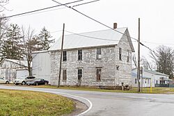
Village hall
|
|

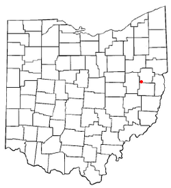
Location of Leesville, Ohio
|
|

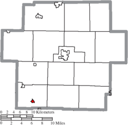
Location of Leesville in Carroll County
|
|
| Country | United States |
| State | Ohio |
| County | Carroll |
| Township | Orange |
| Government | |
| • Type | Incorporated Municipality |
| Area | |
| • Total | 0.26 sq mi (0.66 km2) |
| • Land | 0.26 sq mi (0.66 km2) |
| • Water | 0.00 sq mi (0.00 km2) |
| Elevation | 965 ft (294 m) |
| Population
(2020)
|
|
| • Total | 127 |
| • Density | 494.16/sq mi (190.98/km2) |
| Time zone | UTC-5 (Eastern (EST)) |
| • Summer (DST) | UTC-4 (EDT) |
| ZIP code |
44639
|
| Area code(s) | 740 |
| FIPS code | 39-42518 |
| GNIS feature ID | 2398412 |
Leesville is a small village located in the southwestern part of Carroll County, Ohio, in the United States. In 2020, about 127 people lived there. Leesville is part of the larger Canton–Massillon metropolitan area.
Contents
History of Leesville
Leesville was first planned out on August 1, 1812. It was originally called Leesburg. This happened in an area that was then known as One Leg Township, in Tuscarawas County. Two people named Thomas Price and Peter Saunders were responsible for its creation.
By 1820, Leesburg had 131 residents. By 1880, its population grew to 408 people. Most of these residents worked in farming or coal mining. The village's post office was later named Leesville. This was done to avoid confusion with another town called Leesburg, Ohio in Highland County, Ohio. At some point after that, the entire village officially changed its name to Leesville.
Leesville played an important role in history. It was one of the "stations" on the Underground Railroad. This was a secret network that helped enslaved people escape to freedom. Famous speakers who fought against slavery, like William Lloyd Garrison, Frederick Douglass, Wendell Phillips, and Parker Pillsbury, sometimes visited the village's public hall.
Geography and Location
Leesville is a small village. According to the United States Census Bureau, it covers a total area of about 0.26 square miles (0.66 square kilometers). All of this area is land.
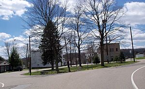
The village is located on Ohio State Route 212. It is also near where Ohio State Route 164 ends. A railway line, which is now part of the Wheeling and Lake Erie Railway, also passes through the town. This railway used to be known as the New York, Chicago and St. Louis Railroad.
Population Information
| Historical population | |||
|---|---|---|---|
| Census | Pop. | %± | |
| 1820 | 131 | — | |
| 1880 | 408 | — | |
| 1890 | 373 | −8.6% | |
| 1900 | 269 | −27.9% | |
| 1910 | 194 | −27.9% | |
| 1920 | 198 | 2.1% | |
| 1930 | 196 | −1.0% | |
| 1940 | 212 | 8.2% | |
| 1950 | 297 | 40.1% | |
| 1960 | 287 | −3.4% | |
| 1970 | 221 | −23.0% | |
| 1980 | 233 | 5.4% | |
| 1990 | 156 | −33.0% | |
| 2000 | 184 | 17.9% | |
| 2010 | 158 | −14.1% | |
| 2020 | 127 | −19.6% | |
2010 Census Details
In 2010, the village of Leesville had 158 people living there. There were 66 households, which means 66 different homes. The population density was about 607.7 people per square mile. This means that for every square mile, there were about 607 people.
Most of the people living in Leesville were White (97.5%). A small percentage (2.5%) were from two or more racial backgrounds.
About 24.2% of the households had children under 18 living with them. Many households (56.1%) were married couples living together. The average household had 2.39 people. The average family had 2.61 people.
The average age of people in the village was 46.3 years old. About 19.6% of residents were under 18. About 25.9% were 65 years old or older. The village had slightly more females (51.9%) than males (48.1%).
Education in Leesville
Students in Leesville attend public schools run by the Conotton Valley Union Local School District.
Notable Person
- Earl Blackburn, a famous Major League Baseball catcher, was from Leesville.
See also
 In Spanish: Leesville (Ohio) para niños
 | Sharif Bey |
 | Hale Woodruff |
 | Richmond Barthé |
 | Purvis Young |


