Lincoln Heights, Los Angeles facts for kids
Quick facts for kids
Lincoln Heights
|
|
|---|---|
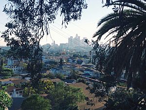
View of Lincoln Heights and Downtown Los Angeles from the Repetto Hills
|
|
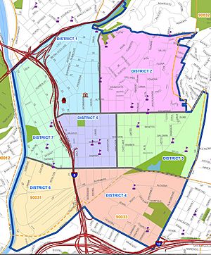
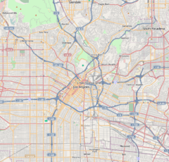
Lincoln Heights boundary map
|
|
| Country | United States |
| State | California |
| County | Los Angeles |
| City | Los Angeles |
| Time zone | UTC-8 (PST) |
| • Summer (DST) | UTC-7 (PDT) |
| ZIP code |
90031
|
| Area code(s) | 323, 213, etc |
Lincoln Heights is one of the oldest neighborhoods in Los Angeles, California, United States. It was first called "East Los Angeles" from 1873 to 1917. This area is very populated and has many Latino and Asian residents. It includes many important historic places. People once called it "the Bedroom of the Pueblo."
Contents
History of Lincoln Heights
Lincoln Heights is one of Los Angeles's oldest neighborhoods. It dates back to the 1870s. The area is located on hills above the Los Angeles River. This made it a good spot for early industries.
In 1863, John Strother Griffin bought 2,000 acres of land for $1,000. By 1870, he and his nephew built homes there. In 1874, they sold smaller plots of land. The neighborhood was known as "East Los Angeles" until 1917. That year, residents voted to change the name to Lincoln Heights.
Lincoln Heights was the first suburban neighborhood in Los Angeles. It was a good place for people who worked in the factories along the Los Angeles River. By the late 1880s, a shopping area grew around North Broadway and Truman Streets. This was the city's first suburban shopping district. However, it was later removed to build the Golden State Freeway.
Over time, the area became more industrial. Wealthy residents moved to other parts of Los Angeles. Lincoln Heights then became home to many different groups of people. These included Italian Americans, Irish Americans, and French Americans by the 1930s. Many poor white Americans, called "Okies," also moved in. By the 1960s, it became a barrio with a large Mexican American population.
In recent years, Lincoln Heights has been slowly changing. This is due to new city plans for land use.
People and Population
In 2019, Lincoln Heights had about 39,916 residents. The neighborhood has a high number of both Latino and Asian residents. About 66.2% of people are Latino, and 23.4% are Asian.
Many residents were born outside the United States. Mexico (57.0%) and Vietnam (16.9%) were the most common birthplaces. The average household income in 2008 was $30,579, which was low for the city. Most homes (75.9%) were rented, while 24.1% were owned. The average household had 3.6 people, which is a high number for Los Angeles.
Lincoln Heights is considered an area with environmental challenges. This is based on a study called CalEnviroScreen 4.0.
Homelessness in Lincoln Heights
The number of people experiencing homelessness in Lincoln Heights has changed over the years. In 2022, the Greater Los Angeles Homeless Count found 531 homeless individuals in the area.
| Homeless population | ||
|---|---|---|
| Year | Pop. | ±% |
| 2016 | 96 | — |
| 2017 | 205 | +113.5% |
| 2018 | 216 | +5.4% |
| 2019 | 277 | +28.2% |
| 2020 | 280 | +1.1% |
| 2022 | 531 | +89.6% |
| Source: Greater Los Angeles Homeless Count Los Angeles Homeless Services Authority |
||
Arts and Culture
Public Libraries
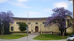
The Lincoln Heights Branch of the Los Angeles Public Library is located on Workman Street.
Important Landmarks
Lincoln Heights has many important places:
- Lincoln Park
- San Antonio Winery: This winery was founded in 1917 and is the oldest business still running in Lincoln Heights.
- Los Angeles Alligator Farm
- Selig Polyscope Company
- The Brewery Art Colony
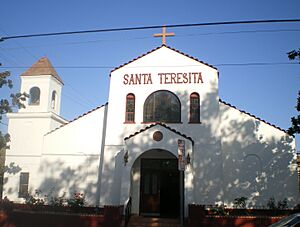
- Church of the Epiphany: This is the oldest Episcopal church still operating in Los Angeles. Cesar Chavez gave speeches here, and a newspaper called La Raza was printed in its basement.
- Lincoln Heights Jail
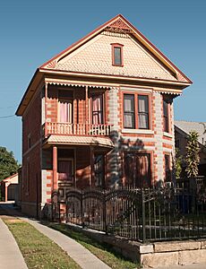
- Heritage Square Museum
- HM157
Education in Lincoln Heights
Only a small percentage (5.5%) of Lincoln Heights residents aged 25 and older had a four-year degree by 2000. This was a low percentage compared to the rest of the city.
Schools in the Area
Public Schools
- Abraham Lincoln High School, 3501 North Broadway
- Academy of Environmental & Social Policy (ESP) at Lincoln High, 3501 North Broadway
- Hillside Elementary School, 120 East Avenue 35
- Alliance College-Ready Middle Academy No. 5, charter, 2635 Pasadena Avenue
- Pueblo de Los Angeles Continuation School, 2506 Alta Street
- Gates Street Elementary School, 3333 Manitou Avenue
- Albion Street Elementary School, 322 South Avenue 18
- Griffin Avenue Elementary School, 2025 Griffin Avenue
- Milagro Charter Elementary School, 1855 North Main Street
- Los Angeles Leadership Academy High School (LALA HS), 234 W Avenue 33
- Alliance College Ready Middle Academy #5 (ACRMA #5)
- Alliance Susan & Eric Smidt Technology High School
- East Los Angeles Skill Center (Adult Education), 3921 Selig Place
PUC Schools runs the Milagro Charter School (for grades K-5) and the Excel Charter Academy (for grades 6-8) in Lincoln Heights.
Private Schools
- Sacred Heart High School, 2111 Griffin Avenue
- Sacred Heart Elementary School, 2109 Sichel Street
Local Services and Transport
Transportation Options
Major roads in Lincoln Heights include Valley Boulevard, Mission Road, Pasadena Avenue, North Main, Marengo, Daly, and Figueroa Streets, and North Broadway. The Golden State Freeway (I-5) goes through the area. The Metro A Line train has a station in the northwest part of the neighborhood.
Fire Services
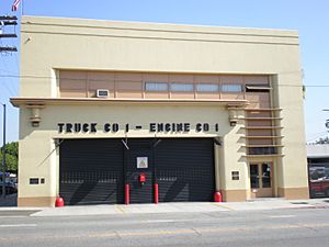
Los Angeles Fire Department Fire Station No. 1 is located in Lincoln Heights. It is part of the Battalion 2 district.
Healthcare Services
The Los Angeles County Department of Public Health runs the Central Health Center in Downtown Los Angeles. This center provides healthcare services to residents of Lincoln Heights.
Famous People from Lincoln Heights
- Frank Capra, a famous film director
- John Strother Griffin, who founded East Los Angeles
- Kenny Washington, a football player
- Cesar Chavez, a civil rights leader, lived temporarily in Lincoln Heights in 1972.
- Daniel Lewis James, an author
- Eldridge Cleaver, a leader in the Black Panther Party
- Gregory Ain, an architect
See also
 | Aaron Henry |
 | T. R. M. Howard |
 | Jesse Jackson |


