List of castles in Gloucestershire facts for kids
Gloucestershire is a county in South West England with a long and exciting history. It's home to many amazing castles! These old buildings were once strongholds, homes, and important places for defense. They tell us stories about knights, kings, and battles from long ago.
Castles in Gloucestershire come in different types. Some are called motte-and-bailey castles. Imagine a big, cone-shaped hill (the motte) with a wooden fence or stone tower on top. Below it, there's a protected area called a bailey, surrounded by a ditch. These were very common after the Normans arrived in England.
Other castles are ringworks. These are like motte-and-baileys but without the tall hill. They are simply a defended area, often round, with a ditch and wall. A ring-motte is a ringwork with a raised center. Sometimes, a motte had a stone wall on top instead of a wooden one; this was called a shell keep.
Contents
History of Castles in Gloucestershire
Building Castles After the Norman Conquest
The first castles in Gloucestershire were built after the Normans invaded England in 1066. William FitzOsbern, a powerful Norman leader, was in charge of this area. He probably built the first castle in Gloucester. He also built Chepstow Castle further west. Many early castles were built in the Forest of Dean to protect Gloucester from attacks from Wales.
However, many of these early castles were soon left empty as the area became safer. To the south, Bristol Castle was a major stronghold. Other castles to the north helped defend the region.
Castles During the Anarchy
Later, Walter de Gloucester and his son, Miles de Gloucester, became very powerful in Gloucestershire. They made their main castle in Gloucester even stronger.
From 1139 to 1153, England faced a civil war called the Anarchy. This was a fight for the throne between King Stephen and Empress Matilda. Castles were super important during this war. Matilda's supporters in Gloucestershire built many new castles. King Stephen destroyed some of these during the war. After the war, King Henry II also destroyed some to bring the country back under royal control.
Later Years of Castles
In the 1200s and 1300s, fortified manor houses became popular. These were large homes built to be defended, but they weren't always as strong as earlier castles.
By the 1500s, most castles in Gloucestershire were no longer used as fortresses. Some, like Gloucester and St Briavels, became administrative centers or even prisons. During the English Civil War (1642–1649), several castles were damaged or even destroyed on purpose (this was called slighted) to prevent enemies from using them.
In the 1700s and 1800s, changes in prison laws meant castles were no longer used as jails. Today, only a few castles in Gloucestershire are still lived in as private homes.
Famous Castles in Gloucestershire
Here are some of the most interesting castles you can find or learn about in Gloucestershire:
| Name | Type and Date | Condition | Location | Picture |
|---|---|---|---|---|
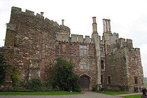
| Berkeley Castle | Motte and bailey, 1067. | Private home, partly open to public | Berkeley51°41′17″N 2°27′25″W / 51.68797°N 2.45707°W | |
| The first castle here was built by William FitzOsbern. It was destroyed during the Anarchy civil war. A new castle was built in 1153, with a shell keep and stone walls. It's famous as the place where King Edward II died in 1327. The castle was damaged in the English Civil War. | ||||
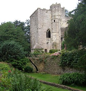
| Beverstone Castle | Pentagonal bailey, before 1229 | Partially intact, private home | Beverston51°38′42″N 2°12′11″W / 51.64507°N 2.203009°W | |
| Maurice de Gaunt built the first castle here. Later, Thomas, Lord Berkeley added a small stronghold with a twin-towered gatehouse. It was damaged during the English Civil War, but part of it is still used as a home. | ||||
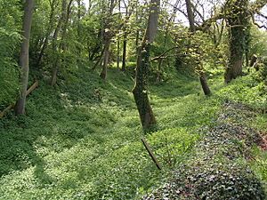
| Brimpsfield Castle | Motte and bailey, 11th century | Earthworks and some stone remains | Brimpsfield51°48′51″N 2°05′16″W / 51.814248°N 2.087721°W | |
| This castle was likely built after the Norman invasion and later rebuilt in stone. Its owner, John Giffard, rebelled against King Edward II and was executed in 1322. The castle was then destroyed. | ||||
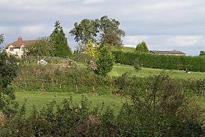
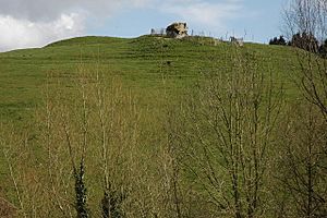
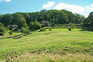
| Castle Tump | Motte and bailey, 11th or 12th century | Earthworks | Dymock51°57′43″N 2°25′17″W / 51.961876°N 2.42129°W | |
| Today, the castle mound is 14 meters (about 46 feet) high. During the Anarchy, the castle was given to William de Braose. It was probably destroyed by King Henry II after the civil war. | ||||
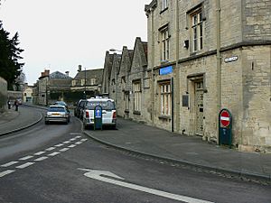
| Cirencester Castle | Motte and bailey, 11th century | Destroyed, covered by modern Cirencester | Cirencester51°42′59″N 1°58′13″W / 51.716275°N 1.970285°W | |
| This castle was first built from timber in the 11th century. A stone tower was added in 1107. During the Anarchy, Robert, Earl of Gloucester took the castle for Empress Matilda. In 1142, King Stephen captured and burned the castle. | ||||
| English Bicknor Castle | Motte and bailey, 11th century | Earthworks | English Bicknor51°50′20″N 2°36′32″W / 51.838779°N 2.608822°W | |
| The castle's mound was at the center of two outer walls. This made it about 150 yards (137 meters) wide. A square stone tower might have been built later. Miles de Gloucester controlled it during the Anarchy. It was still in use in the early 1200s. | ||||
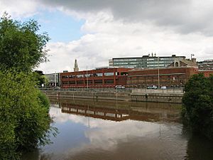
| Gloucester Castle | Motte and bailey, 11th century | Destroyed, covered by modern Gloucester Prison | Gloucester51°51′48″N 2°15′02″W / 51.863464°N 2.250462°W | |
| Built after the Norman Conquest, this castle was made bigger by William Rufus. During the Anarchy, Miles of Gloucester held it for Empress Matilda. King Henry III often stayed here. By 1228, it was used as the county prison. It was torn down between 1787 and 1791 to build a new prison. | ||||
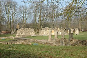
| Hailes Castle | Unknown, 11th or 12th century | Destroyed, covered by ruins of Hailes Abbey | Stanway51°58′11″N 1°55′35″W / 51.9698°N 1.92645°W | |
| This moated castle was built near St Peters' church. Ralph of Worcester strengthened it during the Anarchy. It was probably demolished in the 1240s to make way for Hailes Abbey. | ||||
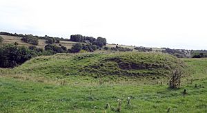
| Lasborough | Motte, 11th century | Earthworks | Lasborough51°38′45″N 2°15′23″W / 51.645867°N 2.256486°W | |
| This castle has a motte, or mound, that is 40 meters (about 130 feet) wide. There is no sign of a bailey. It was likely built to work with the nearby castle at Newington Bagpath. | ||||
| Miserden Castle | Motte and bailey with shell-keep, early 12th century | Earthworks and some stone remains | Miserden51°46′55″N 2°04′55″W / 51.781885°N 2.081859°W | |
| Robert Musard built this castle overlooking the River Frome. It had a 60-foot (18-meter) wide shell keep and a moat. Musard was killed by King Stephen's forces during the Anarchy. The castle survived into the 1200s. | ||||
| Newington Bagpath Motte | Motte, 11th or early 12th century | Earthworks | Bagpath51°39′04″N 2°16′00″W / 51.651239°N 2.266635°W | |
| This castle was built on high ground. It had a 150-foot (46-meter) wide motte and a keep. It didn't have a bailey. It was probably meant to work with the castle at Lasborough. | ||||
| Ruardean Castle | Fortified manor house, 13th century | Earthworks and some stone remains | Ruardean51°51′28″N 2°33′12″W / 51.857709°N 2.553392°W | |
| Alexander de Bykemore was given permission to add battlements to this castle in 1310. It had a courtyard, buildings, a gatehouse, and a curtain wall. It was built on a hill above two valleys. | ||||
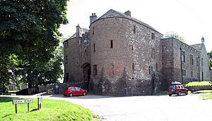
| St Briavels Castle | Square keep and bailey, between 1075–1129 | Largely intact, owned by English Heritage, used as a Youth Hostel | St Briavels51°44′20″N 2°38′32″W / 51.7388°N 2.642233°W | |
| Walter and Miles de Gloucester built St Briavels Castle for the king. It was the main administrative center for the Forest of Dean. It was a favorite hunting lodge for King John. In the 1200s, it became a major place for making crossbow bolts. By the 1830s, it was a prison for people who owed money. | ||||
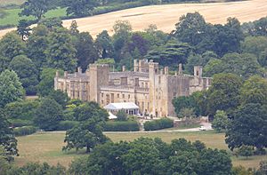
| Sudeley Castle | Mid-15th century double-courtyard | Intact, privately owned and open to the public | Winchcombe51°56′50″N 1°57′25″W / 51.947338°N 1.957039°W | |
| John de Sudeley first fortified a manor house here during the Anarchy. King Stephen seized and destroyed it in 1139. A new, grander castle was built in the late 1400s. It was damaged after the English Civil War in 1649. The castle you see today has been greatly restored in Victorian times. | ||||
| Taynton Castle | Ring-motte, 11th or 12th century | Earthworks | Taynton51°53′17″N 2°24′53″W / 51.888174°N 2.414788°W | |
| This Norman castle was about 25 meters (82 feet) wide. Only its earthworks remain today. | ||||
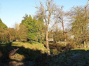
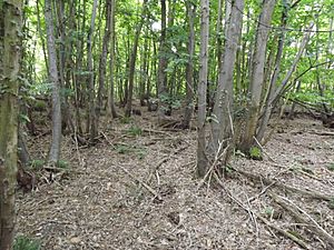
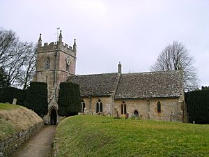
| Upper Slaughter Castle | Motte and bailey, mid-12th century | Earthworks | Upper Slaughter51°54′27″N 1°46′26″W / 51.907569°N 1.773921°W | |
| This castle was built during the Anarchy. It used the natural high ground and even included part of St Peters church in its defenses. It was about 22 meters (72 feet) wide. | ||||
| Weston Park | Motte and bailey, 11th or 12th century | Earthworks | Weston Park52°03′09″N 1°49′48″W / 52.052415°N 1.830066°W | |
| The castle's motte, or mound, which is 8 feet (2.4 meters) high, can still be seen at this site. | ||||
| Winchcombe Castle | Motte and bailey, 1140 or 1144. | Destroyed, covered by modern Winchcombe | Winchcombe51°57′07″N 1°58′02″W / 51.951837°N 1.96722°W | |
| This castle was built during the Anarchy by Roger, Earl of Hereford, who supported Empress Matilda. King Stephen's forces attacked it in 1144. The castle was destroyed and never rebuilt. | ||||
 | Toni Morrison |
 | Barack Obama |
 | Martin Luther King Jr. |
 | Ralph Bunche |


