River Frome, Stroud facts for kids
Quick facts for kids River Frome |
|
|---|---|

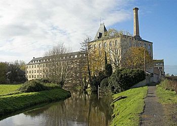
River Frome near Ebley Mill
|
|
|
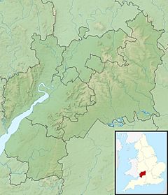
Location within Gloucestershire
|
|
| Country | England |
| Counties | Gloucestershire |
| Physical characteristics | |
| River mouth | River Severn 51°47′34″N 2°21′41″W / 51.7927°N 2.3613°W |
| Length | 40 km (25 mi) |
The River Frome, also known as the Stroudwater, is a small river in Gloucestershire, England. It is about 25 miles (40 km) long. There are other rivers with the name Frome in Gloucestershire, like the Bristol Frome, and another in Herefordshire.
Contents
Journey of the River Frome
The Stroud Frome starts from several natural springs. Some springs are found near Nettleton, and others at Climperwell Farm. These two branches of the river meet up in Miserden Park. From there, the Frome gently winds its way south to Sapperton.
It then turns west towards Brimscombe. The river then flows northwest towards the town of Stroud. It passes through Stroud and goes by the Frome Banks nature reserve. The river continues through Ebley and Stonehouse. It even flows under the M5 motorway! Finally, it passes Saul before joining the larger River Severn at Upper Framilode.
Watershed and River Basins
Near Caudle Green, the land on the eastern side of the valley rises. This area is part of a special line called a watershed. This watershed separates water that flows into the North Sea from water that flows into the Atlantic Ocean. The Frome river basin shares a part of this watershed. Water on one side flows into the River Thames (which goes to the North Sea). Water on the other side flows into the River Severn (which goes to the Atlantic Ocean) through the Frome.
Stroudwater Canal History
Below Sapperton, the River Frome runs next to the Thames and Severn Canal. This canal is not used for boats anymore, but parts of it are being fixed up. This canal connects to the Stroudwater Navigation (also called the Stroudwater Canal) at a place called Wallbridge. The Stroudwater Navigation was very important for Stroud. It helped the town grow a lot during the Industrial Revolution.
The Stroudwater Navigation runs alongside the Frome for most of its journey west from Stroud. It was a busy waterway for trade. Boats carried goods, which helped businesses in Stroud thrive.
The Golden Valley
The valley stretching from Chalford to Stroud is known as the Golden Valley. It is one of the famous Five Valleys in the Stroud area. This valley is important because it carries the railway line. It also holds the Thames and Severn Canal which leads to the Sapperton Tunnels. These tunnels go under the Cotswolds hills. The Sapperton Valley nature reserve is one of the beautiful natural areas you can find here.
Images for kids
 | Georgia Louise Harris Brown |
 | Julian Abele |
 | Norma Merrick Sklarek |
 | William Sidney Pittman |


