List of castles in West Lothian facts for kids
West Lothian, a region in Scotland, is home to many interesting castles. These castles come in different shapes and sizes, from old medieval mounds called mottes to tall tower houses and even fancy homes built to look like castles.
Many of the very first castles are now just ruins or only known from old records. Later castles are often ruined too, but some have been fixed up and are now lived in again. A few, like Bridge Castle, Ochiltree Castle, and the House of the Binns, have been lived in continuously for a long time.
West Lothian also has the famous Linlithgow Palace. This royal palace is now a ruin, but it was once a main home for Scottish kings and queens. It was built on the site of an even older fort.
The area of West Lothian today is a bit different from the historical county. It includes some castles that used to be in Midlothian, like Cairns Castle. It also doesn't include some castles that were once in West Lothian but are now part of Edinburgh.
Castles of West Lothian
West Lothian has a rich history, and its castles tell many stories. Here is a list of some of the castles you can find in the area.
| Name | Type | Date | Condition | Ownership | Location | Notes | Picture |
|---|---|---|---|---|---|---|---|
| Abercorn Castle | Unknown | Unknown | Ruined (site) | Private | Abercorn NT 0828 7928 55°59′52″N 3°28′20″W / 55.9977°N 3.4721°W |
This castle was owned by the powerful Black Douglases family. In 1455, King James II of Scotland had it destroyed after a siege. Today, its remains are found within the grounds of Hopetoun House. | |
| Baads Castle | Unknown | 1588 | Ruined (site) | Unknown | West Calder NT 005 614 55°50′10″N 3°35′20″W / 55.836°N 3.589°W |
Baads Castle was likely built in 1588. It also belonged to the Douglas family and burned down in 1736. Its exact location is not fully known today. | |
| Bathgate Castle | Motte | Unknown | Ruined (earthworks) | Private | Bathgate NS 9807 6805 55°53′41″N 3°37′53″W / 55.8948°N 3.6314°W |
Walter Stewart, 6th High Steward of Scotland received this castle in 1314. He died here in 1327. Today, only a mound with a double ditch remains, located on a golf course. | |
| Bonhard Castle | Tower house | 16th century | Ruined | Unknown | Bo'ness | This was a tower house from the 16th century. | |
| Bridge Castle | Tower house | 16th century | Occupied (apartments) | Private | Westfield NS 9435 7095 55°55′12″N 3°41′31″W / 55.920°N 3.692°W |
Built as a tower house in the 16th century, it was owned by the Livingstone family. It was later made bigger and remodelled. It used to be a hotel and is now divided into apartments. | 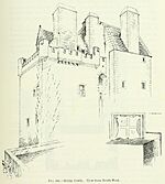 |
| Cairns Castle | Tower house | 1440 | Ruined | Private | Harperrig Reservoir NT 0904 6051 55°49′45″N 3°27′14″W / 55.8292°N 3.4538°W |
The remains of this 15th-century castle stand by Harperrig Reservoir. It was built for George Crichton, 1st Earl of Caithness. The ruins are about 9 meters (30 feet) tall. |  |
| Carribber Castle or Rob Gibb's Castle | Manor house | 16th century | Ruined (site) | Private | Avon Valley, Linlithgow NS 9657 7516 55°57′30″N 3°39′29″W / 55.9583°N 3.6581°W |
This is what's left of a 16th-century manor house. It probably wasn't a strong fort because its walls were thin. Not much remains above ground, but you can see the outlines of old buildings. | 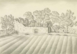 |
| Couston Castle | Tower house | 15th-17th century | Demolished | Unknown | North Couston, Bathgate NS 9558 7115 55°55′20″N 3°40′21″W / 55.9221°N 3.6724°W |
This castle was owned by the Sandilands family. By the early 1900s, it was a ruin. It was demolished in 2006 because it was unsafe. | |
| Duntarvie Castle | Renaissance house | 1590 | Partially restored | Private | Winchburgh NT 0905 7648 55°58′21″N 3°27′32″W / 55.9726°N 3.4588°W |
James Durham built this house after 1588. It's a long, symmetrical house in the Scots Renaissance style. It was a ruin in the 1920s, but restoration work began in 1995 and is still ongoing. | 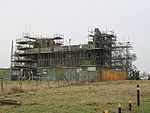 |
| House of the Binns | Castellated house | 1621–1630 | Occupied | National Trust for Scotland | Blackness NT 0508 7857 55°59′27″N 3°31′23″W / 55.9907°N 3.5231°W |
There has been a castle here since the 15th century. The Dalyell family bought it in 1612 and rebuilt it in the 1620s. It has been extended and changed many times. It is now managed by the National Trust for Scotland. | 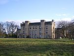 |
| Illieston Castle | Manor house | Late 16th/Early 17th century | Occupied (private house) | Private | Almond Valley, near Broxburn NT 1008 6998 55°54′52″N 3°26′24″W / 55.9145°N 3.4401°W |
Scottish kings like James II and James IV are said to have had a hunting lodge here. The current house is from the late 16th or early 17th century. It is now a private home. | 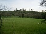 |
| Linlithgow Palace | Royal palace | 1424 onwards | Ruined | Historic Environment Scotland | Linlithgow NT 0019 7732 55°58′43″N 3°36′03″W / 55.9785°N 3.6009°W |
An early fort was built here in 1302 by Edward I of England. It was rebuilt as a grand palace by James I of Scotland in 1424. It was a main royal home until 1603. The palace burned down in 1746 and is now cared for by Historic Environment Scotland. | 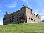 |
| Lochcote Castle | Unknown | Unknown | Ruined (doocot) | Private | Torphichen NS 9769 7396 55°56′52″N 3°38′24″W / 55.9479°N 3.6399°W |
Lochcote Castle is now just the remains of a corner tower. This tower was later used as a doocot, which is a pigeon house. The main castle was replaced by a house that was later demolished. | 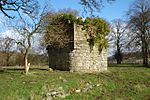 |
| Midhope Castle | Tower house | Late 16th century | Ruined | Private | Abercorn NT 0728 7868 55°59′32″N 3°29′16″W / 55.9921°N 3.4879°W |
Built as a tower house in the late 16th century, it was later extended. It became part of the Hopetoun House estate. The building was divided into apartments in 1926 but has been empty since. | 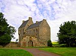 |
| Murieston Castle | Folly | 16th century (rebuilt 1824) | Occupied (farmstead) | Private | Murieston NT 0501 6349 55°51′19″N 3°31′08″W / 55.8552°N 3.5189°W |
This was a tower house in the 16th century. It was rebuilt in 1824 to look like a castle, which is called a folly. Few of its original parts remain today. | 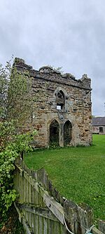 |
| Niddry Castle | Tower house | 15th-16th century | Restored | Private | Winchburgh NT 0952 7437 55°57′14″N 3°27′02″W / 55.9538°N 3.4505°W |
Niddry was a home for the Seton family. Mary, Queen of Scots stayed here after escaping from Loch Leven. The ruined tower was restored in the 1980s. | 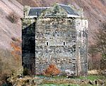 |
| Ochiltree Castle | Laird's house | Late 16th/Early 17th century | Occupied | Private | Bridgend NT 0326 7476 55°57′22″N 3°33′03″W / 55.9561°N 3.5509°W |
This house was owned by the Stirling family. It was built in the Scottish Renaissance style. It is considered a "very fine example" of its type. | 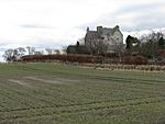 |
| Ogilface Castle | Tower house | 12th century | Ruined (site) | Unknown | Woodend, Armadale NS 9270 6901 55°54′08″N 3°43′03″W / 55.9022°N 3.7176°W |
This castle was owned by the Veteri Ponte family in the 12th century. It is now completely ruined. Old surveys suggest a tower once stood here. | 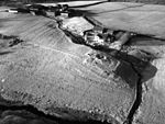 |
| Peel of Livingston | Unknown | 14th century | Ruined (site) | Unknown | Livingston NT 0398 6758 55°53′30″N 3°32′12″W / 55.8918°N 3.5368°W |
This fort was built in the 14th century and held an English army during the Wars of Scottish Independence. Its remains were removed by the mid-1800s, and the area is now part of the town of Livingston. | |
| Pumpherston Castle | Unknown | 15th century | Ruined (site) | Unknown | Pumpherston NT 0755 6865 55°54′08″N 3°28′48″W / 55.9021°N 3.4801°W |
This castle was once a large building, but nothing remains of it today. Its ruins were removed in the late 1700s. It was home to a branch of the Douglas family. | |
| Staneyhill Tower | Tower house | 17th century | Ruined | Private | Hopetoun NT 0916 7851 55°59′27″N 3°27′28″W / 55.9909°N 3.4577°W |
Staneyhill was built in the 17th century for the Sharp family. Only the stair tower remains standing today, along with some ruined lower walls of the house. | 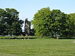 |
| Strathbrock Castle | Motte | 12th century | Ruined (site) | Unknown | Uphall NT 0575 7164 55°55′43″N 3°30′36″W / 55.9286°N 3.5099°W |
The land here was given to a nobleman named Freskyn in the 12th century. The castle may have been a motte with later stone buildings. The area is now built up. | |
| Tartraven Castle | Unknown | Unknown | Ruined (site) | Unknown | Castlepark, Torphichen NT 0045 7264 55°56′11″N 3°35′42″W / 55.9365°N 3.5951°W |
Tartraven might have been a small castle or manor house. Its ruins were still visible in the early 1800s, but nothing remains today. A nearby farm may have used stones from the castle. |
See also
- Castles in Scotland
- List of castles in Scotland
- List of listed buildings in West Lothian
 | James Van Der Zee |
 | Alma Thomas |
 | Ellis Wilson |
 | Margaret Taylor-Burroughs |

