List of mountains in Georgia named Rocky Mountain facts for kids
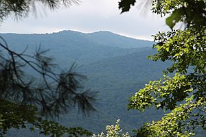
"Rocky Mountain" is a name given to nine different mountains in the beautiful North Georgia mountains. These mountains are spread across six different counties in the state of Georgia. It can be a bit confusing because they all share the same name! Let's explore where each of these "Rocky Mountains" can be found.
Contents
Exploring Georgia's Rocky Mountains
Rocky Mountain in Fannin County
This Rocky Mountain stands at 3,080 feet tall. You can find it west of a place called Gaddistown. It's less than two miles (3 km) away from the border of Union County.
Rocky Mountain in Gilmer County
The Rocky Mountain in Gilmer County is located north of the Rich Mountain Wilderness. It's also east of Lucius. The very top of this mountain is 3,342 feet (1,019 m) high. A famous path called the Benton MacKaye Trail actually goes right over the top of this Rocky Mountain!
Rocky Mountain in Lumpkin County
In Lumpkin County, there's a Rocky Mountain that reaches 3,560 feet (1,085 m) high. It's located south of Blood Mountain. One of Georgia's most popular waterfalls, DeSoto Falls, is found on the southern side of this mountain. This Rocky Mountain is the tallest mountain that is completely inside Lumpkin County. It's also part of the huge Chattahoochee National Forest.
Rocky Mountain in Rabun County
The Rocky Mountain near Tallulah Falls is 2,351 feet (717 m) tall. This makes it the smallest mountain in Georgia with the name "Rocky Mountain." Two streams, Bad Creek and Worse Creek, start on the eastern side of this mountain. These streams are tributaries (smaller rivers that flow into a larger one) of the Chatooga River. Also, the stream that feeds Cascade Falls begins on the southern side of this Rocky Mountain.
Rocky Mountain in Towns County
This Rocky Mountain in Towns County is 4,017 feet (1,224 m) high. It sits right on the Appalachian Trail, which is a very long hiking path. This mountain is on the border between Towns and White counties. If you walk along the Appalachian Trail, the top of this Rocky Mountain is about 51.5 miles (83 km) from Springer Mountain. Springer Mountain is where the southern part of the Appalachian Trail begins.
Rocky Mountains in Union County
Union County has three different mountains named Rocky Mountain!
- One Rocky Mountain is 4,191 feet (1,277 m) tall. It's located south of Brasstown Bald, which is the tallest peak in all of Georgia! This mountain is inside the Brasstown Wilderness. There's also a peak called Rocky Knob, which is 3,740 feet (1,140 m) high. It's found directly south of this Rocky Mountain's main peak.
- Another Rocky Mountain is about five miles (8 km) north of Suches. It's roughly halfway between Baxter to the west and Blood Mountain to the east. This mountain is 3,800 feet (1,158 m) high and is also part of the Chattahoochee National Forest.
- The third Rocky Mountain in Union County is 3,120 feet (951 m) tall. It's located about 1.5 miles northwest of Baxter. It's also less than half a mile east of the border between Union and Fannin counties.
Rocky Mountain in White County
The Rocky Mountain in White County is about nine miles (14 km) west of Helen. It has an elevation of 3,525 feet (1,074 m).
See also
- Rocky Knob (disambiguation)
- Rocky Mountains
- Rocky Mountain (disambiguation)
 | Victor J. Glover |
 | Yvonne Cagle |
 | Jeanette Epps |
 | Bernard A. Harris Jr. |


