List of places of worship in Mole Valley facts for kids
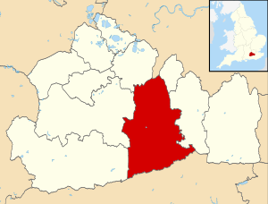
Mole Valley, a district in Surrey, England, is home to over 70 buildings that have been used for worship. Fifty-six of these are still used by different Christian groups and other religions today. Another 16 buildings are no longer used for religious purposes but have found new uses, or in two cases, are now ruins. Surrey is a small county south of London, known for its small market towns, old villages, and newer suburbs.
Most people in Mole Valley are Christian, according to the latest census. Dorking, one of the district's main towns, has a Muslim community centre and mosque. All other places of worship serve Christian groups. The Church of England, which is the official church of the country, has the most churches. The Catholic Church and larger Protestant groups like Methodists, Baptists, and the United Reformed Church also have many buildings and followers. Smaller groups like Quakers, Christian Scientists, and Plymouth Brethren have their own chapels, mostly in Dorking and Leatherhead.
English Heritage has given "listed status" to 29 current and three former places of worship in Mole Valley. A building gets listed status if it's considered very special for its history or architecture. This helps protect it. There are three levels of listed status:
- Grade I: For buildings of "exceptional interest."
- Grade II*: For "particularly important buildings" that are more than just special.
- Grade II: For buildings of "special interest."
As of 2001, Mole Valley had 5 Grade I buildings, 44 Grade II* buildings, and 919 Grade II buildings.
Contents
Exploring Mole Valley's Religious Sites
Mole Valley covers a large area of about 25,832 acres (10,454 hectares) in central Surrey. In 2011, about 85,375 people lived here. It's one of 11 local government areas in Surrey, just south of London. The main towns are Dorking, in the middle of the district, and Leatherhead to the north. Leatherhead is part of a larger urban area that includes Ashtead, Fetcham, and Great Bookham.
The M25 motorway runs through these towns, and several railway lines connect to other places. Gatwick Airport is also nearby. Even with these connections, Mole Valley is mostly countryside. More than 90% of the land is rural, much of it part of the Surrey Hills AONB (Area of Outstanding Natural Beauty). There are many small villages, and most have at least one place of worship. This is usually an Anglican (Church of England) parish church. Some also have chapels for Protestant groups that became more important from the 1700s onwards.
The main towns have a wider variety of churches. For example, you can find churches for Plymouth Brethren, Christian Scientists, the Elim Pentecostal Church, and Jehovah's Witnesses. Roman Catholics have larger churches in Dorking and Leatherhead, and smaller, more modern buildings in Ashtead and Fetcham. Some older Methodist chapels have closed or been demolished, but the Leatherhead Methodist church is still in use. Dorking's Methodist community now shares St Martin's Anglican church.
Ancient Churches and Victorian Changes
The oldest churches in Mole Valley date back to the Saxon times (around the 900s or 1000s). You can still see parts of these old churches in places like Betchworth, Fetcham, and Wotton. Some churches even have older Roman bricks that were reused! Many churches were built in the Norman style (after 1066) and then changed or made bigger in the 1200s. Charlwood is a good example of this. Later, churches were often extended or rebuilt. Leigh, for instance, got a new church in the 1400s.
During the Victorian era (1837-1901), many churches were "restored." This sometimes meant completely rebuilding them, like at Buckland and Capel.
Victorian times also saw many new churches built, especially in large old parishes. For example, Dorking grew a lot in the 1800s. So, new churches like St Paul (1857) and St John the Evangelist at North Holmwood (1875) were built to serve the growing population. Leatherhead also got a new church, All Saints, in 1889. Some churches were built in villages that didn't have one before, like Brockham Green (1848) and Coldharbour (1848). Other old, damaged churches were rebuilt or restored in villages like Headley and Oakwood Hill.
Some churches were built for special reasons. St Barnabas' Church at Ranmore Common (1859) was built for the owners and workers of the Denbies Estate. Holy Trinity at Forest Green (1897) was built not only for villagers but also as a memorial to a man who died in an accident.
Building Materials of Churches
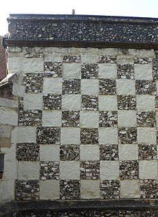
Churches in Mole Valley use different building materials, but many are made from local stone. Brownish Bargate stone, which is very tough, was used at Buckland, Capel, and the Roman Catholic church in Dorking. Other churches, like Brockham and Oakwood Hill, used firestone.
Flint is also very common, especially in the oldest churches. Usually, flint was used on its own. However, a cool checkerboard pattern of flint and stone squares can be seen at only two churches in Surrey, both in Mole Valley: Leatherhead and Mickleham. At Mickleham, clunch is used with flint for this pattern. Clunch is also found at Betchworth and Oakwood Hill.
Softer stones like ashlar were often used for details like window frames. Horsham Stone, a type of sandstone, is often used for roof tiles.
Some places of worship are very unique. A converted cattle shed in Betchworth is now a gospel hall. A timber-framed barn in Westhumble is now a chapel. Providence Chapel at Charlwood is especially remarkable. It was moved to its isolated spot in 1816 from Horsham, where it had been an officers' mess during the Napoleonic Wars! This building, with its white wooden walls and open porch, looks like it belongs in a very remote part of America. It served different Independent and Strict Baptist groups over the years.
Most former places of worship closed because fewer people attended. However, the Hampstead Road Church in Dorking closed for the opposite reason! Built for Plymouth Brethren in 1863, it became so popular that the congregation outgrew the building. They started meeting in a school in 2010, and the old chapel was no longer used for worship.
Religious Groups in Mole Valley
In 2011, the census showed that out of 85,375 people in Mole Valley:
- 64.3% were Christian.
- 0.78% were Muslim.
- 0.66% were Hindu.
- 0.39% were Buddhist.
- 0.25% were Jewish.
- 0.1% were Sikh.
- 0.39% followed another religion.
- 25.2% said they had no religion.
- 7.9% did not state their religion.
The number of Christians in Mole Valley was higher than the average for England. The numbers for other religions or no religion were similar to the rest of England. However, Islam, Judaism, Hinduism, Sikhism, and Buddhism had fewer followers in Mole Valley compared to the country as a whole.
How Churches are Organized
Anglican Churches (Church of England)
The Church of England churches in Mole Valley are part of two different areas called dioceses:
- The Anglican Diocese of Southwark, based in London.
- The Diocese of Guildford, based in Guildford, Surrey.
Churches in Betchworth, Brockham Green, Buckland, Charlwood, and Leigh are part of the Southwark Diocese. Churches in the Guildford Diocese are divided into three smaller areas called deaneries: Dorking, Epsom, and Leatherhead.
- Dorking Deanery covers churches in Abinger Common, Capel, Coldharbour, Dorking (St Martin and St Paul), Forest Green, Newdigate, North Holmwood, Oakwood Hill, Ockley, Pixham, Ranmore Common, South Holmwood, Westcott, and Wotton.
- Epsom Deanery covers Box Hill and Headley.
- Leatherhead Deanery covers Ashtead's two churches (St George and St Giles), Leatherhead's two churches (St Mary and St Nicholas and All Saints), and churches in Fetcham, Great Bookham, Little Bookham, Mickleham, and Westhumble.
Roman Catholic Churches
All four Roman Catholic churches in Mole Valley (in Ashtead, Dorking, Fetcham, and Leatherhead) are part of the Epsom Deanery. This deanery is one of 13 in the Roman Catholic Diocese of Arundel and Brighton, which has its main church in Arundel, West Sussex.
Other Christian Groups
- Baptist Churches: Crossways Community Baptist Church in Dorking is part of the Gatwick Network. Ashtead and Bookham Baptist Churches are in the Guildford Network. Mount Zion Chapel in Leatherhead is a Strict Baptist church. Dorking Baptist Chapel is linked with GraceNet UK, a group of Reformed Evangelical Christian churches.
- Methodist Churches: The Methodist groups in Leatherhead and Dorking (who share St Martin's Anglican church) are part of the Dorking & Horsham Methodist Circuit.
- United Reformed Church: The Southern Synod oversees the United Reformed Churches in Dorking, Great Bookham, and Leatherhead.
Current Places of Worship in Mole Valley
| Name | Image | Location | Denomination/ Affiliation |
Grade | Notes | Refs |
|---|---|---|---|---|---|---|
| St James's Church (More images) |
 |
Abinger Common 51°12′07″N 0°24′20″W / 51.2020°N 0.4055°W |
Anglican | II* | This church was damaged by bombs in World War II and by fire in 1964. It was restored in 1950. The nave (main part) is from the early 1100s, and the chancel (area around the altar) is from the early 1200s. The east window has "the best modern stained glass in the county." | |
| St Giles' Church (More images) |
 |
Ashtead 51°18′31″N 0°17′24″W / 51.3087°N 0.2900°W |
Anglican | II* | Ashtead's old church is in Ashtead Park. It has parts from the 1100s and 1200s, including some Roman bricks. The tower was added in the 1500s. The beautiful 1500s stained glass in the east window came from an abbey near Maastricht. | |
| St George's Church (More images) |
 |
Ashtead 51°18′51″N 0°18′31″W / 51.3143°N 0.3085°W |
Anglican | – | This church was built in 1905 near Ashtead railway station to serve as a smaller chapel for St Giles' Church. It's a simple brick building with a "good, honest" feel. | |
| Ashtead Baptist Church (More images) |
 |
Ashtead 51°18′46″N 0°18′41″W / 51.3129°N 0.3113°W |
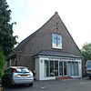
Baptist | – | The first Baptist chapel in Ashtead was built in 1895. This current church, first called the Free Church, was officially registered for marriages in April 1924. | |
| St Michael's Church (More images) |
 |
Ashtead 51°18′45″N 0°18′04″W / 51.3125°N 0.3011°W |
Roman Catholic | – | Ashtead's Roman Catholic church was built in 1967. It has octagonal brick walls with windows high up, a noticeable entrance, and a sloped roof edge. The inside is covered in wood panels. | |
| St Michael's Church (More images) |
 |
Betchworth 51°14′01″N 0°16′03″W / 51.2337°N 0.2674°W |
Anglican | I | This large church, mostly from the mid-1200s, was changed a lot in 1851 and 1870. However, some Saxon (10th-11th century) and later 11th-century parts still remain, like a window in the tower. It's built from chalk, clunch, limestone, and Bath Stone. | |
| St Andrew's Church |  |
Box Hill 51°15′01″N 0°17′20″W / 51.2502°N 0.2888°W |
Anglican | – | A hall was used for worship here from 1938 until this church was finished in 1969. The builder and most workers were local. The church was officially opened on February 1, 1969. | |
| Christ Church (More images) |
 |
Brockham 51°13′53″N 0°17′09″W / 51.2315°N 0.2857°W |
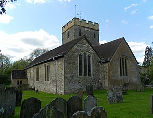
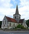
Anglican | II | This church, built in the Gothic Revival style, is a landmark in the village. The outside mixes limestone and firestone, creating a colourful effect. The inside is simple. It has a carved altar screen (1885) and a fancy stone font. The tower is in the middle of the church. | |
| St Mary the Virgin's Church (More images) |
 |
Buckland 51°14′37″N 0°15′04″W / 51.2436°N 0.2510°W |
Anglican | II | The old church was completely rebuilt in 1860. It has a main hall (nave) and chancel (altar area) without side aisles. The windows have detailed Gothic designs. A small bell tower with a shingled roof holds six bells. A "pretty" spiral staircase leads to the bells. The church is mainly built from Bargate stone. | |
| St John the Baptist's Church (More images) |
 |
Capel 51°09′14″N 0°19′14″W / 51.1540°N 0.3206°W |
Anglican | II | This simple church was rebuilt in 1865 from a 1200s church. It shares features with nearby Buckland, like the spiral staircase to the bell tower and the Bargate stone walls. | |
| Friends Meeting House (More images) |
 |
Capel 51°09′05″N 0°19′19″W / 51.1513°N 0.3219°W |
Quaker | II | Quakers have been in Capel for a long time, with meetings starting in the 1650s. This meeting house was built in 1724–25. It's made of red, brown, and blue bricks with a tiled roof. | |
| St Nicholas' Church (More images) |
 |
Charlwood 51°09′21″N 0°13′39″W / 51.1558°N 0.2276°W |
Anglican | I | This large church shows three main building periods. The original Norman (11th-12th century) nave (main hall) got a south aisle in the 1200s. Then, in the 1400s, the whole church was changed and made bigger. The oldest parts still have Norman windows. | |
| Christ Church (More images) |
 |
Coldharbour 51°10′51″N 0°21′28″W / 51.1807°N 0.3577°W |
Anglican | II | This church was built in 1848 in a small, isolated village. It's made of sandstone and has a main hall and chancel without side aisles. It has a stone bellcote on one end and windows with decorative patterns. | |
| St Paul's Church (More images) |
 |
Dorking 51°13′38″N 0°19′53″W / 51.2273°N 0.3314°W |
Anglican | II | This church, built in 1857, is south of Dorking town centre. It was designed in the Gothic Revival style and was added to many times. It has a small bell turret on the roof. | |
| St Martin's Church (More images) |
 |
Dorking 51°13′58″N 0°19′56″W / 51.2328°N 0.3323°W |
Anglican/Methodist | II* | This is a very important church, whose tall spire is a landmark for miles around Dorking. It was built between 1868 and 1877 in a Gothic Revival style. The inside has typical Victorian Gothic decorations. The church is now shared with the Methodist community. | |
| Crossways Community Baptist Church (More images) |
 |
Dorking 51°13′50″N 0°20′06″W / 51.2306°N 0.3350°W |
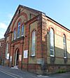
Baptist | – | This chapel was built in either 1869 or 1876. It has a balanced front with three sections, brick pillars, and an arched middle section with a triangular top. It was registered for marriages in September 1912. | |
| Dorking Baptist Chapel (More images) |
 |
Dorking 51°14′01″N 0°19′38″W / 51.2336°N 0.3273°W |
Baptist | – | A Strict Baptist group met here from 1874 to 1900. The church was restarted in 1905, and in 1910, they got a secondhand "tin tabernacle" (a church building made of corrugated iron). Brick walls were built around it, and it opened on October 5, 1910. It was registered for marriages in December 1916. | |
| First Church of Christ, Scientist, Dorking (More images) |
 |
Dorking 51°14′03″N 0°19′36″W / 51.2341°N 0.3267°W |
Christian Scientist | – | This church serves Dorking and the surrounding area. The building on Moores Road was registered in January 1951 and includes a Christian Science Reading Room. | |
| Dorking Muslim Community Association and Mosque |  |
Dorking 51°14′02″N 0°19′48″W / 51.2340°N 0.3299°W |
Muslim | – | This building was first registered as a Plymouth Brethren meeting room in September 1984. After being used as a synagogue, a Muslim community bought it in 2006. It can hold 100 worshippers. | |
| Meeting Room (More images) |
 |
Dorking 51°13′58″N 0°20′00″W / 51.2329°N 0.3332°W |
Plymouth Brethren | – | This is the only place of worship for Plymouth Brethren in Dorking since the Hart Road meeting room closed. It's in a building that used to be a small factory. It was registered in March 1997. | |
| Friends Meeting House (More images) |
 |
Dorking 51°13′50″N 0°20′01″W / 51.2306°N 0.3336°W |
Quaker | – | The Quaker movement grew quickly here. Meetings started around 1702, and a meeting house was built in 1709. This current building, on a different site, dates from 1846. It has a five-section front with a porch supported by columns. | |
| St Joseph's Church (More images) |
 |
Dorking 51°13′33″N 0°20′11″W / 51.2257°N 0.3365°W |
Roman Catholic | – | This church was built in 1894–95 and replaced an earlier temporary church. It was paid for by the Duke of Norfolk. The main building materials are Bargate stone and Bath Stone. A tower and side aisle were planned but never built. | |
| Dorking United Reformed Church (More images) |
 |
Dorking 51°13′55″N 0°20′05″W / 51.2320°N 0.3347°W |
United Reformed Church | II | Congregational meetings started in Dorking in 1662. The first church was built in 1719. This current building, with its "handsome Italianate front" of brick and stone, replaced it in 1834 and was changed a lot 40 years later. The front has three balanced sections with doorways, large arched windows, and a triangular top. | |
| St Mary's Church (More images) |
 |
Fetcham 51°17′18″N 0°21′09″W / 51.2882°N 0.3526°W |
Anglican | II* | Much of the work from the 1000s and 1100s (including Saxon pieces and Roman bricks) remains in this large church. The chancel (altar area) is from the 1200s, as is the north transept (side wing). The side aisles were rebuilt in the 1800s. | |
| Cannon Court Evangelical Church (More images) |
 |
Fetcham 51°17′40″N 0°20′57″W / 51.2945°N 0.3492°W |
Evangelical | – | Evangelical meetings started in a house in Fetcham in 1935. A church, Cannon Court Hall, was built in 1936 and opened in September that year. It was registered for marriages in September 1946. An extension was added in 1940. | |
| Church of the Holy Spirit (More images) |
 |
Fetcham 51°17′22″N 0°21′26″W / 51.2894°N 0.3571°W |
Roman Catholic | – | Fetcham's Roman Catholic church is part of a shared parish with another church in nearby Effingham. It was registered for worship and marriages in November 1968. | |
| Holy Trinity Church (More images) |
 |
Forest Green 51°09′34″N 0°23′57″W / 51.1594°N 0.3993°W |
Anglican | – | Forest Green is a distant part of Abinger parish. This brick and stone church, with a nave, chancel, and rounded apse, dates from 1897. It was built as a memorial to a local resident's son who died in an accident. | |
| Harvest Community Church (More images) |
 |
Goodwyns 51°13′09″N 0°19′26″W / 51.2191°N 0.3240°W |
Elim Pentecostal | – | This church started as an independent Evangelical church and was registered for worship in December 1965. It is now part of the Elim Pentecostal Church. | |
| St Nicolas' Church (More images) |
 |
Great Bookham 51°16′47″N 0°22′26″W / 51.2798°N 0.3740°W |
Anglican | I | This church is very similar to the one in Fetcham. It has a noticeable weatherboarded bell-turret at the west end. The chancel (altar area) was rebuilt in 1341. The church was restored twice in the 1800s. | |
| Bookham Baptist Church (More images) |
 |
Great Bookham 51°16′44″N 0°22′29″W / 51.2788°N 0.3747°W |
Baptist | – | This church is in the centre of Great Bookham village and has been here since 1928. It was registered for marriages in March of that year. | |
| Eastwick Road Church (More images) |
 |
Great Bookham 51°16′49″N 0°22′03″W / 51.2802°N 0.3674°W |
United Reformed Church | – | This church started in 1895 as a Congregational mission chapel. In 1908, it was said to hold 200 worshippers. It was registered for marriages in September 1930. | |
| St Mary the Virgin's Church (More images) |
 |
Headley 51°16′48″N 0°16′25″W / 51.2801°N 0.2736°W |
Anglican | II | The old church is now a ruin in the churchyard. This new church was built in 1855. Four years later, a tower and spire were added. The walls are mostly flint with some stone. | |
| Kingdom Hall (More images) |
 |
Hookwood 51°10′49″N 0°11′42″W / 51.1803°N 0.1949°W |
Jehovah's Witnesses | – | This Kingdom Hall is on the main road between Gatwick Airport and Reigate. It serves the Jehovah's Witnesses groups in Redhill and Reigate. It was registered in May 1995. | |
| St Mary and St Nicholas' Church (More images) |
 |
Leatherhead 51°17′34″N 0°19′37″W / 51.2927°N 0.3269°W |
Anglican | II* | The outside of Leatherhead's old church has been fully restored, but the inside still looks like it did in the early 1200s. It has north and south aisles, a narrower chancel, and side wings. The west tower is in the Perpendicular Gothic style. | |
| All Saints Church (More images) |
 |
Leatherhead 51°18′09″N 0°19′46″W / 51.3024°N 0.3294°W |
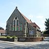
Anglican | – | This church was built in the style of the 1200s to serve the north of Leatherhead. The chancel, nave, side chapel, and entrance porch are made of flint and stone, but the inside is brick. It was designed in 1888 and opened in 1889. In 1981–82, it was changed to be both a church and a community centre. | |
| Light and Life Evangelical Church | Leatherhead 51°17′04″N 0°20′03″W / 51.2844°N 0.3342°W |
Born Again Christians | – | This church is specifically for members of the travelling community. It was registered for worship and marriages in November 1994. | ||
| Kingdom Hall (More images) |
 |
Leatherhead 51°17′40″N 0°19′59″W / 51.2944°N 0.3331°W |
Jehovah's Witnesses | – | This building serves the Jehovah's Witnesses group in Leatherhead. Although the current building is modern, there has been a Kingdom Hall on this site for many years. It was registered for worship in July 1949. | |
| Leatherhead Methodist Church (More images) |
 |
Leatherhead 51°17′39″N 0°19′34″W / 51.2943°N 0.3262°W |
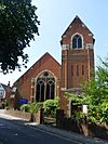
Methodist | – | Leatherhead's Methodist church opened in 1893 and was registered for marriages in February 1896. Its original name was the Wesley Memorial Methodist Church. | |
| Kingscroft Chapel (More images) |
 |
Leatherhead 51°18′10″N 0°19′42″W / 51.3027°N 0.3282°W |
Open Brethren | – | This chapel was registered for marriages in June 1943. It holds a service every Sunday. | |
| Church of Our Lady and St Peter (More images) |
 |
Leatherhead 51°18′00″N 0°19′28″W / 51.3001°N 0.3244°W |
Roman Catholic | – | This church was designed in 1923 in the Perpendicular Gothic style. It has no side aisles but is flanked by side chapels. The Stations of the Cross were designed by Eric Gill. The church was registered for marriages in August 1924. | |
| Mount Zion Chapel (More images) |
 |
Leatherhead 51°17′37″N 0°19′34″W / 51.2937°N 0.3262°W |
Strict Baptist | – | A Strict Baptist meeting started in Leatherhead in 1844. Services moved from a cottage to a hired room in 1858. A permanent chapel opened on April 1, 1869, and was registered for marriages in November 1901. | |
| St Bartholomew's Church (More images) |
 |
Leigh 51°12′31″N 0°14′54″W / 51.2086°N 0.2484°W |
Anglican | II* | This small 15th-century church was restored in 1856 and 1890. The walls and roof are made of Reigate and Horsham Stone. The large wooden bell turret and steeple were added in 1890. | |
| All Saints Church (More images) |
 |
Little Bookham 51°16′27″N 0°23′29″W / 51.2743°N 0.3915°W |
Anglican | II* | This church didn't have a specific name until 1986, when it was called All Saints. The simple building is mostly from the early 1100s but was changed in the 1400s and 1800s. Flint and limestone are the main materials. | |
| St Michael's Church (More images) |
 |
Mickleham 51°16′03″N 0°19′24″W / 51.2675°N 0.3234°W |
Anglican | II* | The large, tall west tower still looks like it did in the 1100s, and the church's history goes back to the 900s. However, it was heavily restored twice in the 1800s. | |
| St Peter's Church (More images) |
 |
Newdigate 51°09′55″N 0°17′18″W / 51.1652°N 0.2884°W |
Anglican | II* | The chancel (altar area) of this church is from the 1200s, and the south aisle is a century later. The bell-turret is from the 1400s. Most other features are from a restoration in 1876–77. The six bells were all made in 1803. | |
| St John the Evangelist's Church (More images) |
 |
North Holmwood 51°12′43″N 0°19′39″W / 51.2119°N 0.3274°W |
Anglican | II | This flint-built church was designed in 1874–75 in the Gothic Revival style. A tower with a spire stands at the northwest corner. Stained glass was added in 1875 and 1892. | |
| St John the Baptist's Church (More images) |
 |
Oakwood Hill 51°07′50″N 0°23′22″W / 51.1305°N 0.3895°W |
Anglican | II* | This church was originally a smaller chapel for Wotton until it became its own parish in 1853. It stands on high ground in a thick wood. Sandstone, firestone, and chalk are the main materials, and the roof is made of Horsham Stone. The church was greatly extended and restored in 1879. A wall painting from the 1400s is also here. | |
| St Margaret's Church (More images) |
 |
Ockley 51°09′13″N 0°20′51″W / 51.1535°N 0.3474°W |
Anglican | II* | This large church is located away from the village in a tree-covered churchyard. It was extended in 1873, but some parts from the 1100s remain. The nave (main hall) is from the 1300s. The west tower was rebuilt between 1699 and 1700. | |
| St Mary the Virgin's Church (More images) |
 |
Pixham 51°14′23″N 0°18′59″W / 51.2397°N 0.3165°W |
Anglican | II* | Pixham's church is an "attractive village church" designed in the Arts and Crafts style. Except for brickwork around the windows, the walls are completely roughcast (a type of plaster). The north side has a double triangular roof. The west (entrance) side has one triangular roof and a double entrance door with a huge semicircular arch. The sanctuary (holy area) is topped with a dome. | |
| St Barnabas' Church (More images) |
 |
Ranmore Common 51°14′30″N 0°21′36″W / 51.2418°N 0.3600°W |
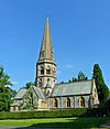
Anglican | II* | This 1859 church is considered one of its architect's best works. It was built for the owners and workers of the Denbies estate. It has a cross shape with a tall tower and spire in the middle. Rounded flint stones cover the walls. The rich interior has a lot of marble, and most of the stained glass was designed by Clayton and Bell. | |
| St Mary Magdalene's Church (More images) |
 |
South Holmwood 51°11′26″N 0°19′27″W / 51.1905°N 0.3243°W |
Anglican | II | This church was originally a smaller chapel built on land given by the Duke of Norfolk. The 1838 building was changed and made bigger four times in the next 25 years. It's in the Gothic Revival style, and local stone was the main material. The final additions in 1863 were the side aisles and southwest tower. | |
| Holy Trinity Church (More images) |
 |
Westcott 51°13′25″N 0°22′11″W / 51.2236°N 0.3696°W |
Anglican | II* | This church, built in 1852, stands on high ground at the southwest corner of the village. The tiled roof has a shingled spire at one end. The walls are made of knapped flint (flint shaped by striking) and ashlar (finely cut stone). Two local residents each gave £1,000 for its construction. The east window has stained glass. | |
| St Michael's Chapel of Ease (More images) |
 |
Westhumble 51°15′17″N 0°19′45″W / 51.2548°N 0.3293°W |
Anglican | II | This chapel was made from an old farm building. The outside is timber-framed with red brick in between. The tiled roof has triangular ends. | |
| St John the Evangelist's Church (More images) |
 |
Wotton 51°16′48″N 0°16′25″W / 51.2799°N 0.2737°W |
Anglican | I | The church dates back to the Saxon era, with the oldest parts from the very early Norman period. Most of the building is from the 1200s. The vestry and porch were added in Victorian times. The Evelyn family, including the famous diarist John Evelyn, are buried in the 17th-century mausoleum here. The tower's two-part pyramid roof is a unique feature. |
Former Places of Worship
| Name | Image | Location | Denomination/ Affiliation |
Grade | Notes | Refs |
|---|---|---|---|---|---|---|
| Abinger Hammer Mission Church Room |  |
Abinger Hammer 51°12′56″N 0°25′48″W / 51.2155°N 0.4301°W |
Anglican | – | This opened in 1887 as a smaller chapel for St James's Church at Abinger Common. It was used for worship until it closed in 1977 and is now a house. | |
| Free Church Mission Hall |  |
Ashtead 51°18′49″N 0°18′37″W / 51.3135°N 0.3102°W |
Baptist | – | Ashtead's first Baptist church opened in 1895. A new church replaced it in 1924, but this building still exists and is used by the Conservative political party. | |
| Church of Christ Our Hope (More images) |
 |
Beare Green 51°10′49″N 0°19′10″W / 51.1803°N 0.3195°W |
Roman Catholic | – | This church was built in 1971 and closed in 1989. It was originally planned to be demolished, but instead, it became the village hall. | |
| Gospel Hall (More images) |
 |
Betchworth 51°14′36″N 0°16′07″W / 51.2434°N 0.2686°W |
Open Brethren | – | This building was originally a cattle shed. It was given for use by a local Brethren group, though not formally registered until 1944. By 2016, it had become part of the neighbouring house's garden. | |
| Brockham Green Chapel (More images) |
 |
Brockham 51°14′00″N 0°17′09″W / 51.2332°N 0.2859°W |
Strict Baptist | – | This chapel was founded in 1783. The building was changed in 1907 and is now a house. | |
| Capel Methodist Chapel (More images) |
 |
Capel 51°09′04″N 0°19′16″W / 51.1510°N 0.3212°W |
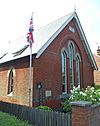
Methodist | – | A Methodist chapel existed in the village by 1911 and was registered for marriages in January 1921. Records for the church go up to 1985. | |
| Mission Hall (More images) |
 |
Charlwood 51°09′14″N 0°13′31″W / 51.1540°N 0.2252°W |
Congregational | – | This building was first used by a blacksmith, then as a slaughterhouse. It was first used for worship in 1885, then bought and converted into a proper chapel in 1889. | |
| Providence Chapel (More images) |
 |
Charlwood 51°09′24″N 0°13′08″W / 51.1567°N 0.2188°W |
Independent Calvinistic | II* | This "startling" wooden building served for nearly 200 years until it was put up for sale in 2012. Before 1816, it was an officers' mess in Horsham. When it opened in Charlwood, it was called Charlwood Union Chapel. | |
| Hampstead Road Church (More images) |
 |
Dorking 51°13′29″N 0°20′09″W / 51.2246°N 0.3358°W |
Open Brethren | – | This building dates from 1863 and was built for a Plymouth Brethren group. It closed in 2010 because it was too small. The group reformed under a new name and now meets in a school. | |
| Forest Green Congregational Church (More images) |
 |
Forest Green 51°09′32″N 0°23′39″W / 51.1589°N 0.3943°W |
Congregational | – | This church opened in 1878 in the centre of Forest Green village. It was operated as an outpost of the church at Ewhurst. It was registered for marriages between May 1910 and March 1980. | |
| Gospel Hall |  |
Gadbrook 51°13′04″N 0°16′05″W / 51.2177°N 0.2681°W |
Open Brethren | – | Gadbrook is a small village. An Independent Calvinist chapel became Strict Baptist for a time, then in June 1903, it was re-registered as a gospel hall. It closed in 2001. | |
| Ruins of Headley Old Church |  |
Headley 51°16′48″N 0°16′25″W / 51.2799°N 0.2737°W |
Anglican | II | All that remains of Headley's 15th-century church is this structure. It stands over the grave of a former priest. It was made from the surviving flint and stone of the old building. It has an archway entrance and a domed roof. | |
| Christ Church (More images) |
 |
Leatherhead 51°17′55″N 0°19′12″W / 51.2985°N 0.3200°W |
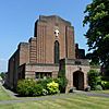
United Reformed Church | – | The first Congregational church in Leatherhead opened in 1816. A larger chapel was finished 28 years later. The current building is on Epsom Road and was registered for marriages in June 1936. The church closed on January 4, 2021. | |
| St John's Church (More images) |
 |
Ockley 51°08′49″N 0°21′53″W / 51.1469°N 0.3646°W |
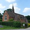
Anglican | – | Built in the early 1870s, this smaller chapel for St Margaret's Church was officially opened in December 1872. The building has brickwork and stonework, and the roof supports a bell turret. It was no longer needed in January 1983 and was sold three years later to be turned into homes. | |
| Park Gate Mission Hall |  |
Parkgate 51°11′01″N 0°16′17″W / 51.1835°N 0.2715°W |
Congregational | – | A Congregational mission started in this small village in 1876. Services were held outside or in cottages until this small mission hall was built. It opened on June 2, 1885, and was registered for worship between July 1898 and March 1980. | |
| Hope Chapel |  |
South Holmwood 51°11′33″N 0°19′28″W / 51.1924°N 0.3245°W |
Strict Baptist | – | This chapel was founded in 1869. The building was always partly residential and was registered for marriages in September 1909. | |
| St John's Free Church (More images) |
 |
Westcott 51°13′34″N 0°21′52″W / 51.2261°N 0.3645°W |
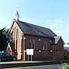
Countess of Huntingdon's Connexion | – | This chapel was founded in 1840 for followers of a Nonconformist group. It was registered for marriages between January 1842 and October 2012. It is now owned by Holy Trinity parish church and used as a community hall. | |
| Ruins of West Humble Chapel (More images) |
 |
Westhumble 51°15′17″N 0°20′21″W / 51.2548°N 0.3393°W |
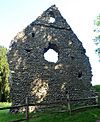
Roman Catholic (Pre-Reformation) | II | This chapel is now a ruin with only two flint walls standing. It was originally a simple rectangular church from around the late 1200s. The west end still has a triangular roof and a circular opening. |
 | William L. Dawson |
 | W. E. B. Du Bois |
 | Harry Belafonte |


