Little Rincon Mountains facts for kids
Quick facts for kids Little Rincon Mountains |
|
|---|---|
| Highest point | |
| Peak | Forest Hill (peak) (Little Rincon Mountains) |
| Elevation | 6,114 ft (1,864 m) |
| Dimensions | |
| Length | 15 mi (24 km) SW x NE |
| Width | 8 mi (13 km) |
| Geography | |
| Country | United States |
| Cities | Cascabel, AZ–Redington, AZ (Benson, AZ) |
| Range coordinates | 32°07′39″N 110°25′54″W / 32.1276°N 110.4317°W |
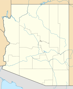
The Little Rincon Mountains are a small group of mountains in Arizona. They are found in eastern Pima County and northwest Cochise County. These mountains are just east of the larger Rincon Mountains, near the city of Tucson. They also form part of the western edge of the San Pedro River and its valley. The San Pedro River flows north from south of the US-Mexico border in Sonora, Mexico, to join the Gila River.
Contents
Exploring the Little Rincon Mountains
The Little Rincon Mountains stretch about 15 miles (24 km) from southwest to northeast. They are a long, narrow mountain range, about 8 miles (13 km) wide. A deep canyon called Paige Canyon separates them from the main part of the Rincon Mountains.
Peaks of the Range
The highest points in the Little Rincon Mountains are found near the start of Paige Canyon. Here are some of the important peaks, listed from south to north:
- San Juan Hill, which is 5,269 feet (1,606 meters) tall.
- North Star Peak, reaching 6,041 feet (1,841 meters).
- Forest Hill, the tallest peak at 6,114 feet (1,863 meters).
- Bald Mountain, standing at 5,324 feet (1,623 meters).
- Wildhorse Mountain.
Forest Hill is the highest point in the entire range. It is located at 32°07′39″N 110°25′54″W / 32.1276°N 110.4317°W.
The San Pedro Valley
The Little Rincon Mountains sit right next to the San Pedro Valley. The San Pedro River has to flow around the mountains' eastern and northern sides. North of the mountains, the valley becomes narrower. To the south, the San Pedro River flows mostly north from the Mexican border.
River Tributaries
The San Pedro Valley gets wider in some areas, especially where smaller rivers and streams join the main river. These smaller streams are called tributary washes. One of the largest tributaries is the Babocomari River. It flows from the Canelo Hills, located between the Huachuca Mountains and the Santa Rita Mountains.
 | Jessica Watkins |
 | Robert Henry Lawrence Jr. |
 | Mae Jemison |
 | Sian Proctor |
 | Guion Bluford |


