Locust Creek (Shamokin Creek tributary) facts for kids
Quick facts for kids Locust Creek |
|
|---|---|

Locust Creek
|
|
| Physical characteristics | |
| Main source | pond in East Cameron Township, Northumberland County, Pennsylvania between 1,340 and 1,360 feet (408 and 415 m) |
| River mouth | Shamokin Creek in Mount Carmel Township, Northumberland County, Pennsylvania 1,010 ft (310 m) 40°46′54″N 76°27′22″W / 40.7817°N 76.4562°W |
| Length | 4.0 mi (6.4 km) |
| Basin features | |
| Progression | Shamokin Creek → Susquehanna River → Chesapeake Bay |
| Basin size | 5.75 sq mi (14.9 km2) |
| Tributaries |
|
Locust Creek is a small stream, or tributary, that flows into Shamokin Creek in Northumberland County, Pennsylvania. It's about 4.0 miles (6.4 km) long. The creek flows through two townships: East Cameron Township and Mount Carmel Township.
The area of land that drains into Locust Creek, called its watershed, covers about 5.75 square miles (14.9 km2). Sadly, the creek's water quality isn't great. It has too many metals and a low pH (meaning it's quite acidic). This is mostly due to old, abandoned mines nearby.
Despite these issues, the creek flows through a cool water gap in Locust Mountain. Much of the land around it is covered by forests. The creek's watershed is also important for fish, as it's known as a Coldwater Fishery and a Migratory Fishery. This means it's a place where cold-water fish can live and where other fish travel through.
Contents
Where Locust Creek Flows
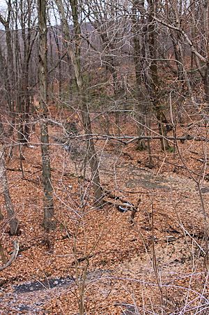
Locust Creek starts in a pond in East Cameron Township. It flows towards the east-northeast through a deep valley. After a short distance, it enters Mount Carmel Township.
The creek continues flowing east-northeast for over a mile. Then, it gets water from a small, unnamed stream joining it from the right side. At this point, Locust Creek suddenly turns and flows north-northwest.
For the next part of its journey, the creek flows right next to Pennsylvania Route 54. It carves a path through a water gap in Locust Mountain. After leaving the water gap, it crosses Pennsylvania Route 901 and turns west. A bit further downstream, Locust Creek meets up with Shamokin Creek.
Locust Creek joins Shamokin Creek about 28.88 miles (46.48 km) before Shamokin Creek reaches its own mouth.
Small Streams Joining Locust Creek
Locust Creek doesn't have any named streams joining it. However, it does have one unnamed stream that flows into it. This small stream is known as UNT #18656. About 1 mile (1.6 km) of this tributary also has water quality problems.
Water Quality of Locust Creek
Locust Creek has poor water quality. Its entire length is considered an "impaired waterbody." This means the water isn't healthy enough for all living things. The main problem is too many metals in the water. This comes from abandoned mine drainage, which is water that flows out of old mines. This mine drainage makes the creek very acidic.
Locust Creek is an intermittent stream. This means it doesn't always flow all year round. Some parts are even "ephemeral," meaning they only flow right after it rains or snow melts. The creek gets some of its water from several mine discharges, which are known as the Locust Gap Mine discharges.
Interestingly, the creek also loses some water. It leaks into underground mines below the surface. Scientists have measured the water flow, or discharge, of the stream. It can range from no flow at all to about 1.8 cubic feet per second (0.051 m3/s).
In March 2000, the water temperature was 10.0 °C (50.0 °F). The pH of Locust Creek averages around 3.6, which is very acidic. For comparison, pure water has a pH of 7.0. The water also has high levels of acidity and iron. This can cause problems for the environment.
The water in Locust Creek can also be quite turbid, meaning it's cloudy. It also has a certain level of water hardness.
Land and Geology Around the Creek
The land around the mouth of Locust Creek is about 1,010 feet (310 m) above sea level. Where the stream begins, its source, the elevation is between 1,340 and 1,360 feet (408 and 415 m) above sea level.
You might see a thick orange-brown coating on Locust Creek. This is from iron that has settled out of the water. The area around the creek is fairly flat in many places. However, the creek cuts a water gap right through Locust Mountain. This gap shows a special rock formation called an anticlinal.
The entire watershed of Locust Creek is located within the Mount Carmel area, as mapped by the United States Geological Survey.
Most of the land in the Locust Creek watershed is covered by forests.
History and Fun Activities
Locust Creek was officially named and added to the Geographic Names Information System on August 2, 1979.
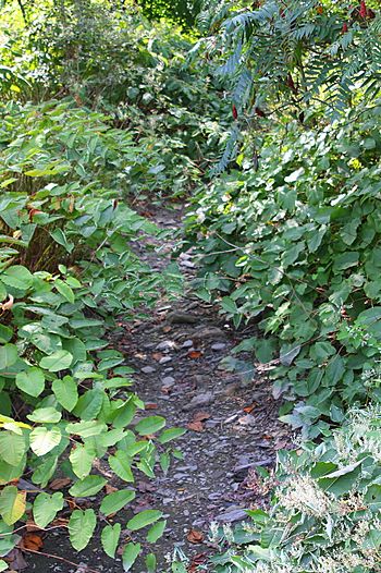
There's a bridge that carries Pennsylvania Route 901 over Locust Creek. This bridge is important and is planned to be preserved. Near where the creek starts, there are some trails that people can use for walking or exploring.
Animals and Plants Near the Creek
The area that drains into Locust Creek is special for fish. It's called a Coldwater Fishery and a Migratory Fishery. This means it's a good place for fish that like cold water, and it's also a route for fish that travel to different places.
Some interesting plants might grow near the beginning of Locust Creek. These include Juncus biflorus and Platanthera ciliaris.
 | Roy Wilkins |
 | John Lewis |
 | Linda Carol Brown |


