Long Hunter State Park facts for kids
Quick facts for kids Long Hunter State Park |
|
|---|---|
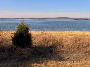
J. Percy Priest Lake
|
|
| Type | Tennessee State Park |
| Location | Hermitage, Hermitage, Tennessee |
| Operated by | TDEC |
| Website | Long Hunter State Park |
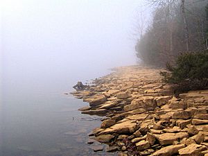
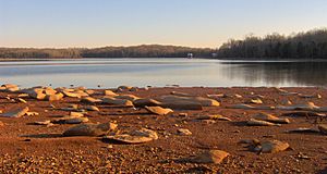
Long Hunter State Park is a beautiful state park in Tennessee, located in both Davidson County and Rutherford County. It's in the southeastern part of the United States. Most of the park is found along the eastern side of Percy Priest Lake. This lake is man-made, created by holding back the waters of the Stones River.
The park has three main areas along the lake. These are Baker's Grove in the north, Couchville in the middle, and Bryant Grove to the south. Narrow strips of land connect all three sections. Long Hunter State Park also takes care of Sellars Farm. This is an important archaeological site near Lebanon to the east.
Exploring the Park's Location
The Stones River has two main parts, called forks. The West Fork starts in the hills near Rock Springs and flows north. It goes through Murfreesboro and the Stones River National Battlefield. Then, it joins with the East Fork near Smyrna.
The East Fork flows west from Short Mountain. It passes north of Murfreesboro. When these two forks meet, they form the main Stones River. This meeting point marks the southern end of J. Percy Priest Lake.
J. Percy Priest Lake stretches for about 22 miles (35 kilometers). It goes from where the two forks of the Stones River meet, all the way to the J. Percy Priest Dam. This dam is located near Donelson. After the dam, the Stones River twists and turns. It eventually flows into the Cumberland River, just east of Nashville. Long Hunter State Park is officially located in Hermitage, which is a suburb of Nashville.
To get to the park, you can take Tennessee State Route 171. This road follows Mount Juliet Road south from Interstate 40. When you reach the park's edge, the roads split. TN-171 goes west to the Couchville part of the park. Mount Juliet Road continues south to the Bryant Grove section. Granny Wright Road also leads to the Volunteer Trailhead and the Bakers Grove area.
A Look Back at the Park's History
Native Americans were hunting in the Stones River area a very long time ago. We know this because flint tools, used for hunting, have been found at Long Hunter State Park. These tools are about 12,000 years old! The Nashville area has many signs of early people. These include special spear points called Clovis points. There's even a place where a mastodon was hunted in Williamson County.
A strong village from the Mississippian culture was located near Lebanon. This village was at Sellars Farm, which is now part of Long Hunter State Park. People lived at Sellars Farm between the years 1000 and 1300 AD. The village had special "platform" mounds and a central open area.
Among the first European-Americans to explore the Nashville area were groups of hunters. They were called "long hunters." These long hunters arrived in the region by the 1760s. They usually followed the Cumberland River valley from Virginia. They were called "long hunters" because their trips lasted a very long time, usually 6 to 18 months!
Most long hunters first looked for animal furs to sell back in Virginia. Later, some long hunters worked as surveyors, mapping the land. The Stones River, where Long Hunter State Park is, is named after Uriah Stone. He was a long hunter who supposedly had all his furs stolen by a French friend in 1767. The maps and information gathered by these long hunters were very helpful for the first settlers in the Nashville area.
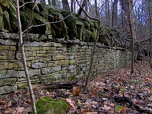
After the Cherokee people gave up the Stones River area to the United States in 1805, many settlers started to arrive. Sherrod Bryant and his son, Henderson, were among the first to settle where Long Hunter State Park is today. They were living in the valley by 1820. The Bryant family, who gave their name to Bryant Grove, became one of the wealthiest African American families in Tennessee by 1854. Other early settlers included the Couch family. They ran a store and a river crossing just north of Bryant Grove.
In 1963, the United States Army Corps of Engineers began building Stewart's Ferry Dam. This was mainly to control floods along the Stones River. The dam was completed in 1968. It was later renamed for Congressman James Percy Priest. When the river was held back by the dam, water flowed into underground channels. This created Couchville Lake, a smaller lake in the middle of the park. In 1972, the Corps of Engineers rented 2,400 acres (9.7 square kilometers) of land to the state of Tennessee. This land was used to create a state park. Long Hunter State Park officially opened in 1978.
The Sellars Mound site was studied by Frederic Putnam in the late 1870s. It was added to the National Register of Historic Places in 1972. The state of Tennessee bought it in 1974. In the late 1990s, a group of volunteers called the Friends of Sellars Farm State Archaeological Area was formed. They started promoting the site and offering tours. In 2004, the site became a part of Long Hunter State Park.
What You Can Do at the Park Today
Long Hunter State Park covers about 2,600 acres (10.5 square kilometers). It is managed by the Tennessee Department of Environment and Conservation. The park offers many things for visitors to enjoy.
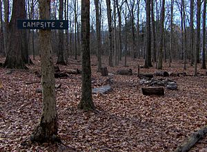
You can find two boat launch ramps on J. Percy Priest Lake. There are also several miles of hiking trails. The park has group campsites and one campsite for backcountry camping. There is also a meeting facility and a visitor center. You can use non-motorized boats, like kayaks or canoes, on Couchville Lake.
The Volunteer Trail is 5.5 miles (8.9 kilometers) long. It follows the lakeshore and connects the Couchville and Bakers Grove areas. Two backcountry campsites are located at the end of this trail. There's also a flat, paved trail that goes around Couchville Lake. This trail includes a 300-foot (91-meter) bridge over the eastern end of the lake. The Jones Mill Trail, in the Bryant Grove section, leads to the top of Bald Knob. This is a clear hilltop with great views of J. Percy Priest Lake.
 | George Robert Carruthers |
 | Patricia Bath |
 | Jan Ernst Matzeliger |
 | Alexander Miles |


