Loudoun Heights (mountain) facts for kids
Quick facts for kids Loudoun Heights |
|
|---|---|

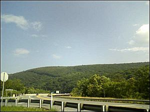
Loudoun Heights from U.S. Rt. 340 in West Virginia
|
|
| Highest point | |
| Elevation | 1,175 ft (358 m) |
| Prominence | 340 ft (100 m) |
| Geography | |
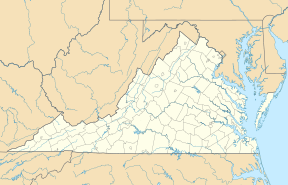
| Location | Loudoun County, Virginia / Jefferson County, West Virginia, U.S. |
| Parent range | Blue Ridge Mountains Appalachian Mountains |
| Topo map | USGS Harpers Ferry |
Loudoun Heights, sometimes called Loudoun Mountain, is the first peak of the Blue Ridge Mountains south of the Potomac River. It sits on the border between Loudoun County, Virginia and Jefferson County, West Virginia in the United States. The northwestern side of the peak is part of Harpers Ferry National Historical Park.
A Look Back in Time
This peak looks over the town of Harpers Ferry, West Virginia. During the Battle of Harpers Ferry in the American Civil War, a famous Confederate general named Stonewall Jackson used Loudoun Heights. His soldiers placed cannons here to fire down on the town.
Loudoun Heights was also the site of a tough battle for John S. Mosby. He was a Confederate "partisan," which means he led a small group of soldiers who fought behind enemy lines. His group faced a defeat here against a Union cavalry unit called Cole's Maryland Cavalry.
Exploring the Trails
The famous Appalachian Trail (AT) goes right over Loudoun Heights. It then heads down the northwestern side towards the Shenandoah River and Harpers Ferry.
There's also a special path called the Loudoun Heights Trail. This trail used to be part of the original Appalachian Trail. It branches off the AT and goes down the northern slope. Along this trail, you can see old earthworks from the Civil War. These are like old dirt walls built for defense.
The trail also offers amazing views from a spot called Split Rock overlook. From here, you can see where the Potomac and Shenandoah rivers meet. You can also look down on Harpers Ferry. Until recently, the trail continued from this overlook. It crossed the Potomac River on the U.S. Route 340 bridge. Then it rejoined the AT in Sandy Hook, Maryland. However, this part of the trail is now closed. It was damaged by storms and erosion, making it unsafe.
Images for kids
 | Frances Mary Albrier |
 | Whitney Young |
 | Muhammad Ali |


