Madison County, Florida facts for kids
Quick facts for kids
Madison County
|
|
|---|---|
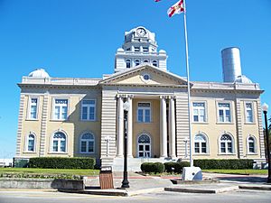
Madison County Courthouse
|
|
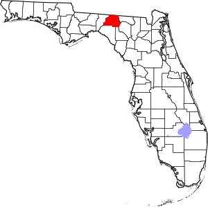
Location within the U.S. state of Florida
|
|
 Florida's location within the U.S. |
|
| Country | |
| State | |
| Founded | December 26, 1827 |
| Named for | James Madison |
| Seat | Madison |
| Largest city | Madison |
| Area | |
| • Total | 716 sq mi (1,850 km2) |
| • Land | 696 sq mi (1,800 km2) |
| • Water | 20 sq mi (50 km2) 2.8%% |
| Population
(2020)
|
|
| • Total | 17,968 |
| • Estimate
(2023)
|
18,519 |
| • Density | 25.095/sq mi (9.689/km2) |
| Time zone | UTC−5 (Eastern) |
| • Summer (DST) | UTC−4 (EDT) |
| Congressional district | 2nd |
Madison County is a county located in the north central part of Florida. It borders the state of Georgia to the north. In 2020, about 17,968 people lived here. The main town and county seat is also called Madison.
Contents
History of Madison County
Madison County was created in 1827. It was named after James Madison. He was the fourth President of the United States, serving from 1809 to 1817.
The small town of Greenville in Madison County was the childhood home of the famous rhythm and blues musician, Ray Charles.
Geography and Location
According to the U.S. Census Bureau, Madison County covers a total area of about 716 square miles. Most of this area, about 696 square miles, is land. The remaining 20 square miles (2.8%) is water.
Neighboring Counties
Madison County shares borders with several other counties:
- Brooks County, Georgia - to the north
- Lowndes County, Georgia - to the northeast
- Hamilton County - to the east
- Suwannee County - to the southeast
- Lafayette County - to the southeast
- Taylor County - to the southwest
- Jefferson County - to the west
Population Changes
The number of people living in Madison County has changed over many years. Here's how the population has grown and shrunk:
| Historical population | |||
|---|---|---|---|
| Census | Pop. | %± | |
| 1830 | 525 | — | |
| 1840 | 2,644 | 403.6% | |
| 1850 | 5,490 | 107.6% | |
| 1860 | 7,779 | 41.7% | |
| 1870 | 11,121 | 43.0% | |
| 1880 | 14,798 | 33.1% | |
| 1890 | 14,316 | −3.3% | |
| 1900 | 15,446 | 7.9% | |
| 1910 | 16,919 | 9.5% | |
| 1920 | 16,516 | −2.4% | |
| 1930 | 15,614 | −5.5% | |
| 1940 | 16,190 | 3.7% | |
| 1950 | 14,197 | −12.3% | |
| 1960 | 14,154 | −0.3% | |
| 1970 | 13,481 | −4.8% | |
| 1980 | 14,894 | 10.5% | |
| 1990 | 16,569 | 11.2% | |
| 2000 | 18,733 | 13.1% | |
| 2010 | 19,224 | 2.6% | |
| 2020 | 17,968 | −6.5% | |
| 2023 (est.) | 18,519 | −3.7% | |
| U.S. Decennial Census 1790-1960 1900-1990 1990-2000 2010-2019 |
|||
In 2020, there were 17,968 people living in Madison County. There were 6,778 households and 4,232 families.
Transportation Routes
Madison County has important roads and railway lines that help people travel and goods move.
Major Highways
 I-10 (Interstate 10) is a major highway that runs across Florida. It goes through Madison County from west to east. There are four exits in the county.
 US 19 / US 27 are two U.S. highways that briefly pass through the southwestern part of the county. This area is sometimes called the Florida-Georgia Parkway.
 US 90 used to be the main east-west road through Madison County before I-10 was built.
 US 221 is the main north-south U.S. highway in western Madison County.
 SR 6 runs northeast from US 90 into Jasper in Hamilton County.
 SR 14 is a short state road connecting I-10 to US 90 in Madison.
 SR 53
SR 53 SR 145
Railroads
Madison County has at least two railroad lines. One is a CSX line that used to be part of the Seaboard Air Line Railroad. This line served Amtrak's Sunset Limited train until 2005. The station in Madison was the only active passenger train station in the county until then. Another line is owned by the Georgia and Florida Railway. It runs close to US 221 throughout Madison County.
Education and Libraries
Madison County Schools manages the public schools in the county. Madison County High School is one of the two high schools in Madison. The other is a charter high school called James Madison Preparatory High School.
Libraries in the Area
Madison County is part of the Suwannee River Regional Library System. This system has eight library branches and also serves Hamilton and Suwannee counties.
- Branford
- Greenville
- Jasper
- Jennings
- Lee
- Live Oak
- Madison
- White Springs
Communities in Madison County
City
Towns
Unincorporated Communities
These are smaller areas that are not officially cities or towns.
- Cherry Lake
- Hamburg
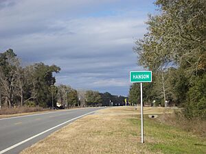
- Hanson
- Hopewell
- Lamont
- Lovett
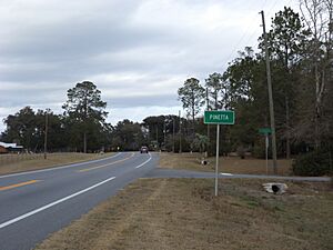
- Pinetta
- Sirmans
Notable Residents
Madison County has been home to several well-known people.
- The small town of Greenville was the childhood home of rhythm and blues music legend Ray Charles.
- Professional football player Chris Thompson is also from Greenville.
- Professional baseball player Lorenzo Cain is from Madison County.
- Scott Phillips, who is the drummer for the bands Creed and Alter Bridge, is also from Madison.
See also
 In Spanish: Condado de Madison (Florida) para niños


