Maiden Peak (Oregon) facts for kids
Quick facts for kids Maiden Peak |
|
|---|---|

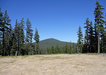
Maiden Peak as seen from the north side of Eagle Peak
|
|
| Highest point | |
| Elevation | 7,823 ft (2,384 m) NAVD 88 |
| Prominence | 2,578 ft (786 m) |
| Geography | |
| Location | Deschutes / Lane counties, Oregon, U.S. |
| Parent range | Cascades |
| Topo map | USGS The Twins |
| Geology | |
| Age of rock | Less than 250,000 years old |
| Mountain type | Shield volcano |
| Climbing | |
| Easiest route | Trail |
Maiden Peak is a tall, steep-sided shield volcano located in the Cascade Mountains of central Oregon. It is the highest point in the 43-mile (69 km) stretch between Mount Bachelor and Diamond Peak. During the Ice Age, huge glaciers carved a large bowl-shaped valley, called a cirque, into the northeast side of the mountain. This carving exposed the magma (melted rock) that had hardened inside the volcano's tubes, forming the many tall, pointy rocks you can see there today.
The very top of Maiden Peak has a smaller, steeper cone made of cinders (volcanic ash). This cinder cone sits right on top of the main shield volcano. Maiden Peak is located on the Cascade Crest, which is the border between Lane County and Deschutes County. It also divides two large forests: the Deschutes National Forest and the Willamette National Forest.
About Maiden Peak
Maiden Peak is a fascinating natural landmark. It stands tall in the beautiful Cascade Mountains. This mountain is a great example of how powerful nature can be.
What is a Shield Volcano?
Maiden Peak is known as a shield volcano. This type of volcano gets its name because it looks like a warrior's shield lying on the ground. Shield volcanoes are usually wide and have gentle slopes. They are built up over time by many flows of very runny lava. This lava spreads out far from the center, creating the shield shape.
Exploring the Mountain
A Forest Service fire lookout tower was built on the summit of Maiden Peak in 1923. This tower helped people spot forest fires from high up. However, the tower was taken down in 1958. Today, you can still reach the summit. A 5.8-mile (9.3 km) trail winds its way up to the top from the southwest side. It's a great way to see the mountain up close!
 | Madam C. J. Walker |
 | Janet Emerson Bashen |
 | Annie Turnbo Malone |
 | Maggie L. Walker |


