
Manchester, Michigan facts for kids
Quick facts for kids
Manchester, Michigan
|
|
|---|---|
| City of Manchester | |

Downtown Manchester along Main Street
|
|

Location within Washtenaw County
|
|

Manchester, Michigan
Location in Michigan

Manchester, Michigan
Location in the United States
|
|
| Country | United States |
| State | Michigan |
| County | Washtenaw |
| Settled | 1833 |
| Incorporated | 1867 (village) 2023 (city) |
| Government | |
| • Type | Council–manager |
| Area | |
| • Total | 2.24 sq mi (5.81 km2) |
| • Land | 2.13 sq mi (5.51 km2) |
| • Water | 0.12 sq mi (0.31 km2) |
| Elevation | 899 ft (274 m) |
| Population
(2020)
|
|
| • Total | 2,037 |
| • Density | 957.69/sq mi (369.82/km2) |
| Time zone | UTC-5 (Eastern (EST)) |
| • Summer (DST) | UTC-4 (EDT) |
| ZIP code(s) |
48158
|
| Area code(s) | 734 |
| FIPS code | 26-50660 |
| GNIS feature ID | 0631375 |
Manchester is a city located in Washtenaw County, in the state of Michigan, USA. In 2020, about 2,037 people lived there. The city is part of Manchester Township.
Manchester was first settled in 1833. It became a village in 1867. On November 7, 2023, most residents voted to make Manchester an official city. It officially became a city on November 15, 2023. The mayor and city council members started their jobs on November 20, 2023.
Contents
History of Manchester
How Chicago Road Helped Manchester Grow
In 1824, the United States government passed a law to build military roads. One important road connected Detroit and Fort Dearborn (which is now Chicago). This road was called the Chicago Road. It followed an old Native American path called the Sauk Trail. This new road helped open up the area for people to settle.
Also in 1824, a man named John Mack surveyed the land where Manchester is today. He noticed it was a good spot for a mill. John Gilbert, who had worked on the Erie Canal, agreed. On May 10, 1826, he bought 80 acres of land along the Raisin River in that spot.
Manchester's Early Days as a Village
John Gilbert moved to Ypsilanti, Michigan, in 1831. In 1832, he decided to develop the land he owned. He had a grist mill built along the Raisin River on the land he bought in 1826. The first map of Manchester village was made in 1833. It was officially recorded on March 25, 1835. The spot was chosen because the river provided power for mills. The village was named after Manchester, New York.
Soulesville: A Neighboring Settlement
In 1833, James Soule bought a large piece of land about 1 mile downstream from Manchester. He built a small settlement and called it Soulesville. At first, Manchester and Soulesville were rivals. But on March 16, 1867, both settlements joined together to become the village of Manchester. Today, the Manchester Village Office and Public Library are located where Soulesville used to be.
Geography and Location
According to the U.S. Census Bureau, Manchester covers about 2.24 square miles (5.81 square kilometers). Most of this area, about 2.13 square miles (5.51 square kilometers), is land. The remaining 0.12 square miles (0.31 square kilometers) is water.
The River Raisin flows right through the city.
Main Roads in Manchester
- M-52 is a major highway that runs through the center of Manchester.
Population and People
| Historical population | |||
|---|---|---|---|
| Census | Pop. | %± | |
| 1880 | 1,156 | — | |
| 1890 | 1,191 | 3.0% | |
| 1900 | 1,209 | 1.5% | |
| 1910 | 1,047 | −13.4% | |
| 1920 | 1,024 | −2.2% | |
| 1930 | 1,037 | 1.3% | |
| 1940 | 1,100 | 6.1% | |
| 1950 | 1,388 | 26.2% | |
| 1960 | 1,568 | 13.0% | |
| 1970 | 1,650 | 5.2% | |
| 1980 | 1,686 | 2.2% | |
| 1990 | 1,753 | 4.0% | |
| 2000 | 2,160 | 23.2% | |
| 2010 | 2,091 | −3.2% | |
| 2020 | 2,037 | −2.6% | |
| U.S. Decennial Census | |||
What the 2010 Census Showed
In 2010, there were 2,091 people living in Manchester. They lived in 938 households, and 570 of these were families. The village had about 986 people per square mile (381 people per square kilometer). There were 1,029 homes, with about 485 homes per square mile (187 homes per square kilometer).
Most people in Manchester were White (98.3%). A small number were African American (0.3%), Native American (0.2%), or Asian (0.3%). About 1.6% of the population was Hispanic or Latino.
In 28.9% of homes, there were children under 18. About 43.5% of homes had married couples. The average household had 2.23 people, and the average family had 2.85 people.
The average age in Manchester was 41.3 years. About 23.3% of residents were under 18. About 15.2% were 65 years or older. There were slightly more females (53.1%) than males (46.9%).
Education in Manchester
The Michigan Lutheran Seminary first opened in Manchester in 1885. However, it moved to Lansing two years later.
Manchester has its own school district called Manchester Community Schools. This district includes three schools:
- Luther C. Klager Elementary School
- Riverside Intermediate School
- Manchester Junior & Senior High School
All these schools are located within the city. The district serves a large area, including parts of several nearby townships.
Famous People from Manchester
- Fernando C. Beaman was a US Congressman.
- Patrick Chapin is a well-known player and designer for the game Magic: The Gathering. He was born and grew up in Manchester.
- Nick Davis played professional football in the NFL. He was born in Manchester and played for Manchester High School.
- Cub Koda was the lead singer for the band Brownsville Station. They were famous for their 1973 song "Smokin' in the Boys Room". Cub Koda graduated from Manchester High School.
- John Swainson was the 42nd governor of Michigan from 1961 to 1963. He also served as a Justice on the Michigan Supreme Court. He lived in Manchester from the mid-1970s until he passed away in 1994.
Images for kids
-
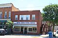
U.S. Post Office in Manchester
-
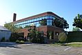
Manchester Village Offices
-
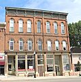
Historic Goodyear Block


See also
 In Spanish: Manchester (Míchigan) para niños
