Manitou Islands (Lake Nipissing) facts for kids

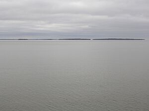
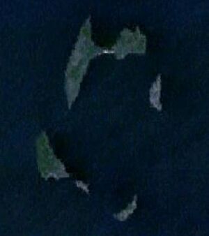
The Manitou Islands are a group of small islands located in Lake Nipissing, in the Nipissing District of Ontario, Canada. These islands form a circle and are about 10 kilometers (6 miles) southwest of the city of North Bay.
Contents
History of the Islands
The famous explorer Samuel de Champlain visited these islands in 1613 and thought they were "pretty." For many years, fur traders found the islands to be a great place to rest and often camped there overnight. Even today, the islands' sandy beaches are a popular spot for boaters to relax and have fun.
In the 1880s, when the Canadian Pacific Railway was being built, people dug for lime on the islands. A special oven called a lime kiln was used to make lime for building materials. Great Manitou Island, which is the biggest island, once had a dance hall and a hotel, but sadly, they both burned down. Later, in the 1950s, people even mined for uranium on Newman Island.
There's a local story that says the islands are haunted by the Nipissing people. The legend tells that they died of hunger after fighting the Iroquois and had to leave the islands.
In 1972, the remains of a steamship called the John B. Fraser were discovered. It was found underwater, about 14 meters (46 feet) deep, between Goose Island and the Manitou Islands.
Geography of the Islands
The Manitou Islands cover a total area of about 100 hectares (247 acres). If you were to walk around all of them, the total distance would be about 5 kilometers (3.1 miles). There are five main islands:
- Great Manitou Island 46°16′41″N 79°34′34″W / 46.27806°N 79.57611°W
- Little Manitou Island 46°15′32″N 79°35′17″W / 46.25889°N 79.58806°W
- Calder Island 46°16′14″N 79°33′38″W / 46.27056°N 79.56056°W
- Rankin Island 46°15′00″N 79°34′03″W / 46.25000°N 79.56750°W
- Newman Island 46°15′17″N 79°34′45″W / 46.25472°N 79.57917°W
Manitou Islands Provincial Park
Today, the Manitou Islands are protected as a special natural area called Manitou Islands Provincial Park. This helps keep them safe and beautiful for everyone to enjoy.
Geology: How the Islands Were Formed
The Manitou Islands are located within a large valley called the Ottawa-Bonnechere Graben. This valley was formed by cracks in the Earth's crust. The islands themselves are what's left of an eroded volcanic pipe. Think of a volcanic pipe as the main channel of an ancient volcano, like a giant tube that goes deep into the Earth.
This volcanic pipe was created by a very powerful and fast volcanic eruption. These types of volcanoes start much deeper underground than most others. The melted rock, called magma, that came up from these deep volcanoes had a lot of magnesium and special gases like water and carbon dioxide.
As this magma rose closer to the surface, the pressure around it dropped. This caused the gases trapped in the magma to expand very quickly, like shaking a soda bottle and then opening it. This sudden expansion pushed the magma upwards at incredibly high speeds, leading to a super-fast eruption. Over a very long time, the softer parts of the volcano wore away, leaving behind the harder rock that now forms the Manitou Islands.
The Manitou Islands have some unusual rock types called fenite and syenite. You can also find different Minerals here, including pyroxenes, amphibole, apatite, biotite, calcite, magnetite, monazite, nepheline, pyrite, pyrochlore, and quartz.
Nearby, Callander Bay was also formed by a similar volcanic pipe.
 | Stephanie Wilson |
 | Charles Bolden |
 | Ronald McNair |
 | Frederick D. Gregory |


