Lake Nipissing facts for kids
Quick facts for kids Lake Nipissing |
|
|---|---|
 |
|
| Location | Ontario |
| Coordinates | 46°16′12″N 079°47′24″W / 46.27000°N 79.79000°W |
| Type | Mesotrophic |
| Primary inflows | Sturgeon River, South River, Rivière Veuve |
| Primary outflows | French River |
| Catchment area | 12,300 km2 (4,700 sq mi) |
| Basin countries | Canada |
| Max. length | 65 km (40 mi) |
| Max. width | 25 km (16 mi) |
| Surface area | 873.3 km2 (337.2 sq mi) |
| Average depth | 4.5 m (15 ft) |
| Max. depth | 64 m (210 ft) |
| Water volume | 3.8 km3 (0.91 cu mi) |
| Shore length1 | 795 km (494 mi) (+ 619 km (385 mi) islands) |
| Surface elevation | 196 m (643 ft) |
| Islands | Numerous |
| Settlements | North Bay |
| 1 Shore length is not a well-defined measure. | |
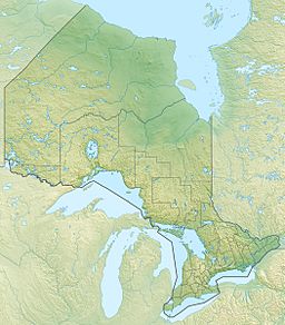
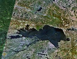
Lake Nipissing (French: lac Nipissing) is a large lake in the Canadian province of Ontario. It covers an area of about 873.3 km2 (337.2 sq mi) and sits 196 m (643 ft) above sea level. You can find it between the Ottawa River and Georgian Bay. Lake Nipissing is the third-largest lake completely within Ontario.
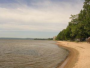
Even though it's big, Lake Nipissing is quite shallow. Its average depth is only about 4.5 m (15 ft). This means there are many sandy areas (called sandbars) along its wiggly shoreline. The deepest part of the lake is 64 m (210 ft) deep. This deep spot is near the mouth of the French River, close to Blueberry Island.
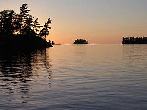
The lake has many islands. Most of these islands are protected because they are important wetlands. The Ministry of Natural Resources and Forestry helps to look after them.
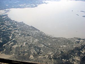
The biggest city on the lake's shore is North Bay. It's located on the northeastern side of the lake. Other towns nearby include Callander, which is south of North Bay. Towards the western end of the lake, you'll find larger towns like Sturgeon Falls, Garden Village, Cache Bay, and Lavigne.
Contents
Discovering Lake Nipissing's History and Geography
Lake Nipissing sends its water into Georgian Bay through the French River. Georgian Bay is actually part of Lake Huron. The lake is about 25 km (16 mi) northwest of Algonquin Provincial Park.
The first European to visit the lake was a French fur trader named Étienne Brûlé in 1610. Another French explorer, Jean Nicolet, lived among the local Indigenous people on the lake's shores for many years. He had a trading post there until 1633. In an old map from 1776, the lake was still called "Lac des Sorcieres" in French, which means "Lake of Witches."
The first permanent European settlement on the lake started around 1874. It was a trading post set up by the Hudson's Bay Company in what is now Sturgeon Falls. In 1882, the North-West Mounted Police (who later became the RCMP) also set up a base on the northeast shore.
The name "Nipissing" means "big water" in the Algonquin language. This name was also given to other places nearby, like the Township of Nipissing, Nipissing District, and Nipissing University.
In the past, during the fur trade days, brave traders called coureur des bois and voyageurs traveled through the lake by canoe. They used the Mattawa River and the French River. When the fur trade became less important in the 1880s, logging (cutting down trees) became the main way people made money. After World War I, tourism and recreation became very popular. Even today, logging is still an important part of the local economy.
Unlike most lakes in Ontario, Lake Nipissing has two special geological features called volcanic pipes. These are the Manitou Islands and Callander Bay. Volcanic pipes are formed when volcanoes erupt very powerfully from deep underground. Lake Nipissing is located in the Ottawa-Bonnechere Graben. This is a large rift valley that formed about 175 million years ago.
Wildlife and Nature at Lake Nipissing
Lake Nipissing is home to many different kinds of plants and animals.
Trees and Plants of Lake Nipissing
The shores and islands of the lake are covered with many broadleaved trees. Some of the larger islands, like Garden Island, have mostly broadleaf trees such as maple, oak, and dogwood.
Here are some of the tree species you can find around Lake Nipissing:
- White pine: These tall trees are common on the smaller, rocky islands.
- Ash trees: Including black, mountain, red, and white ash.
- Aspen trees: Such as trembling and largetooth aspen.
- Beech trees
- Birch trees: Like white and yellow birch.
- Dogwood
- Elm trees
- Ironwood trees
- Maple trees: Including silver, striped, and sugar maple.
- Oak trees: Such as burr and red oak.
You might also spot Juniper, sumac, scrub oak, oak ferns, and even poison ivy.
Animals and Fish of Lake Nipissing
Lake Nipissing is famous for its many fish species, which makes it a great place for sport fishing. There are over 40 different types of fish in the lake! Many fishing lodges are located along the shoreline and on the islands. People often try to catch walleye, smallmouth bass, muskie, and northern pike. Local groups work hard to help manage the walleye population in the lake.
Here are some of the important fish species found in Lake Nipissing:
- Northern pike
- Muskie (which can be clear or have stripes and spots)
- Walleye
- Gar
- Smallmouth bass
- Yellow perch
- Cisco or lake herring
- Whitefish
- Burbot
- Two species that are considered 'at risk' by the Ministry of Natural Resources and Forestry: the northern brook lamprey and lake sturgeon.
Many mammals also visit the shores and islands of the lake, including:
You can also see many different birds around the lake, some live there all the time, and others just visit. These include:
- Bald eagle
- Osprey
- Great blue heron
- Mallard
- Gull
- Common loon
- Double crested cormorant
- Great horned owl
- Trumpeter swan
And a huge variety of ducks and geese.
See also
 In Spanish: Lago Nipissing para niños
 | Laphonza Butler |
 | Daisy Bates |
 | Elizabeth Piper Ensley |


