
Marquette County, Wisconsin facts for kids
Quick facts for kids
Marquette County
|
|
|---|---|

Marquette County Courthouse
|
|

Location within the U.S. state of Wisconsin
|
|
 Wisconsin's location within the U.S. |
|
| Country | |
| State | |
| Founded | 1848 |
| Seat | Montello |
| Largest city | Montello |
| Area | |
| • Total | 464 sq mi (1,200 km2) |
| • Land | 456 sq mi (1,180 km2) |
| • Water | 8.7 sq mi (23 km2) 1.9%% |
| Population
(2020)
|
|
| • Total | 15,592 |
| • Estimate
(2023)
|
15,838 |
| • Density | 34.2/sq mi (13.2/km2) |
| Time zone | UTC−6 (Central) |
| • Summer (DST) | UTC−5 (CDT) |
| Congressional district | 6th |
Marquette County is a place in the state of Wisconsin, USA. It's like a big district with its own local government. In 2020, about 15,592 people lived here. The main town, or county seat, is Montello. Marquette County was first set up in 1836 and officially started in 1848.
Contents
History of Marquette County
A famous person named John Muir lived in Marquette County. He was a naturalist, which means he loved studying nature. In 1849, when he was 11 years old, John Muir and his family moved to a farm here.
Part of their old farm is now called Fountain Lake Farm. It is a special place listed on the National Register of Historic Places. This means it's an important historical site.
Geography of Marquette County
Marquette County covers about 464 square miles. Most of this area is land, around 456 square miles. The rest, about 8.7 square miles, is water.
The county has several important water bodies. These include the Mecan River, Buffalo Lake, and Puckaway Lake. The highest point in the county is a rocky area called Mt. Shaw.
Main Roads
Many important roads run through Marquette County. These roads help people travel and connect different towns.
 Interstate 39
 U.S. Highway 51
 Highway 22 (Wisconsin)
 Highway 23 (Wisconsin)
 Highway 73 (Wisconsin)
 Highway 82 (Wisconsin)
Train Lines
The Union Pacific railroad also passes through Marquette County. Train lines are important for moving goods across the country.
Neighboring Counties
Marquette County shares its borders with several other counties.
- Waushara County to the north
- Green Lake County to the east
- Columbia County to the south
- Adams County to the west
Protected Natural Areas
Part of the Fox River National Wildlife Refuge is located in Marquette County. This refuge helps protect wildlife and their homes.
People of Marquette County
In 2020, the population of Marquette County was 15,592 people. This means there were about 34 people living in every square mile.
Most people living in the county are White (94.2%). There are also smaller groups of Native American, Asian, and Black or African American residents. About 3.1% of the population is Hispanic or Latino.
Towns and Villages
Marquette County has several cities, villages, and towns. These are the different communities where people live.
City
- Montello (This is the main town, or county seat.)
Villages
Towns
- Buffalo
- Crystal Lake
- Douglas
- Harris
- Mecan
- Montello
- Moundville
- Neshkoro
- Newton
- Oxford
- Packwaukee
- Shields
- Springfield
- Westfield
Special Communities
- Packwaukee is a census-designated place. This means it's a community that the government counts separately for population data.
Small Communities
Images for kids
-
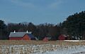
Farming in rural Marquette County
-
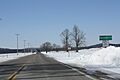
Welcome sign for Marquette County


See also
 In Spanish: Condado de Marquette (Wisconsin) para niños
