Green Lake County, Wisconsin facts for kids
Quick facts for kids
Green Lake County
|
|
|---|---|

|
|

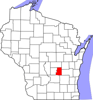
Location within the U.S. state of Wisconsin
|
|
 Wisconsin's location within the U.S. |
|
| Country | |
| State | |
| Founded | 1858 |
| Named for | Green Lake |
| Seat | Green Lake |
| Largest city | Berlin |
| Area | |
| • Total | 380 sq mi (1,000 km2) |
| • Land | 349 sq mi (900 km2) |
| • Water | 31 sq mi (80 km2) 8.1%% |
| Population
(2020)
|
|
| • Total | 19,018 |
| • Estimate
(2023)
|
19,344 |
| • Density | 54.4/sq mi (21.0/km2) |
| Time zone | UTC−6 (Central) |
| • Summer (DST) | UTC−5 (CDT) |
| Congressional district | 6th |
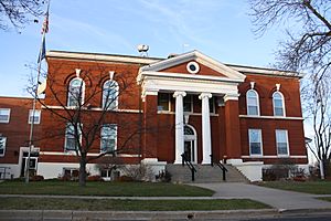
Green Lake County is a county located in the state of Wisconsin, USA. It's named after the beautiful Green Lake. As of the 2020 census, about 19,018 people live here. The main town, or county seat, is also called Green Lake. Did you know that in 2020, the very center of Wisconsin's population was found right here in Green Lake County, near the city of Markesan?
Contents
Exploring Green Lake County
Green Lake County covers a total area of about 380 square miles. Most of this is land, around 349 square miles. The rest, about 31 square miles, is covered by water, like lakes and rivers. This makes Green Lake County the third-smallest county in Wisconsin by its total size.
Main Roads
Here are some of the important highways that help people travel through Green Lake County:
 Highway 23 (Wisconsin)
 Highway 44 (Wisconsin)
 Highway 49 (Wisconsin)
 Highway 73 (Wisconsin)
 Highway 91 (Wisconsin)
Railroads
Trains also play a role in connecting Green Lake County. Here are the main railroad lines:
- Union Pacific
- Wisconsin and Southern Railroad
Neighboring Counties
Green Lake County shares its borders with several other counties. These are its neighbors:
- Waushara County – to the north
- Winnebago County – to the northeast
- Fond du Lac County – to the east
- Dodge County – to the southeast
- Columbia County – to the southwest
- Marquette County – to the west
People of Green Lake County
| Historical population | |||
|---|---|---|---|
| Census | Pop. | %± | |
| 1860 | 12,663 | — | |
| 1870 | 13,195 | 4.2% | |
| 1880 | 14,483 | 9.8% | |
| 1890 | 15,163 | 4.7% | |
| 1900 | 15,797 | 4.2% | |
| 1910 | 15,491 | −1.9% | |
| 1920 | 14,875 | −4.0% | |
| 1930 | 13,913 | −6.5% | |
| 1940 | 14,092 | 1.3% | |
| 1950 | 14,749 | 4.7% | |
| 1960 | 15,418 | 4.5% | |
| 1970 | 16,878 | 9.5% | |
| 1980 | 18,370 | 8.8% | |
| 1990 | 18,651 | 1.5% | |
| 2000 | 19,105 | 2.4% | |
| 2010 | 19,051 | −0.3% | |
| 2020 | 19,018 | −0.2% | |
| 2023 (est.) | 19,344 | 1.5% | |
| U.S. Decennial Census 1790–1960 1900–1990 1990–2000 2010 2020 |
|||
Population in 2020
In 2020, the county had a population of 19,018 people. This means there were about 54 people living in each square mile. Most of the people living in Green Lake County are White. There are also people from many other backgrounds, making the county a diverse place.
Communities in Green Lake County
Green Lake County has several different types of communities, from bigger cities to smaller villages and towns.
Cities
- Berlin (partly in Waushara County)
- Green Lake (this is the county seat, where the main government offices are)
- Markesan
- Princeton
Villages
Towns
Census-Designated Place
Unincorporated Communities
These are smaller places that aren't officially cities, villages, or towns:
County Services
Law Enforcement
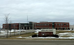
The Green Lake County Jail, which is where law enforcement holds people, is located in the county seat city of Green Lake.
See also
 In Spanish: Condado de Green Lake para niños
 | Ernest Everett Just |
 | Mary Jackson |
 | Emmett Chappelle |
 | Marie Maynard Daly |


