Maury River facts for kids
Quick facts for kids Maury River |
|
|---|---|

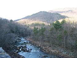
Maury River at Goshen Pass
|
|
| Country | United States |
| Physical characteristics | |
| Main source | Confluence of Calfpasture and Little Calfpasture Rivers 1,430 feet (440 m) 37°56′57″N 79°27′35″W / 37.9492961°N 79.4597624°W |
| River mouth | James River at Glasgow, Virginia 679 feet (207 m) 37°37′26″N 79°26′39″W / 37.6240240°N 79.4442022°W |
| Length | 43 miles (69 km) |
The Maury River is a river in west-central Virginia, United States. It is about 43-mile-long (69 km). The Maury River flows into the James River. It is also part of the larger watershed that leads to Chesapeake Bay.
Contents
Where Does the Maury River Flow?
The Maury River flows entirely within Rockbridge County. It starts near Goshen. Here, two smaller rivers, the Calfpasture and Little Calfpasture rivers, join together. The Maury River then flows south past the towns of Lexington and Buena Vista. Between these towns, another river called the South River joins it. Finally, the Maury River flows into the James River at Glasgow.
How Was the Maury River Used in the Past?

For many years, the Maury River was an important water route. From the late 1700s to the late 1800s, people used it to travel and move goods. These goods included pig iron and farm products. The river connected to the James River and Kanawha Canal at Glasgow. A system of canals, locks, and dams helped boats called James River bateaux travel on the river. These boats could handle the river's shallow and rocky parts. The first canal boat reached Lexington in 1860.
The use of canals on the river ended quickly, around 1880. This happened because railroads were built along the river. The Richmond and Alleghany Railroad and later the Shenandoah Valley Railroad offered faster ways to transport things.
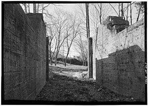
You can still see parts of the old canal system today. There are ruins of several locks and dams. The lock at Ben Salem Wayside, between Buena Vista and Interstate 81 on U.S. Route 60, is well-preserved. Two dams from the canal era still hold water. These are Moomaw's Lock and Dam in Buena Vista, and the Lexington Mills Dam in Lexington. Many other ruins are visible along the river from the Chessie Nature Trail.
The Maury River used to be called "a branch of the North River." Its name was officially changed to "Maury River" in 1968. It is named after Commodore Matthew Fontaine Maury. He was a famous oceanographer who worked at Washington and Lee University and Virginia Military Institute in Lexington during his last years. There is a stone memorial to him at Goshen Pass.
Has the Maury River Flooded Before?
The Maury River has a history of big floods that have damaged nearby towns. Some major floods happened in 1870, 1936, 1969, 1985, and 1995. The 1969 flood was caused by rain from Hurricane Camille. The 1985 flood was very severe. It happened when three weather systems, including Hurricane Juan, brought huge amounts of rain to western Virginia. Downtown Buena Vista and Glasgow were covered in over 5 feet (1.5 m) of water.
The 1969 flood caused so much damage that railroad service to Lexington stopped permanently. The tracks along the river were destroyed. Instead of rebuilding them, the railroad company decided to use the old rail bed for public use. This became the Chessie Nature Trail.
To help prevent future damage, the James C. Olin Flood Control Project was finished in 1997. This project helps protect Buena Vista from flooding.
What Can You Do at the Maury River Today?
The Chessie Nature Trail runs along the river for seven-mile (11 km). It is a long park between Buena Vista and Lexington. This trail goes through beautiful forests and open fields next to the river. Other great parks along the river include Goshen Pass, Jordan's Point in Lexington, Ben Salem Wayside, and Glenn Maury Park in Buena Vista.
There are also state-owned public lands along the river. These include the Goshen and Little North Mountain Wildlife Management Area and the Goshen Pass Natural Area Preserve.
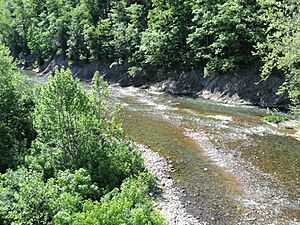
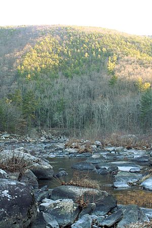
People enjoy the river by swimming, fishing, canoeing, kayaking, and floating in inner tubes. The river is usually wide and shallow, often less than three feet (0.91 m) deep. However, it does have some deeper spots. The upper part of the river has exciting rapids, which are rated as Class II, III, and IV. Below Jordan's Point in Lexington, the river is mostly calm. It has Class I and II rapids down to the James River at Glasgow. Most people do not use motorboats on the Maury River.
 | Sharif Bey |
 | Hale Woodruff |
 | Richmond Barthé |
 | Purvis Young |


