McCaysville, Georgia facts for kids
Quick facts for kids
McCaysville, Georgia
|
|||
|---|---|---|---|
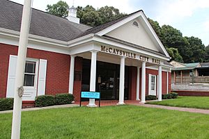
McCaysville city hall
|
|||
|
|||
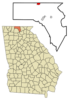
Location in Fannin County and the state of Georgia
|
|||
| Country | United States | ||
| State | Georgia | ||
| County | Fannin | ||
| Area | |||
| • Total | 1.54 sq mi (4.00 km2) | ||
| • Land | 1.50 sq mi (3.90 km2) | ||
| • Water | 0.04 sq mi (0.10 km2) | ||
| Elevation | 1,460 ft (450 m) | ||
| Population
(2020)
|
|||
| • Total | 1,149 | ||
| • Density | 763.46/sq mi (294.80/km2) | ||
| Time zone | UTC-5 (Eastern (EST)) | ||
| • Summer (DST) | UTC-4 (EDT) | ||
| ZIP code |
30555
|
||
| Area code(s) | Area codes 706 | ||
| FIPS code | 13-48428 | ||
| GNIS feature ID | 0328732 | ||
| Website | http://cityofmccaysvillega.gov | ||
McCaysville is a city in Georgia, United States. It is located in Fannin County. In 2020, about 1,149 people lived there. It is the second biggest city in Fannin County. The largest city is Blue Ridge.
Contents
History of McCaysville
For thousands of years, the Cherokee people lived in the area. Other Indigenous groups also lived here. This was before Europeans came to America.
Exploring McCaysville's Geography
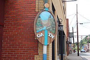
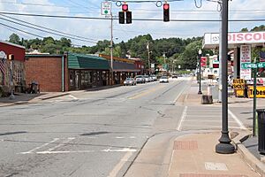
McCaysville is on the northern edge of Fannin County. It sits right on the border of Georgia. To the north is its twin city, Copperhill, Tennessee. These two cities act like one town. They are built along a river. This river is called the Toccoa River in Georgia. In Tennessee, it is called the Ocoee River. The river's name changes right at the state line.
The state line runs through the middle of town. This means that McCaysville is in area code 706. Copperhill, on the Tennessee side, is in area code 423. The main road through McCaysville is Georgia 60. It is also known as Toccoa Avenue. In Tennessee, it becomes Tennessee 68 or Ocoee Street.
McCaysville covers about 1.54 square miles (4.00 square kilometers). Most of this area is land. A small part, about 0.04 square miles (0.10 square kilometers), is water. In 1990, a big flood hit the town.
Understanding McCaysville's Climate
McCaysville has mild weather. This is because it is high up in the Appalachian Mountains. Summers are warm. High temperatures are usually in the mid-80s Fahrenheit. Low temperatures are in the low 60s Fahrenheit. Winters are cool. Highs are in the 40s Fahrenheit. Lows are in the 20s Fahrenheit.
The area gets a lot of rain. About 67 inches of rain fall each year. This rain happens on about 127 days. Snow usually falls a few times in winter. It can be a light dusting or a big storm. A very big snowstorm happened in March 1993. The area got about 40 inches of snow. This storm was called "the storm of the century." The first frost usually comes in mid-October. The last frost is usually in late April.
Population and Demographics
| Historical population | |||
|---|---|---|---|
| Census | Pop. | %± | |
| 1910 | 1,253 | — | |
| 1920 | 2,166 | 72.9% | |
| 1930 | 1,969 | −9.1% | |
| 1940 | 1,832 | −7.0% | |
| 1950 | 2,067 | 12.8% | |
| 1960 | 1,871 | −9.5% | |
| 1970 | 1,619 | −13.5% | |
| 1980 | 1,219 | −24.7% | |
| 1990 | 1,065 | −12.6% | |
| 2000 | 1,071 | 0.6% | |
| 2010 | 1,056 | −1.4% | |
| 2020 | 1,149 | 8.8% | |
| U.S. Decennial Census | |||
2020 Census Information
| Race | Num. | Perc. |
|---|---|---|
| White (non-Hispanic) | 1,019 | 88.69% |
| Native American | 2 | 0.17% |
| Asian | 4 | 0.35% |
| Other/Mixed | 74 | 6.44% |
| Hispanic or Latino | 50 | 4.35% |
In 2020, there were 1,149 people living in McCaysville. There were 605 households. About 320 families lived in the city.
2010 Census Information
In 2010, the city had 1,056 people. Most people, about 97.8%, were White. A small number were Black (0.2%), Asian (0.6%), or from two or more races (0.6%). About 0.9% of the people were Hispanic or Latino.
Notable People from McCaysville
- Joe Tipton, a famous Major League Baseball catcher.
See also
 In Spanish: McCaysville para niños
 | William L. Dawson |
 | W. E. B. Du Bois |
 | Harry Belafonte |


