McGaheysville, Virginia facts for kids
Quick facts for kids
McGaheysville
|
|
|---|---|
 |
|

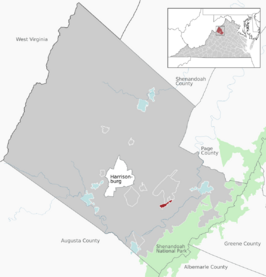
Location of the McGaheysville CDP within the Rockingham County
|
|
| Country | |
| State | Virginia |
| County | Rockingham County |
| Population
(2020)
|
|
| • Total | 978 |
| FIPS code | 51-48232 |
| GNIS feature ID | 2807440 |
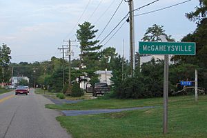
McGaheysville is a small community in Rockingham County, Virginia, in the United States. It is located along U.S. Route 33, between Penn Laird and Elkton. This town sits right at the base of the Massanutten Mountain. In 2020, about 978 people lived here.
Contents
History of McGaheysville
Early Settlement and Naming
The first records of people settling in this area go back to 1716. This was when Governor Alexander Spotswood traveled west of the Blue Ridge Mountains on an adventure called the Knights of the Golden Horseshoe Expedition.
The first European-American to settle here permanently was Adam Miller. He was from Germany and arrived in 1726. He built his home near what is now Elkton. Later, more German and Dutch immigrants moved to the area. A small village started to grow around the Upper Peaked Mountain Church.
In 1762, a man named Jacob Herman gave land to both the Lutherans and the Reformed Church. They built a church together called the Union Church in a spot known as "Stony Run."
The village was first named Ursulaburg. This name honored Eva Conrad, an innkeeper whose tavern was a popular spot.
McGaheysville got its current name from surveyor Tobias Randolph McGahey. He came to the area in 1801 as part of a settlement effort by people from Scotland and Ireland. In 1802, he opened a post office and named it "McGaheysville," giving the town its official name.
McGaheysville During the Civil War
McGaheysville did not see much fighting during the American Civil War. There was a small fight, known as a skirmish, on April 27, 1862. This happened during the Shenandoah Valley Campaign. Even though there wasn't a major battle in McGaheysville itself, soldiers from both the Union Army and the Confederate Army passed through the town. This was because it was close to the site of the Battle of Cross Keys.
Geography of McGaheysville
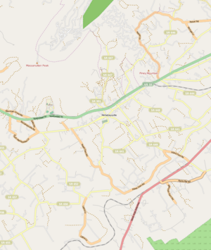
McGaheysville is located in the northern part of central Virginia. It sits along U.S. Route 33. To the west of McGaheysville is Penn Laird, and to the east is Elkton. This road is part of the Spotswood Trail, which connects to Harrisonburg further west.
The town is near the south fork of the Shenandoah River, right in the middle of the beautiful Shenandoah Valley. South of the village, you'll find mostly farmland. Beyond that, the mountainous Shenandoah National Park begins. To the north of McGaheysville, the land is also mountainous. The peak of Massanutten is just northeast of the town. Pikey Mountain is even closer to the village, located in the northeastern part of McGaheysville.
Community Facilities and Local Economy
Many buildings in McGaheysville are quite old, with some dating back to 1840. The town has an elementary school, which was built in 1969. It stands on the same spot where the old high school used to be before it was destroyed by fire in 1968.
McGaheysville has a volunteer fire department. They often host fun events like weekly bingo games. They also have a big annual three-day lawn party in the summer. Families come to enjoy live music, rides, games, and lots of food.
The nearby resort of Massanutten is very important to the local economy. It started in 1971 and brings in tourists all year long. The resort has 14 ski trails for winter fun and 36 holes of golf. It also has a water park that opened in 2005, along with many other activities. The idea for the resort came in the late 1960s from John L. Hopkins II, a wealthy local landowner from McGaheysville. He saw the potential of Massanutten Peak and brought in investors to build the large resort.
Cave Hill Farm, a historic place listed on the National Register of Historic Places, is also located near McGaheysville.
Notable people
- Thomas G. Mauzy
 | Georgia Louise Harris Brown |
 | Julian Abele |
 | Norma Merrick Sklarek |
 | William Sidney Pittman |


