
Merrill, Wisconsin facts for kids
Quick facts for kids
City of Merrill
|
|
|---|---|

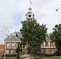
Looking west at the western downtown
|
|
| Nickname(s):
City of Parks
|
|

Location of Merrill in Lincoln County, Wisconsin
|
|

Merrill, Wisconsin
Location in Wisconsin

Merrill, Wisconsin
Location in the United States
|
|
| Country | United States |
| State | Wisconsin |
| County | Lincoln County |
| Name Adopted | 1881 |
| First Mayor and City Council | 1883 |
| Area | |
| • Total | 8.08 sq mi (20.94 km2) |
| • Land | 7.50 sq mi (19.44 km2) |
| • Water | 0.58 sq mi (1.50 km2) 7.30% |
| Elevation | 1,316 ft (401 m) |
| Population
(2020)
|
|
| • Total | 9,347 |
| • Estimate
(2022)
|
9,122 |
| • Density | 1,245.6/sq mi (480.9/km2) |
| Demonym(s) | Merrillite |
| Time zone | UTC-6 (CST) |
| • Summer (DST) | UTC-5 (CDT) |
| ZIP code |
54452
|
| Area code(s) | 715 & 534 |
| FIPS code | 55-51250 |
| Website | www.ci.merrill.wi.us |
Merrill is a city in Lincoln County, Wisconsin, United States. It is the main city, or county seat, of Lincoln County. Merrill is located just south of the Town of Merrill. In 2020, about 9,347 people lived there.
Merrill is part of a larger area called the Merrill MSA. This area includes all of Lincoln County. It also connects with the Wausau area to form a bigger region called the Wausau-Merrill CSA.
Contents
History of Merrill
Merrill was first home to the Chippewa Native Americans. The first European settlement was a logging town called Jenny Bull Falls. By 1843, a trading post was built there. John Faely was the first settler.
Four years later, a dam was built on the Wisconsin River by Andrew Warren. Warren then opened the first mill powered by the dam. Other sawmills soon followed. In 1870, T. B. Scott took over the mill, and it became very successful. The mill later burned down in 1899.
The community's name was changed to Merrill. This was done to honor Sherburn S. Merrill (1818–1885). He was the general manager of the Chicago, Milwaukee, St. Paul, and Pacific Railroad.
In 1881, the Wisconsin Telephone Company started in Merrill. It had 20 phones in use. In 1883, the first City Council met. T. B. Scott became the first mayor. By 1885, the population grew to 7,000 people. This is about 3,000 fewer than today's population. The railroad station was a busy place during the lumber industry's best years. It later became a youth center, but it has since been taken down. By 1900, the timber industry was slowing down. The community had to find new ways to grow its economy.
In 1892, the Weinbrenner Shoe Company started in Merrill. In July 1912, the Wisconsin River and other nearby rivers flooded. This caused a lot of damage in Merrill. Several dams were destroyed, and the city faced hundreds of thousands of dollars in repairs.
Geography of Merrill
Merrill is located where the Wisconsin River meets the Prairie River. The city's exact location is 45.182569 degrees north and 89.69559 degrees west.
The city covers a total area of about 8.08 square miles (20.94 square kilometers). About 7.5 square miles (19.44 square kilometers) is land. The remaining 0.58 square miles (1.50 square kilometers) is water.
Merrill is located west of US Route 51. It is also on State Highway 64, which is known as Main Street.
Council Grounds State Park is just west of the city.
Climate in Merrill
Merrill has a climate with warm summers and cold, snowy winters. The average high temperature in July is about 80.2°F (26.8°C). The average low temperature in January is about 3.4°F (-15.9°C). The city gets about 33.76 inches (857.5 mm) of rain each year. It also gets about 54.3 inches (137.9 cm) of snow annually.
| Climate data for Merrill, Wisconsin (1991–2020 normals, extremes 1905–present) | |||||||||||||
|---|---|---|---|---|---|---|---|---|---|---|---|---|---|
| Month | Jan | Feb | Mar | Apr | May | Jun | Jul | Aug | Sep | Oct | Nov | Dec | Year |
| Record high °F (°C) | 57 (14) |
65 (18) |
86 (30) |
92 (33) |
104 (40) |
104 (40) |
110 (43) |
101 (38) |
97 (36) |
89 (32) |
75 (24) |
62 (17) |
110 (43) |
| Mean daily maximum °F (°C) | 22.0 (−5.6) |
26.6 (−3.0) |
38.7 (3.7) |
52.9 (11.6) |
66.6 (19.2) |
76.1 (24.5) |
80.2 (26.8) |
77.9 (25.5) |
69.7 (20.9) |
55.4 (13.0) |
39.7 (4.3) |
27.4 (−2.6) |
52.8 (11.6) |
| Daily mean °F (°C) | 12.7 (−10.7) |
15.8 (−9.0) |
27.9 (−2.3) |
41.3 (5.2) |
54.6 (12.6) |
64.6 (18.1) |
68.6 (20.3) |
66.3 (19.1) |
58.0 (14.4) |
44.9 (7.2) |
31.4 (−0.3) |
19.4 (−7.0) |
42.1 (5.6) |
| Mean daily minimum °F (°C) | 3.4 (−15.9) |
5.1 (−14.9) |
17.0 (−8.3) |
29.6 (−1.3) |
42.6 (5.9) |
53.2 (11.8) |
57.1 (13.9) |
54.7 (12.6) |
46.3 (7.9) |
34.5 (1.4) |
23.1 (−4.9) |
11.4 (−11.4) |
31.5 (−0.3) |
| Record low °F (°C) | −48 (−44) |
−42 (−41) |
−35 (−37) |
−5 (−21) |
18 (−8) |
28 (−2) |
33 (1) |
30 (−1) |
18 (−8) |
4 (−16) |
−15 (−26) |
−31 (−35) |
−48 (−44) |
| Average precipitation inches (mm) | 1.19 (30) |
1.06 (27) |
1.75 (44) |
2.93 (74) |
3.72 (94) |
4.63 (118) |
3.82 (97) |
4.05 (103) |
3.86 (98) |
3.16 (80) |
2.06 (52) |
1.53 (39) |
33.76 (858) |
| Average snowfall inches (cm) | 12.4 (31) |
11.6 (29) |
7.2 (18) |
5.5 (14) |
0.1 (0.25) |
0.0 (0.0) |
0.0 (0.0) |
0.0 (0.0) |
0.0 (0.0) |
0.9 (2.3) |
5.0 (13) |
11.6 (29) |
54.3 (138) |
| Average precipitation days (≥ 0.01 in) | 10.6 | 7.9 | 9.0 | 11.7 | 13.6 | 13.8 | 12.0 | 11.7 | 12.6 | 12.5 | 9.8 | 11.0 | 136.2 |
| Average snowy days (≥ 0.1 in) | 9.7 | 7.0 | 5.1 | 2.6 | 0.1 | 0.0 | 0.0 | 0.0 | 0.0 | 0.8 | 4.4 | 8.9 | 38.6 |
| Source: NOAA | |||||||||||||
People in Merrill
| Historical population | |||
|---|---|---|---|
| Census | Pop. | %± | |
| 1880 | 882 | — | |
| 1890 | 6,809 | 672.0% | |
| 1900 | 8,537 | 25.4% | |
| 1910 | 8,689 | 1.8% | |
| 1920 | 8,068 | −7.1% | |
| 1930 | 8,458 | 4.8% | |
| 1940 | 8,711 | 3.0% | |
| 1950 | 8,951 | 2.8% | |
| 1960 | 9,451 | 5.6% | |
| 1970 | 9,502 | 0.5% | |
| 1980 | 9,578 | 0.8% | |
| 1990 | 9,860 | 2.9% | |
| 2000 | 10,146 | 2.9% | |
| 2010 | 9,661 | −4.8% | |
| 2020 | 9,347 | −3.3% | |
| 2022 (est.) | 9,122 | −5.6% | |
| U.S. Decennial Census | |||
How Many People Live Here?
In 2020, the city of Merrill had 9,347 people. This means there were about 1,245 people per square mile. There were also about 4,503 homes in the city.
Most people in Merrill are White (93.1%). Other groups include Native American (0.7%), Black or African American (0.7%), and Asian (0.4%). About 2.6% of the population was Hispanic or Latino.
In 2010, there were 9,661 people living in Merrill. About 29.4% of homes had children under 18. The average age in the city was 40.4 years. About 23.9% of residents were under 18.
Education in Merrill
Merrill has its own school district called the Merrill Area Public School District. There is also a special training center in Merrill. It is for public safety and was built by Northcentral Technical College in 2005.
Public Schools

- Kate Goodrich Elementary School
- Washington Elementary School
- Prairie River Middle School
- Merrill High School
Private Schools
- Trinity Lutheran School
- St. John Lutheran School
- St. Francis Xavier Catholic School
- New Testament Church Christian Academy
Getting Around Merrill
Highways
Merrill is connected by several important highways:
|
|
U.S. 51 goes north to Woodruff, Wisconsin. It goes south to Wausau, Wisconsin. |
|
|
WIS 17 travels north to Rhinelander, Wisconsin. |
|
|
WIS 64 travels east to Antigo, Wisconsin. It goes west to Medford, Wisconsin. |
|
|
WIS 107 travels north to Tomahawk, Wisconsin. It goes south to Mosinee, Wisconsin. |
From 1889 to 1921, a streetcar line ran in Merrill. It was operated by the Merrill Railway & Lighting Co. This company also ran one of the first trolleybus lines in the United States in 1913.
Local Transportation
The City of Merrill has a bus system called the Merrill Transit System. You can call for a bus to pick you up anywhere in the city. As of 2019, a ride costs $2.00. It costs $1.00 for older adults and people with disabilities.
There is also a private taxi service called Blue Jay Taxi. This service helps people get home safely.
Airport
Merrill has its own airport, the Merrill Municipal Airport (KRRL). It is about one mile northwest of the city center. The airport handles about 18,600 flights each year. Most of these are small planes, but some are air taxis. The airport has two runways for planes to land and take off.
Parks and Fun Things to Do
Parks in Merrill
Merrill is known as the "City of Parks" because it has many green spaces for everyone to enjoy.
Community Parks:
- Lion's Park
- Stange Park
- Merrill Area Recreation Complex (MARC)
- Dog Park
Neighborhood Parks:
- Streeter Square
- Ott's Park
- Riverside Park
- Stange Kitchenette
- Normal Park
Special Use Parks:
- Athletic Park
- Gebert Park
- Memorial Forest Wildlife Area
State Park:
- Council Grounds State Park
Other Parks:
- Camp New Wood County Park
- Cenotaph Memorial Park
- Jack Pines Park
- Tug Lake Recreation Area
Recreation and Activities
Merrill offers many ways to have fun and stay active:
- Merrill Enrichment Center
- MARC/Smith Center (a recreation complex)
- Merrill Soccer
- Merrill City Band (music performances)
- Merrill Tennis
- River Bend Trail (for walking and biking)
- Merrill City Softball
- Merrill Fast Pitch
Historic Places to See
Merrill has several places that are important to its history:
- Center Avenue Historic District
- First Street Bridge
- Fromm, Walter, and Mabel House
- Lincoln County Courthouse
- Merrill City Hall
- Merrill Post Office
- T.B. Scott Free Library
- Gesundheit, Maine Street (built in 1874)
Famous People from Merrill
Many notable people have come from Merrill:
- Wendy Boglioli, an Olympic swimming gold medalist
- Peter B. Champagne, Wisconsin politician
- Walter Chilsen, Wisconsin politician
- Walter B. Chilsen, Wisconsin politician and newspaper editor
- Charles Chvala, Wisconsin politician
- Sheehan Donoghue, Wisconsin politician
- William T. Evjue, Wisconsin politician and founder of the Capital Times newspaper
- Hermann R. Fehland, Wisconsin politician
- William H. Flett, Wisconsin politician
- Daniel E. Freeman, musicologist
- Paul Gebert, Sr., Wisconsin politician
- Leo Gesicki, Wisconsin politician
- James H. Hamlin, Wisconsin politician
- Ralph Dorn Hetzel, former president of Pennsylvania State University
- Emil A. Hinz, Wisconsin politician
- Paul Jesperson, college basketball player
- Zola Jesus, singer and songwriter
- H. V. Kaltenborn, journalist
- Clarence Kretlow, Wisconsin politician
- Clifford Krueger, Wisconsin politician
- F. W. Kubasta, Wisconsin politician
- Oxie Lane, NFL player
- Myron Hawley McCord, U.S. Representative
- John O'Day, Wisconsin politician
- Fred C. Reger, Wisconsin politician
- Thomas B. Scott, Wisconsin politician
- Donald Edgar Tewes, United States House of Representatives member
- Reno W. Trego, Wisconsin politician
- Tom Uttech, artist
- Edward W. Whitson, Wisconsin politician
- James A. Wright, Wisconsin politician
Images for kids
-
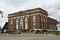
Post office
-
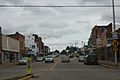
Looking east at the eastern downtown
-
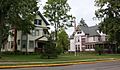
Center Avenue Historic District
-
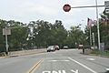
First Street bridge
-
Lincoln County Courthouse


See also
 In Spanish: Merrill (Wisconsin) para niños
